Wisconsin Highway 157
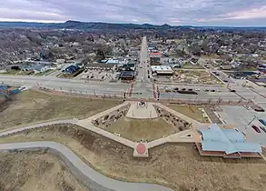
State Trunk Highway 157 (often called Highway 157, STH-157 or WIS 157) is a short state highway in the US state of Wisconsin. It runs east on Main Street from WIS 35 (Second Avenue) in downtown Onalaska to the US Highway 53 (US 53) freeway. There it turns south, running concurrently with US 53 to the Interstate 90 (I-90) interchange. US 53 leaves WIS 157 to head west on I-90, but WIS 157 continues southeast to WIS 16 at the Valley View Mall.
State Trunk Highway 157 | ||||
|---|---|---|---|---|
WIS 157 highlighted in red | ||||
| Route information | ||||
| Maintained by WisDOT | ||||
| Length | 2.81 mi[1] (4.52 km) | |||
| Major junctions | ||||
| West end | ||||
| East end | ||||
| Location | ||||
| Country | United States | |||
| State | Wisconsin | |||
| Counties | La Crosse | |||
| Highway system | ||||
| ||||
Route description

WIS 157 starts to travel north from WIS 16. Almost immediately, it meets I-90/US 53 at an interchange. At this point, not only does the roadway become an expressway, US 53 briefly runs concurrently with WIS 157. At the next interchange north, WIS 157 leaves the expressway to travel due west to downtown Onalaska. Then, in downtown Onalaska, WIS 157 ends at WIS 35.[2]
History
Initially, in 1923, WIS 157 briefly appeared to serve Briggsville via present-day CTH-AA. It traveled from WIS 29 (part of it is now WIS 107) south of Briggsville to WIS 23 in Briggsville.[3][4] In 1924, WIS 23 superseded the routing because WIS 23/WIS 29 concurrency was moved southward on present-day WIS 127.[4][5] In 1926, WIS 157 was re-established to travel along part of the former alignment of WIS 64. This new routing traveled mostly along CTH-M from WIS 32 in Frostville to US 141 in between Coleman and Lena.[6][7] In 1934, the routing was removed again in favor of transferring this route to local control (there were no county trunk highway replacement until later).[8][9]
In 1938, WIS 157 was re-established to travel along its present-day route and present-day CTH-OS.[10][11] It remained that way until around 1969 when the easternmost portion of WIS 157 moved southward to serve I-90 while still serving US 16 (replaced by WIS 16).[12][13] Around 1990, part of WIS 157 north of I-90 was widened to an expressway in order to accommodate the newly-built US 53 expressway around Onalaska.[14][15]
Major intersections
The entire highway is in La Crosse County.
| Location | mi[2] | km | Destinations | Notes | |
|---|---|---|---|---|---|
| Onalaska | 0.0 | 0.0 | |||
| 1.1 | 1.8 | Western end of US 53 concurrency | |||
| 1.8 | 2.9 | Eastern end of US 53 concurrency | |||
| La Crosse | 2.6 | 4.2 | |||
1.000 mi = 1.609 km; 1.000 km = 0.621 mi
| |||||
See also
References
- Bessert, Chris. "Highways 150–159". Wisconsin Highways. Retrieved March 20, 2007.
- Google (December 27, 2020). "Overview Map of WIS 157" (Map). Google Maps. Google. Retrieved December 27, 2020.
- Wisconsin Highway Commission (1923). Official Map of the State Trunk Highway System of Wisconsin (PDF) (Map). Scale not given. Madison: Wisconsin Highway Commission. Retrieved February 5, 2023 – via Wikimedia Commons.
- Wisconsin Highway Commission (1924). Official Highway Map of Wisconsin: 'The Playground of the Middle West' (PDF) (Map). c. 1:950,400. Madison: Wisconsin Highway Commission. OCLC 560719947. Retrieved February 5, 2023 – via Wikimedia Commons.
- Wisconsin Highway Commission (1925). Official Highway Map of Wisconsin: 'The Playground of the Middle West' (PDF) (Map). 1:950,400. Madison: Wisconsin Highway Commission. OCLC 826902797. Retrieved February 5, 2023 – via Wikimedia Commons.
- Wisconsin Highway Commission (1926). Official Highway Map of Wisconsin (PDF) (Map). 1:950,400. Madison: Wisconsin Highway Commission. OCLC 237003454, 71251169. Retrieved February 5, 2023 – via Wikimedia Commons.
- Wisconsin Highway Commission (1927). Official Highway Map of Wisconsin, 'The Playground of the Middle West' (PDF) (Map). 1:950,400. Madison: Wisconsin Highway Commission. Retrieved February 5, 2023 – via Wikimedia Commons.
- Wisconsin Highway Commission (1934). Official Highway Map of Wisconsin (PDF) (Map). 1:887,040. Madison: Wisconsin Highway Commission. Retrieved February 5, 2023 – via Wikimedia Commons.
- State Highway Commission of Wisconsin (January 1935). Official Highway Map of Wisconsin (PDF) (Map). 1:887,040. Madison: State Highway Commission of Wisconsin. Retrieved February 5, 2023 – via Wikimedia Commons.
- State Highway Commission of Wisconsin (January 1, 1938). Official Highway Map of Wisconsin (PDF) (Map). 1:823,680. Madison: State Highway Commission of Wisconsin. Retrieved February 5, 2023 – via Wikimedia Commons.
- State Highway Commission of Wisconsin (1939). Official Highway Service Map of Wisconsin (PDF) (Map). 1:538,560. Madison: State Highway Commission of Wisconsin. Retrieved February 5, 2023 – via Wikimedia Commons.
- State Highway Commission of Wisconsin (1967). Wisconsin Highway Map (Map). 1:823,680. Madison: State Highway Commission of Wisconsin. Retrieved February 5, 2023 – via American Geographical Society Library Digital Map Collection.
- State Highway Commission of Wisconsin (1969). Wisconsin Highway Map (Map). Scale not given. Madison: State Highway Commission of Wisconsin. Retrieved February 5, 2023 – via American Geographical Society Library Digital Map Collection.
- Wisconsin Department of Transportation Division of Highways (1989). Wisconsin Highway Map (PDF) (Map) (1989–1990 ed.). 1:823,680. Madison: Wisconsin Department of Transportation. Retrieved February 5, 2023.
- Wisconsin Department of Transportation Division of Highways (1991). Wisconsin Highway Map (PDF) (Map) (1991–1992 ed.). 1:823,680. Madison: Wisconsin Department of Transportation. OCLC 25418391, 781234246, 27016238. Retrieved February 5, 2023.
External links
 Media related to Wisconsin Highway 157 at Wikimedia Commons
