Wittenberg (district)
Wittenberg is a district (German: Kreis) in the east of Saxony-Anhalt, Germany. Neighboring districts are (from west clockwise) Anhalt-Bitterfeld, the district-free city of Dessau-Roßlau, the districts of Potsdam-Mittelmark, Teltow-Fläming and Elbe-Elster in Brandenburg, and the district of Nordsachsen in Saxony. The capital and largest city is Wittenberg, famous for its association with the influential religious reformer Martin Luther and containing a UNESCO World Heritage Site.[2]
Wittenberg | |
|---|---|
 Flag  Coat of arms | |
| Country | Germany |
| State | Saxony-Anhalt |
| Capital | Wittenberg |
| Area | |
| • Total | 1,933.3 km2 (746.5 sq mi) |
| Population (31 December 2021)[1] | |
| • Total | 123,341 |
| • Density | 64/km2 (170/sq mi) |
| Time zone | UTC+01:00 (CET) |
| • Summer (DST) | UTC+02:00 (CEST) |
| Vehicle registration | WB, GHC, JE |
| Website | landkreis-wittenberg.de |
History
In 1994 the district was merged with the district of Jessen and a small part of the district of Gräfenhainichen. In 2007, 27 municipalities from the former district Anhalt-Zerbst were added to the district of Wittenberg.
Geography
The area of the district is 1,933.3 km2 (746.5 sq mi).[3] The main rivers in the district are the Elbe and its tributary, the Schwarze Elster.
Coat of arms
The coat of arms show two swords which is the symbol of a field marshal in the Holy Roman Empire. This title was bestowed upon the counts of Saxony, who therefore added the symbol to their coat of arms. The center of the principality of Saxony was located in the area now covered by the district.
Towns and municipalities
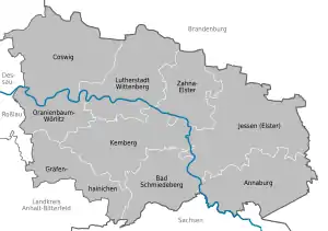
The district of Wittenberg consists of the following towns:
- Annaburg
- Bad Schmiedeberg
- Coswig
- Gräfenhainichen
- Jessen (Elster)
- Kemberg
- Oranienbaum-Wörlitz
- Wittenberg
- Zahna-Elster
After the resolution of 6 October 2005, as part of municipal reform, the (then) 27 towns and municipalities of the former Verwaltungsgemeinschaften of Coswig and Wörlitzer Winkel, formerly in the Anhalt-Zerbst district, were assigned to Wittenberg district on 1 July 2007.
Sights
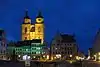 Wittenberg market square with Stadtkirche Wittenberg
_-_geo.hlipp.de_-_28216.jpg.webp) Wittenberg old town with All Saints' Church
Wittenberg old town with All Saints' Church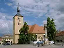 Jessen market square
%252CElbe%252CSchloss.jpg.webp) Coswig view river Elbe
Coswig view river Elbe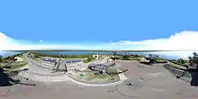 Ferropolis in Gräfenhainichen
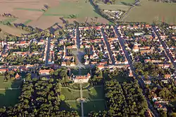 Oranienbaum aerial view
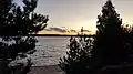 Bergwitz lake
External links
![]() Media related to Landkreis Wittenberg at Wikimedia Commons
Media related to Landkreis Wittenberg at Wikimedia Commons
- Official website (in German)
References
- "Bevölkerung der Gemeinden – Stand: 31. Dezember 2021" (PDF) (in German). Statistisches Landesamt Sachsen-Anhalt. June 2022.
- "Luther Memorials in Eisleben and Wittenberg". UNESCO World Heritage Centre. United Nations Educational, Scientific, and Cultural Organization. Retrieved 3 July 2022.
- "Tabellen Bodenfläche". Statistisches Landesamt Sachsen-Anhalt. Retrieved 20 November 2022.
| Urban districts | |
|---|---|
| Rural districts | |
| Former districts | |