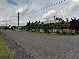
Woodhouselee, New South Wales
Woodhouselee is a locality in the Upper Lachlan Shire, New South Wales, Australia.[2][3] It lies about 25 km northwest of Goulburn and 115 km northeast of Canberra. At the 2016 census, it had a population of 15.[1]
| Woodhouselee New South Wales | |||||||||||||||
|---|---|---|---|---|---|---|---|---|---|---|---|---|---|---|---|
 Woodhouselee | |||||||||||||||
 Woodhouselee Location in New South Wales | |||||||||||||||
| Coordinates | 34°33′57″S 149°38′02″E | ||||||||||||||
| Population | 15 (2016 census)[1] | ||||||||||||||
| Postcode(s) | 2580 | ||||||||||||||
| Elevation | 808 m (2,651 ft) | ||||||||||||||
| Location | |||||||||||||||
| LGA(s) | Upper Lachlan Shire | ||||||||||||||
| Region | Southern Tablelands | ||||||||||||||
| County | Argyle | ||||||||||||||
| Parish | Wayo | ||||||||||||||
| State electorate(s) | Goulburn | ||||||||||||||
| Federal division(s) | Hume | ||||||||||||||
| |||||||||||||||
Woodhouselee is said to have been named after an early settler called Woodhouse or to be a name given by William Lithgow[4] to his "private township" after Woodhouselee, a small estate town south of Edinburgh, because of his early association as a student of the University of Edinburgh with the Tytler family.[2]
Woodhouselee station was a station on the now disused Crookwell railway line from 1902 to 1975.[5] Woodhouselee had a state public school from 1877 to 1893.[6]
References
- Australian Bureau of Statistics (27 June 2017). "Woodhouselee". 2016 Census QuickStats. Retrieved 22 November 2018.
- "Woodhouselee". Geographical Names Register (GNR) of NSW. Geographical Names Board of New South Wales. Retrieved 22 November 2018.
- "Woodhouselee". OpenStreetMap. Retrieved 22 November 2018.
- Possibly referring to William Lithgow.
- "Woodhouselee Station". NSWRail.net. Retrieved 22 November 2018.
- "Woodhouselee in the School history database search". New South Wales Department of Education. Retrieved 22 November 2018.
This article is issued from Wikipedia. The text is licensed under Creative Commons - Attribution - Sharealike. Additional terms may apply for the media files.