Worcester Summit
Worcester Summit is the crest of a ridge rising to about 2,030 m at the east end of Jaeger Table, Dufek Massif, in the Pensacola Mountains of Antarctica. It was named by the Advisory Committee on Antarctic Names (US-ACAN) in 1979 after Robin D. Worcester who, with David W. Bennett, comprised the first of the annual United States Geological Survey (USGS) satellite surveying teams at the South Pole Station during the winter of 1973.
| Worcester Summit | |
|---|---|
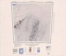 Map sheet with Worcester Summit | |
| Highest point | |
| Elevation | 2,030 m (6,660 ft) |
| Coordinates | 82°36′S 52°22′W |
| Geography | |
 Worcester Summit | |
![]() This article incorporates public domain material from "Worcester Summit". Geographic Names Information System. United States Geological Survey.
This article incorporates public domain material from "Worcester Summit". Geographic Names Information System. United States Geological Survey.
This article is issued from Wikipedia. The text is licensed under Creative Commons - Attribution - Sharealike. Additional terms may apply for the media files.