Xoulces
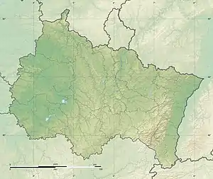
The Xoulces is a small but abundant river in France which flows in Lorraine in the Vosges department. It is a left tributary of the Moselotte, and thus a sub-tributary of the Rhine via the Moselotte and the Moselle. It is 9.4 km (5.8 mi) long.[1]
| Xoulces | |
|---|---|
  | |
| Location | |
| Country | France |
| Physical characteristics | |
| Mouth | |
• location | Moselotte |
• coordinates | 47.9619°N 6.8356°E |
| Length | 9.4 km (5.8 mi) |
| Basin size | 24.5 km2 (9.5 sq mi) |
| Discharge | |
| • average | 1.10 m3/s (39 cu ft/s) |
| Basin features | |
| Progression | Moselotte→ Moselle→ Rhine→ North Sea |
Geography
The river starts from the confluence of the Rouge Rupt and the Goutte du Grand Clos in the massif des Vosges. Its course lies entirely in the commune of Cornimont.
Hydrology
The hydrological discharge of the Xoulces measured at its confluence with the Moselotte is 1.10 cubic metres per second (39 cu ft/s), for a watershed of 24.5 square kilometres (9.5 sq mi).[2] The runoff curve number in the watershed is 1,416 millimetres (55.7 in), which is highly abundant and comparable to the average for rivers in the Moselotte basin. It is more than four times higher than the average for France including all basins, but also three times higher than average for the French Moselle basin, 445 millimetres (17.5 in) at Hauconcourt downstream of Metz[3]). The specific flow rate of the Xoulces thus rises to 44.9 litres per second per square kilometre of watershed.
See also
External links
- (in French) "Characteristic flow rates of the Xoulces" (PDF). Archived from the original (PDF) on 2006-11-21.
- (in French) "Characteristic flow rates of the Moselotte" (PDF). Archived from the original (PDF) on 2006-11-21.
References
- Sandre. "Fiche cours d'eau - Ruisseau de Xoulces (A4110580)".
- (in French)"Characteristic flow rates of the Xoulces" (PDF). Archived from the original (PDF) on 2006-11-21. Archived November 21, 2006, at the Wayback Machine
- (in French) Banque Hydro - Station A7930610 - The Moselle at Hauconcourt (Synthèse option)