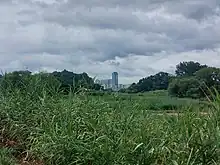
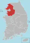
Yangpyeong County
Yangpyeong County (Yangpyeong-gun) is a county in Gyeonggi Province, South Korea.
Yangpyeong
양평군 | |
|---|---|
| Korean transcription(s) | |
| • Hangul | 양평군 |
| • Hanja | 楊平郡 |
| • Revised Romanization | Yangpyeong-gun |
| • McCune-Reischauer | Yangp'yŏng kun |
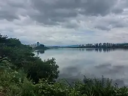 Namhan River through Yangpyeong County | |
 Flag Emblem of Yangpyeong | |
| Country | |
| Region | Sudogwon |
| Administrative divisions | 1 eup, 11 myeon |
| Area | |
| • Total | 877.76 km2 (338.91 sq mi) |
| Population (September 2016) | |
| • Total | 112,577 |
| • Density | 128.26/km2 (332.2/sq mi) |
| • Dialect | Gyeonggi |
Climate
Yangpyeong has a monsoon-influenced humid continental climate (Köppen: Dwa) with cold, dry winters and hot, rainy summers.
| Yangpyeong | ||||||||||||||||||||||||||||||||||||||||||||||||||||||||||||
|---|---|---|---|---|---|---|---|---|---|---|---|---|---|---|---|---|---|---|---|---|---|---|---|---|---|---|---|---|---|---|---|---|---|---|---|---|---|---|---|---|---|---|---|---|---|---|---|---|---|---|---|---|---|---|---|---|---|---|---|---|
| Climate chart (explanation) | ||||||||||||||||||||||||||||||||||||||||||||||||||||||||||||
| ||||||||||||||||||||||||||||||||||||||||||||||||||||||||||||
| ||||||||||||||||||||||||||||||||||||||||||||||||||||||||||||
| Climate data for Yangpyeong (1991–2020 normals, extremes 1972–present) | |||||||||||||
|---|---|---|---|---|---|---|---|---|---|---|---|---|---|
| Month | Jan | Feb | Mar | Apr | May | Jun | Jul | Aug | Sep | Oct | Nov | Dec | Year |
| Record high °C (°F) | 13.6 (56.5) |
20.2 (68.4) |
24.4 (75.9) |
31.2 (88.2) |
34.4 (93.9) |
36.5 (97.7) |
37.6 (99.7) |
40.1 (104.2) |
33.4 (92.1) |
30.1 (86.2) |
25.5 (77.9) |
17.6 (63.7) |
40.1 (104.2) |
| Average high °C (°F) | 2.3 (36.1) |
5.6 (42.1) |
11.9 (53.4) |
19.2 (66.6) |
24.5 (76.1) |
28.3 (82.9) |
29.6 (85.3) |
30.3 (86.5) |
26.2 (79.2) |
20.2 (68.4) |
11.9 (53.4) |
4.1 (39.4) |
17.8 (64.0) |
| Daily mean °C (°F) | −3.4 (25.9) |
−0.5 (31.1) |
5.4 (41.7) |
12.0 (53.6) |
17.6 (63.7) |
22.2 (72.0) |
24.9 (76.8) |
25.2 (77.4) |
20.0 (68.0) |
13.0 (55.4) |
5.7 (42.3) |
−1.3 (29.7) |
11.7 (53.1) |
| Average low °C (°F) | −8.6 (16.5) |
−6.1 (21.0) |
−0.7 (30.7) |
5.1 (41.2) |
11.2 (52.2) |
16.9 (62.4) |
21.2 (70.2) |
21.3 (70.3) |
15.4 (59.7) |
7.6 (45.7) |
0.6 (33.1) |
−6.0 (21.2) |
6.5 (43.7) |
| Record low °C (°F) | −32.6 (−26.7) |
−23.5 (−10.3) |
−14.0 (6.8) |
−7.2 (19.0) |
0.0 (32.0) |
4.9 (40.8) |
12.0 (53.6) |
9.7 (49.5) |
0.8 (33.4) |
−5.8 (21.6) |
−15.4 (4.3) |
−24.8 (−12.6) |
−32.6 (−26.7) |
| Average precipitation mm (inches) | 17.2 (0.68) |
28.0 (1.10) |
38.0 (1.50) |
72.5 (2.85) |
94.4 (3.72) |
134.2 (5.28) |
409.0 (16.10) |
330.9 (13.03) |
144.5 (5.69) |
47.1 (1.85) |
46.4 (1.83) |
21.4 (0.84) |
1,383.6 (54.47) |
| Average precipitation days (≥ 0.1 mm) | 5.7 | 5.3 | 6.8 | 7.9 | 8.4 | 9.1 | 15.3 | 14.6 | 8.2 | 6.0 | 7.8 | 6.9 | 102 |
| Average relative humidity (%) | 66.9 | 63.1 | 59.8 | 58.0 | 64.4 | 69.4 | 79.3 | 79.3 | 77.3 | 75.4 | 71.5 | 69.3 | 69.5 |
| Mean monthly sunshine hours | 173.2 | 177.2 | 206.5 | 212.2 | 230.8 | 207.1 | 150.3 | 170.9 | 181.2 | 191.6 | 154.0 | 160.9 | 2,215.9 |
| Percent possible sunshine | 55.3 | 58.1 | 54.9 | 54.6 | 52.7 | 47.1 | 36.5 | 42.3 | 50.7 | 56.3 | 51.0 | 54.0 | 50.8 |
| Source: Korea Meteorological Administration (percent sunshine 1981–2010)[2][3][4] | |||||||||||||
Downtown Yangpyeong County seen from the bank of the South Han River
Korean War
Yangpyeong includes the village of Jipyeong, which was a Korean War battle site.
Sister cities
Culture
Natural Monument
- Yongmunsa Ginkgo (Natural Monument No. 30)
Movie
- Introduction of Architecture (2012)
Region festival
- Clear Water Love Festival (Every May–June)
- World Outdoor Performance Festival (Every August)
- Yangpyeong Ginkgo Festival (Every October)
- Yangpyeong Lee Bong-ju Marathon (Every June)
- Han River Riders Gran Fondo (Every Fall)
Attraction
- Dumulmeori : dumulmeori that a pure Korean of yangsuri formed one by meeting South Han River and the North Han River is a favorite place for lovers
- Semiwon
- South Han River Bike Trail
Notable people
- Lee Soo-geun — is a South Korean comedian
- Choung Byoung-gug — is a South Korean politician, Member of Parliament.(Yeoju-Yangpyeong)
- JooE - Member of Momoland (Originally from Seoul, South Korea)
- Kim Keon-hee - is a South Korean businesswoman and the current First lady of South Korea
See also
References
- "평년값자료(1981–2010)". Korea Meteorological Administration. Retrieved 2011-05-03.
- "Climatological Normals of Korea (1991 ~ 2020)" (PDF) (in Korean). Korea Meteorological Administration. Archived from the original (PDF) on 29 January 2022. Retrieved 4 April 2022.
- 순위값 - 구역별조회 (in Korean). Korea Meteorological Administration. Retrieved 4 April 2022.
- "Climatological Normals of Korea" (PDF). Korea Meteorological Administration. 2011. Archived from the original (PDF) on 7 December 2016. Retrieved 8 December 2016.
External links
![]() Media related to Yangpyeong County at Wikimedia Commons
Media related to Yangpyeong County at Wikimedia Commons
This article is issued from Wikipedia. The text is licensed under Creative Commons - Attribution - Sharealike. Additional terms may apply for the media files.