Yarraman railway station
Yarraman railway station is a minor commuter railway station on the Pakenham and Cranbourne lines of the metropolitan railway network in Victoria, Australia, located about 27 km (17 mi) from the Melbourne CBD. It serves the neighbourhoods immediately around the boundary between southeastern Melbourne suburbs of Noble Park and Dandenong, and is named after the nearby Yarraman Creek, a first-order tributary of the lower Dandenong Creek/Patterson River system.
Yarraman | ||||||||||||||||||||||||||||||||||||||||||||||||||||||||||||||||||||||||||||||||||||
|---|---|---|---|---|---|---|---|---|---|---|---|---|---|---|---|---|---|---|---|---|---|---|---|---|---|---|---|---|---|---|---|---|---|---|---|---|---|---|---|---|---|---|---|---|---|---|---|---|---|---|---|---|---|---|---|---|---|---|---|---|---|---|---|---|---|---|---|---|---|---|---|---|---|---|---|---|---|---|---|---|---|---|---|---|
| PTV commuter rail station | ||||||||||||||||||||||||||||||||||||||||||||||||||||||||||||||||||||||||||||||||||||
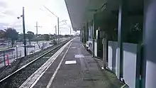
 Station building in January 2021 | ||||||||||||||||||||||||||||||||||||||||||||||||||||||||||||||||||||||||||||||||||||
| General information | ||||||||||||||||||||||||||||||||||||||||||||||||||||||||||||||||||||||||||||||||||||
| Location | Railway Parade, Noble Park, Victoria 3174 City of Greater Dandenong Australia | |||||||||||||||||||||||||||||||||||||||||||||||||||||||||||||||||||||||||||||||||||
| Coordinates | 37°58′41″S 145°11′29″E | |||||||||||||||||||||||||||||||||||||||||||||||||||||||||||||||||||||||||||||||||||
| Owned by | VicTrack | |||||||||||||||||||||||||||||||||||||||||||||||||||||||||||||||||||||||||||||||||||
| Operated by | Metro Trains | |||||||||||||||||||||||||||||||||||||||||||||||||||||||||||||||||||||||||||||||||||
| Line(s) | ||||||||||||||||||||||||||||||||||||||||||||||||||||||||||||||||||||||||||||||||||||
| Distance | 29.04 kilometres from Southern Cross | |||||||||||||||||||||||||||||||||||||||||||||||||||||||||||||||||||||||||||||||||||
| Platforms | 2 (1 island) | |||||||||||||||||||||||||||||||||||||||||||||||||||||||||||||||||||||||||||||||||||
| Tracks | 2 | |||||||||||||||||||||||||||||||||||||||||||||||||||||||||||||||||||||||||||||||||||
| Connections | ||||||||||||||||||||||||||||||||||||||||||||||||||||||||||||||||||||||||||||||||||||
| Construction | ||||||||||||||||||||||||||||||||||||||||||||||||||||||||||||||||||||||||||||||||||||
| Structure type | At-grade | |||||||||||||||||||||||||||||||||||||||||||||||||||||||||||||||||||||||||||||||||||
| Parking | 255 spaces | |||||||||||||||||||||||||||||||||||||||||||||||||||||||||||||||||||||||||||||||||||
| Bicycle facilities | Yes | |||||||||||||||||||||||||||||||||||||||||||||||||||||||||||||||||||||||||||||||||||
| Accessible | No—steep ramp | |||||||||||||||||||||||||||||||||||||||||||||||||||||||||||||||||||||||||||||||||||
| Other information | ||||||||||||||||||||||||||||||||||||||||||||||||||||||||||||||||||||||||||||||||||||
| Status | Operational, unstaffed | |||||||||||||||||||||||||||||||||||||||||||||||||||||||||||||||||||||||||||||||||||
| Station code | YMN | |||||||||||||||||||||||||||||||||||||||||||||||||||||||||||||||||||||||||||||||||||
| Fare zone | Myki Zone 2 | |||||||||||||||||||||||||||||||||||||||||||||||||||||||||||||||||||||||||||||||||||
| Website | Public Transport Victoria | |||||||||||||||||||||||||||||||||||||||||||||||||||||||||||||||||||||||||||||||||||
| History | ||||||||||||||||||||||||||||||||||||||||||||||||||||||||||||||||||||||||||||||||||||
| Opened | 21 December 1976 | |||||||||||||||||||||||||||||||||||||||||||||||||||||||||||||||||||||||||||||||||||
| Electrified | December 1922 (1500 V DC overhead) | |||||||||||||||||||||||||||||||||||||||||||||||||||||||||||||||||||||||||||||||||||
| Passengers | ||||||||||||||||||||||||||||||||||||||||||||||||||||||||||||||||||||||||||||||||||||
| 2005–2006 | 163,691[1] | |||||||||||||||||||||||||||||||||||||||||||||||||||||||||||||||||||||||||||||||||||
| 2006–2007 | 217,005[1] | |||||||||||||||||||||||||||||||||||||||||||||||||||||||||||||||||||||||||||||||||||
| 2007–2008 | 308,847[1] | |||||||||||||||||||||||||||||||||||||||||||||||||||||||||||||||||||||||||||||||||||
| 2008–2009 | 336,235[2] | |||||||||||||||||||||||||||||||||||||||||||||||||||||||||||||||||||||||||||||||||||
| 2009–2010 | 337,991[2] | |||||||||||||||||||||||||||||||||||||||||||||||||||||||||||||||||||||||||||||||||||
| 2010–2011 | 325,545[2] | |||||||||||||||||||||||||||||||||||||||||||||||||||||||||||||||||||||||||||||||||||
| 2011–2012 | 305,602[2] | |||||||||||||||||||||||||||||||||||||||||||||||||||||||||||||||||||||||||||||||||||
| 2012–2013 | Not measured[2] | |||||||||||||||||||||||||||||||||||||||||||||||||||||||||||||||||||||||||||||||||||
| 2013–2014 | 281,349[2] | |||||||||||||||||||||||||||||||||||||||||||||||||||||||||||||||||||||||||||||||||||
| 2014–2015 | 302,532[1] | |||||||||||||||||||||||||||||||||||||||||||||||||||||||||||||||||||||||||||||||||||
| 2015–2016 | 341,602[2] | |||||||||||||||||||||||||||||||||||||||||||||||||||||||||||||||||||||||||||||||||||
| 2016–2017 | 326,785[2] | |||||||||||||||||||||||||||||||||||||||||||||||||||||||||||||||||||||||||||||||||||
| 2017–2018 | 284,084[2] | |||||||||||||||||||||||||||||||||||||||||||||||||||||||||||||||||||||||||||||||||||
| 2018–2019 | 302,072[2] | |||||||||||||||||||||||||||||||||||||||||||||||||||||||||||||||||||||||||||||||||||
| 2019–2020 | 283,350[2] | |||||||||||||||||||||||||||||||||||||||||||||||||||||||||||||||||||||||||||||||||||
| 2020–2021 | 158,500[2] | |||||||||||||||||||||||||||||||||||||||||||||||||||||||||||||||||||||||||||||||||||
| 2021–2022 | 140,000[3] | |||||||||||||||||||||||||||||||||||||||||||||||||||||||||||||||||||||||||||||||||||
| Services | ||||||||||||||||||||||||||||||||||||||||||||||||||||||||||||||||||||||||||||||||||||
| ||||||||||||||||||||||||||||||||||||||||||||||||||||||||||||||||||||||||||||||||||||
| ||||||||||||||||||||||||||||||||||||||||||||||||||||||||||||||||||||||||||||||||||||
The EastLink toll road is located near the down (southeastern) end of the station, crossing via an overpass across the railway line, Railway Parade and Hanna Street. The EastLink Trail, which follows the tollway, uses the station's entrance footbridge to traverse the railway.
The station was opened for service on 21 December, 1976.[4] To allow construction of the station, the existing track towards Flinders Street was slewed in 1974.[5] During construction, an alternative name for the station, Fotheringham, a notable local family, was suggested.[5]
In 2015, the Level Crossing Removal Project announced the grade separation of the nearby Chandler Road level crossing. Construction began in 2016,[6] with the level crossing removed and a railway overpass built over the road in 2018.[7] Unlike many train stations that are rebuilt into elevated "Skyrail" stations along the viaducts between Noble Park and Caulfield, the railway tracks between Dandenong and Noble Park largely remained at ground level, and Yarraman station was not rebuilt as it is over 500 m (550 yd) away from the Chandler Road viaduct.
Platforms and services
Yarraman station has one island platform with two faces, accessible only via only a ramped elevated footbridge at its southeastern end. It is serviced by Metro Trains' Pakenham and Cranbourne line services.[8][9] The Department of Transport has also planned to connect the Pakenham and Cranbourne lines to the Sunbury line, through the new Metro Tunnel, in late 2025.
During peak hours, limited express services towards Flinders Street, Pakenham and Cranbourne often skip the station. V/Line services on the Traralgon and Bairnsdale line also skip the station at full speed both ways.
Platform 1:
- Pakenham line all stations and limited express services to Flinders Street
- Cranbourne line all stations and limited express services to Flinders Street
Platform 2:
- Pakenham line all stations services to Pakenham
- Cranbourne line all stations services to Cranbourne
Future services
In addition to the current services, the Network Development Plan – Metropolitan Rail proposes linking the Pakenham and Cranbourne lines to both the Sunbury line and under-construction Melbourne Airport rail link via the Metro Tunnel.[10]
- Sunbury line express services to West Footscray and Sunbury (2025 onwards)
- Airport line express services to Melbourne Airport (2029 onwards)
Transport links
Ventura Bus Lines operates two routes via Yarraman station, under contract to Public Transport Victoria:
- 812 : Dandenong station – Brighton[11]
- 813 : Dandenong station – Waverley Gardens Shopping Centre[12]
Gallery
 Northwest bound view from Platform 1 in March 2018
References
- Estimated Annual Patronage by Network Segment Financial Year 2005-2006 to 2018-19 Department of Transport
- Railway station and tram stop patronage in Victoria for 2008-2021 Philip Mallis
- Annual metropolitan train station patronage (station entries) Data Vic
- "Yarraman". vicsig.net. Retrieved 18 March 2023.
- "Way & Works". Newsrail. Australian Railway Historical Society. May 1974. p. 115.
- "Crossings". levelcrossings.vic.gov.au. Retrieved 20 January 2016.
- "Chandler Road, Noble Park". levelcrossings.vic.gov.au. Retrieved 29 July 2018.
- "Pakenham Line". Public Transport Victoria.
- "Cranbourne Line". Public Transport Victoria.
- "Network Development Plan Metropolitan Rail Overview" (PDF). Public Transport Victoria. December 2012. Archived (PDF) from the original on 19 September 2021. Retrieved 13 February 2023.
- "812 Dandenong - Brighton via Parkmore Shopping Centre". Public Transport Victoria.
- "813 Dandenong - Waverley Gardens SC". Public Transport Victoria.
External links
- Melway map at street-directory.com.au