Shire of York
The Shire of York is a local government area in the Wheatbelt region of Western Australia, covering an area of 2,133 square kilometres (824 sq mi) just beyond the eastern fringe of Perth's metropolitan area. The Shire's seat of government is the town of York.
| Shire of York Western Australia | |||||||||||||||
|---|---|---|---|---|---|---|---|---|---|---|---|---|---|---|---|
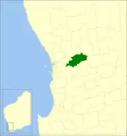 Location in Western Australia | |||||||||||||||
| Population | 3,459 (LGA 2021)[1] | ||||||||||||||
| Established | 1871 | ||||||||||||||
| Area | 2,132.7 km2 (823.4 sq mi) | ||||||||||||||
| Shire President | Denese Smythe | ||||||||||||||
| Council seat | York | ||||||||||||||
| Region | Wheatbelt | ||||||||||||||
| State electorate(s) | Central Wheatbelt | ||||||||||||||
| Federal division(s) | Durack | ||||||||||||||
| Website | Shire of York | ||||||||||||||
| |||||||||||||||
History
The Shire of York was established as the York Road District on 24 January 1871. The townsite of York separated as the Municipality of York (later the Town of York) ten weeks later on 7 March 1871. It became a shire on 1 July 1961 following the passage of the Local Government Act 1960, which reformed all road districts into shires. The Town of York merged back into the shire on 15 March 1965.[2]
Wards
The council was previously split into three wards - Town (4 councillors), West (2 councillors) and East (3 councillors) - but these were abolished and an election for 6 councillors for the entire Shire was held on 6 May 2006.
Towns and localities
The towns and localities of the Shire of York with population and size figures based on the most recent Australian census:[3][4]
| Locality | Population | Area | Map |
|---|---|---|---|
| Badgin | 11 (SAL 2021)[5] | 85 km2 (33 sq mi) | |
| Balladong | 93 (SAL 2021)[6] | 50.3 km2 (19.4 sq mi) | |
| Burges | 11 (SAL 2021)[7] | 40.8 km2 (15.8 sq mi) | |
| Caljie | 38 (SAL 2021)[8] | 77.6 km2 (30.0 sq mi) | |
| Cold Harbour | 108 (SAL 2021)[9] | 41.2 km2 (15.9 sq mi) | |
| Daliak | 58 (SAL 2021)[10] | 43.9 km2 (16.9 sq mi) | |
| Flynn | 0 (SAL 2016)[11][12] | 427.1 km2 (164.9 sq mi) | |
| Gilgering | 85 (SAL 2021)[13] | 153.1 km2 (59.1 sq mi) | |
| Greenhills | 46 (SAL 2021)[14] | 66.4 km2 (25.6 sq mi) | |
| Gwambygine | 83 (SAL 2021)[15] | 48.2 km2 (18.6 sq mi) | |
| Inkpen | 13 (SAL 2021)[16] | 79.4 km2 (30.7 sq mi) | |
| Kauring | 72 (SAL 2021)[17] | 79.6 km2 (30.7 sq mi) | |
| Malebelling | 39 (SAL 2021)[18] | 94 km2 (36 sq mi) | |
| Mount Hardey | 154 (SAL 2021)[19] | 77.2 km2 (29.8 sq mi) | |
| Mount Observation | 0 (SAL 2016)[20][21] | 135.8 km2 (52.4 sq mi) | |
| Narraloggan | 36 (SAL 2021)[22] | 136.8 km2 (52.8 sq mi) | |
| Quellington | 22 (SAL 2021)[23] | 57.1 km2 (22.0 sq mi) | |
| St Ronans | 66 (SAL 2021)[24] | 98.8 km2 (38.1 sq mi) | |
| Talbot | 114 (SAL 2021)[25] | 180.4 km2 (69.7 sq mi) | |
| Wilberforce | 21 (SAL 2021)[26] | 141.9 km2 (54.8 sq mi) | |
| York | 2,393 (SAL 2021)[27] | 17.6 km2 (6.8 sq mi) |
Notable councillors
- Frederick Monger, York Municipality councillor 1892; later a state MP
- Garnet Wood, York Road Board member 1932–1951; also a state MP
Heritage-listed places
As of 2023, 321 places are heritage-listed in the Shire of York,[28] of which 34 are on the State Register of Heritage Places.[29]
See also
References
- Australian Bureau of Statistics (28 June 2022). "York (Local Government Area)". Australian Census 2021 QuickStats. Retrieved 28 June 2022.
- "Municipality Boundary Amendments Register" (PDF). Western Australian Electoral Distribution Commission. Retrieved 11 January 2020.
- "SLIP Map". maps.slip.wa.gov.au. Landgate. Retrieved 15 February 2023.
- "NationalMap". nationalmap.gov.au. Geoscience Australia. Retrieved 15 February 2023.
- Australian Bureau of Statistics (28 June 2022). "Badgin (Suburb and Locality)". Australian Census 2021 QuickStats. Retrieved 28 June 2022.
- Australian Bureau of Statistics (28 June 2022). "Balladong (Suburb and Locality)". Australian Census 2021 QuickStats. Retrieved 28 June 2022.
- Australian Bureau of Statistics (28 June 2022). "Burges (Suburb and Locality)". Australian Census 2021 QuickStats. Retrieved 28 June 2022.
- Australian Bureau of Statistics (28 June 2022). "Caljie (Suburb and Locality)". Australian Census 2021 QuickStats. Retrieved 28 June 2022.
- Australian Bureau of Statistics (28 June 2022). "Cold Harbour (Suburb and Locality)". Australian Census 2021 QuickStats. Retrieved 28 June 2022.
- Australian Bureau of Statistics (28 June 2022). "Daliak (Suburb and Locality)". Australian Census 2021 QuickStats. Retrieved 28 June 2022.
- Australian Bureau of Statistics (27 June 2017). "Flynn (Suburb and Locality)". Australian Census 2016.
- Australian Bureau of Statistics (27 June 2017). "Flynn (WA) (Suburb and Locality)". Australian Census 2016 QuickStats. Retrieved 28 June 2022.
- Australian Bureau of Statistics (28 June 2022). "Gilgering (Suburb and Locality)". Australian Census 2021 QuickStats. Retrieved 28 June 2022.
- Australian Bureau of Statistics (28 June 2022). "Greenhills (Suburb and Locality)". Australian Census 2021 QuickStats. Retrieved 28 June 2022.
- Australian Bureau of Statistics (28 June 2022). "Gwambygine (Suburb and Locality)". Australian Census 2021 QuickStats. Retrieved 28 June 2022.
- Australian Bureau of Statistics (28 June 2022). "Inkpen (Suburb and Locality)". Australian Census 2021 QuickStats. Retrieved 28 June 2022.
- Australian Bureau of Statistics (28 June 2022). "Kauring (Suburb and Locality)". Australian Census 2021 QuickStats. Retrieved 28 June 2022.
- Australian Bureau of Statistics (28 June 2022). "Malebelling (Suburb and Locality)". Australian Census 2021 QuickStats. Retrieved 28 June 2022.
- Australian Bureau of Statistics (28 June 2022). "Mount Hardey (Suburb and Locality)". Australian Census 2021 QuickStats. Retrieved 28 June 2022.
- Australian Bureau of Statistics (27 June 2017). "Mount Observation (Suburb and Locality)". Australian Census 2016.
- Australian Bureau of Statistics (27 June 2017). "Mount Observation (WA) (Suburb and Locality)". Australian Census 2016 QuickStats. Retrieved 28 June 2022.
- Australian Bureau of Statistics (28 June 2022). "Narraloggan (Suburb and Locality)". Australian Census 2021 QuickStats. Retrieved 28 June 2022.
- Australian Bureau of Statistics (28 June 2022). "Quellington (Suburb and Locality)". Australian Census 2021 QuickStats. Retrieved 28 June 2022.
- Australian Bureau of Statistics (28 June 2022). "St Ronans (Suburb and Locality)". Australian Census 2021 QuickStats. Retrieved 28 June 2022.
- Australian Bureau of Statistics (28 June 2022). "Talbot (WA) (Suburb and Locality)". Australian Census 2021 QuickStats. Retrieved 28 June 2022.
- Australian Bureau of Statistics (28 June 2022). "Wilberforce (WA) (Suburb and Locality)". Australian Census 2021 QuickStats. Retrieved 28 June 2022.
- Australian Bureau of Statistics (28 June 2022). "York (Suburb and Locality)". Australian Census 2021 QuickStats. Retrieved 28 June 2022.
- "Shire of York Heritage Places". inherit.stateheritage.wa.gov.au. Heritage Council of Western Australia. Retrieved 25 February 2023.
- "Shire of York State Register of Heritage Places". inherit.stateheritage.wa.gov.au. Heritage Council of Western Australia. Retrieved 25 February 2023.