Zagné
Zagné is a town in western Ivory Coast. It is a sub-prefecture of Taï Department in Cavally Region, Montagnes District.
Zagné | |
|---|---|
Town and sub-prefecture | |
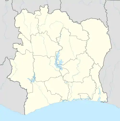 Zagné Location in Ivory Coast | |
| Coordinates: 6°13′N 7°29′W | |
| Country | |
| District | Montagnes |
| Region | Cavally |
| Department | Taï |
| Area | |
| • Total | 2,120 km2 (820 sq mi) |
| Population (2021 census)[1] | |
| • Total | 74,478 |
| • Density | 35/km2 (91/sq mi) |
| • Town | 48,863[2] |
| (2014 census) | |
| Time zone | UTC+0 (GMT) |
Prior to 2013, when Taï Department was created, Zagné was a sub-prefecture of Guiglo Department. A small portion of the sub-prefecture of Zagné lies within Taï National Park.
Zagné was a commune until March 2012, when it became one of 1126 communes nationwide that were abolished.[3]
Notable people
- Adé Liz, singer
Villages
In 2014, the population of the sub-prefecture of Zagné was 71,020.[4] The 8 villages of this sub-prefecture and their population are:[4]
- Djidoubaye (5 092)
- Gahably (1 614)
- Goulégui-Béoué (2 939)
- Kéibly (5 905)
- Tienkoula (2 229)
- Vodélobly (2 314)
- Zagné (48 863)
- Zaϊpobly (2 064)
References
- Citypopulation.de Population of the regions and sub-prefectures of Ivory Coast
- Citypopulation.de Population of cities & localities in Ivory Coast
- "Le gouvernement ivoirien supprime 1126 communes, et maintient 197 pour renforcer sa politique de décentralisation en cours", news.abidjan.net, 7 March 2012.
- "RGPH 2014, Répertoire des localités, Région Cavally" (PDF). ins.ci. Retrieved 5 August 2019.
Regional seat: Guiglo | ||
| Bloléquin Department | 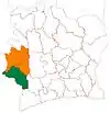 | |
| Guiglo Department | ||
| Taï Department | ||
| Toulépleu Department | ||
* also a commune | ||
This article is issued from Wikipedia. The text is licensed under Creative Commons - Attribution - Sharealike. Additional terms may apply for the media files.