Cavite
Cavite, officially the Province of Cavite (Tagalog: Lalawigan ng Kabite;[lower-alpha 2] Chavacano: Provincia de Cavite), is a province in the Philippines located in the Calabarzon region in Luzon. Located on the southern shores of Manila Bay and southwest of Manila, it is one of the most industrialized and fastest-growing provinces in the Philippines. As of 2020, it has a population of 4,344,829, making it the most populated province in the country if the independent cities of Cebu are excluded from Cebu's population figure.
Cavite | |
|---|---|
| Province of Cavite | |
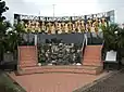
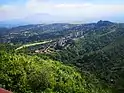
Clockwise (from the top): Aguinaldo Shrine, monolith of Mount Pico de Loro, Tagaytay, Corregidor Island, monument of the Thirteen Martyrs of Cavite | |
 Flag  Seal | |
| Nickname: Historical Capital of the Philippines[1] | |
| Motto(s): Dangal at Pag-ibig sa Bayan (Honor and Love for Country) | |
| Anthem: Himno ng Kabite "Cavite Hymn" | |
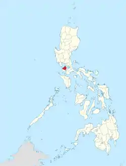 Location in the Philippines | |
OpenStreetMap 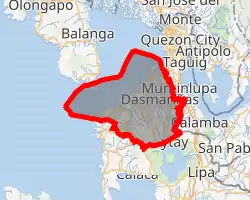 | |
| Coordinates: 14°16′N 120°52′E | |
| Country | Philippines |
| Region | Calabarzon |
| Established | 1614[2][3] |
| Capital |
|
| Largest city | Dasmariñas |
| Government | |
| • Type | Sangguniang Panlalawigan |
| • Governor | Jonvic Remulla (NUP) |
| • Vice Governor | Athena Bryana Tolentino (NUP) |
| • Legislature | Cavite Provincial Board |
| Area | |
| • Total | 1,574.17 km2 (607.79 sq mi) |
| • Land | 1,426.06 km2 (550.60 sq mi) |
| • Rank | 67th out of 81 |
| Highest elevation (Pico de Loro) | 688 m (2,257 ft) |
| Population | |
| • Total | 4,344,829 |
| • Rank | 1st out of 81 |
| • Density | 2,800/km2 (7,100/sq mi) |
| • Rank | 2nd out of 81 |
| Demonym(s) | Caviteño (masculine or neutral) Caviteña (feminine) |
| Divisions | |
| • Independent cities | 0 |
| • Component cities | 7
|
| • Municipalities | 16
|
| • Barangays | 829 |
| • Districts | Legislative districts of Cavite |
| Demographics | |
| • Ethnic groups |
|
| • Native languages | Tagalog Chavacano |
| • Languages | (Major language) Filipino English Chavacano (Minor language) Bicolano Cebuano Ilocano Hiligaynon Waray |
| Time zone | UTC+8 (PHT) |
| IDD : area code | +63 (0)46 |
| ISO 3166 code | PH-CAV |
| Major religions |
|
| Ecclesiastical diocese |
|
| Patron saint | |
| Website | www |
.JPG.webp)
The de facto capital and seat of the government of the province is Trece Martires, although Imus is the official (de jure) capital.
For over 300 years, the province played an important role in both the country's colonial past and eventual fight for independence, earning it the title "Historical Capital of the Philippines". It became the cradle of the Philippine Revolution, which led to the renouncement of Spanish colonial control, finally culminating in the Philippine Declaration of Independence on June 12, 1898 in Kawit. The old provincial capital, Cavite City also hosted docks for the Manila galleon, becoming an essential part of commerce between Asia and Latin America.
Originally an agricultural province, its northern cities of Bacoor, Imus, and Dasmariñas (with a combined population of 1,864,560 at the 2020 Census) are now suburbs of Manila due to increasing urbanization in the late 1900s. This province forms part of the Greater Manila Area.
Etymology
The name "Cavite" comes from the Hispanicized form of kawit or it may be a corruption of kalawit, Tagalog words for "hook", in reference to the small hook-shaped peninsula jutting out to Manila Bay.[10] The name originally applied to the peninsula, Cavite La Punta (now Cavite City) and the adjacent lowland coastal area of Cavite Viejo (now Kawit).
Another theory proposes that the name is a Hispanicized form of kabit, Tagalog for "joined", "connected", or "attached", referring to the peninsula's topographical relation to the mainland.[10] Edmund Roberts, in his 1821 memoir, stated that the "natives" called it Caveit due to the "crooked point of land extending into the sea".[11]
History
Pre-Hispanic period
The present Cavite City was once a mooring place for Chinese junks that came to trade with the settlements around Manila Bay. The land was formerly known as "Tangway". Archeological evidence in coastal areas shows prehistorical settlements. According to local folklore, the earliest settlers of Cavite came from Sulu or Borneo.
Spanish colonial period
The Spanish colonizers who arrived in the late 16th century saw the unusual tongue of land jutting out on Manila Bay and saw its deep waters as the main staging ground where they could launch their bulky galleons. It would later become the most important port linking the colony to the outside world through the Manila-Acapulco Galleon trade. In 1571, Spanish colonizers established the port and City of Cavite and fortified the settlement as a first line of defense for the city of Manila. Galleons were built and fitted at the port and many Chinese merchants settled in the communities of Bacoor and Kawit, opposite the Spanish city to trade silks, porcelain and other oriental goods.[12]
"A defensive curtained wall was constructed the length of Cavite's western side," beginning from the entrance, "La Estanzuela", and continuing to the end of the peninsula, "Punta de Rivera", with the eastern shore unprotected by a wall. Cavite contained government offices, churches, mission buildings, Spanish homes, Fort San Felipe and the Rivera de Cavite shipyard. Docks were in place to construct galleons and galleys, but without a dry dock, ships were repaired by careening along the beach.[12]
Fort San Felipe, La Fuerza de San Felipe, was built between 1609 and 1616. This quadrilateral structure of curtained walls, with bastions at the corners, contained 20 cannons facing the seashore. Three infantry companies, 180 men each, plus 220 Pampangan infantry, garrisoned the fort.[12]: 142–143
The galleons Espiritu Santo and San Miguel, plus six galleys were constructed between 1606 and 1616. From 1729 to 1739, "the main purpose of the Cavite shipyard was the construction and outfitting of the galleons for the Manila to Acapulco trade run."[12]
The vibrant mix of traders, Spanish seamen from Spain and its Latin-American colonies,[13][14] as well as local residents, gave rise to the use of pidgin Spanish called Chabacano. A great number of Mexican men had settled at Cavite, spread throughout Luzon, and had integrated with the local Philippine population. Some of these Mexicans became Tulisanes (Bandits) that led peasant revolts against Spain.[15] Mexicans weren't the only Latin Americans in Cavite, as there were also a fair number of other Latin Americans, one such was the Puerto Rican, Alonso Ramirez, who became a sailor in Cavite, and published the first Latin American novel called "Infortunios de Alonso Ramirez"[16]
In 1614, the politico-military jurisdiction of Cavite was established. As with many other provinces organized during the Spanish colonial era, Cavite City, the name of the capital, was applied to the whole province, Cavite. The province covered all the present territory except for the town of Maragondon, which used to belong to the Corregimiento of Mariveles. Maragondon was ceded to Cavite in 1754 when Bataan province was created from Pampanga province.[17] Within Maragondon is a settlement established in 1660 by Christian Papuan exiles brought in by the Jesuits from Ternate in the Maluku Islands, and named this land Ternate after their former homeland.[2][3]
Owing to its military importance, Cavite had been attacked by foreigners in their quest to conquer Manila and the Philippines. The Dutch made a surprise attack on the city in 1647, pounding the port incessantly, but were repulsed. In 1672, the British occupied the port during their two-year control in the Philippines.[2]
In the 17th century, encomiendas (Spanish Royal land grants) were given in Cavite and Maragondon to Spanish conquistadores and their families. The religious orders began acquiring these lands, with some donated, enlarging vast haciendas (estates) in Cavite during the 18th and 19th centuries, enriching themselves. These haciendas became the source of bitter conflicts between the friar orders and Filipino farmers and pushed a number of Caviteños to live as outlaws. This opposition to the friar orders was an important factor that drove many Cavite residents to support reform, and later, independence.[2]
In 1872, Filipinos launched their revolt against Spain. Three Filipino priests—Jose Burgos, Mariano Gomez and Jacinto Zamora—were implicated in the Cavite mutiny when 200 Filipinos staged a rebellion within Spanish garrisons. On August 28, 1896, when the revolution against Spain broke out, Cavite became a bloody theater of war. Led by Emilio Aguinaldo, Caviteños made lightning raids on Spanish headquarters, and soon liberated the entire province through the Battle of Alapan. Aguinaldo commanded the Revolution to its successful end – the proclamation of the First Republic of the Philippines on June 12, 1898, in Kawit.
During the Spanish–American War, American forces attacked the Spanish squadron in Cavite. The Spanish defeat marked the end of Spanish rule in the country.[2] A captured Spanish cannon from the Cavite arsenal now sits in Village Green Park in Winnetka, Illinois, United States of America.[18]
World War II: Japanese occupation and liberation
In May 1942, after the fall of Bataan and Corregidor Island, the Japanese Imperial forces occupied Cavite and made garrisons in each town of the province.
After surviving the Bataan Death March and released from Capas, Tarlac concentration camp United States Army Forces in the Far East (USAFFE) Col. Mariano Castañeda, returned to Cavite and secretly organized the guerilla forces in the province.
The Japanese authorities pressured him to accept the position as Provincial Governor of Cavite, he refused many times over until his excuses did not work, much against his will he was forced to accept the position by the Japanese, and by thinking that it would be beneficial to further organize the resistance movement as Governor by day and a guerilla commander by night. Eventually, the Japanese discovered his guerilla connection and raided his house in the attempt to capture him, but he escaped along with Col. Lamberto Javalera by swimming the Imus river up to Salinas, Bacoor and finally joined his comrades in the field in Neneng, the General Headquarters of the Fil American Cavite Guerilla Forces (FACGF) located in Dasmariñas.
At this time due to his organizational skills the FACGF raised a regiment in each of the administrative units and also created attached special battalions Overall, 3 special battalions, 1 medical battalion, 1 signal company, 1 hospital unit, Division GHQ and Staff were raised to provide administrative and combat support. Later on, the FACGF, with a peak of 14,371 Enlisted Men and 1,245 officers, grew into a formidable force to take on the omnipresent rule of the Japanese in the province. At its peak the force contained 14 infantry regiments:
- 1st Infantry Regiment, Imus (Col. Lorenzo Saulog)
- 2nd Infantry Regiment, Bacoor (Col. Francisco Guererro)
- 3rd Infantry Regiment, Silang (Col. Dominador Kiamson)
- 4th Infantry Regiment, Dasmariñas (Col. Estanislao Mangubat Carungcong)
- 5th Infantry Regiment, Barangay Anabu, Imus (Col. Raymundo Paredes)
- 6th Infantry Regiment, Cavite City (Col. Amado Soriano)
- 7th Infantry Regiment, Alfonso (Col. Angeles Hernais)
- 8th Infantry Regiment, Naic (Col. Emilio Arenas)
- 9th Infantry Regiment, Mendez (Col. Maximo Rodrigo)
- 10th Infantry Regiment Kawit (Col. Hugo Vidal)
- 11th Infantry Regiment Imus (Col. Maximo Reyes)
- 12th Infantry Regiment, Amadeo (Col. Daniel Mediran)
- 13th Infantry Regiment, Rosario (Col. Ambrosio Salud)
- 14th Infantry Regiment, Brgy. Paliparan, Dasmariñas (Col. Emiliano De La Cruz)
On January 31, 1945, the liberation of the province of Cavite started with the combined forces of the American 11th Airborne Division under General Swing and Col. Hildebrand and the valiant Caviteño guerilleros of the Fil-American Cavite Guerilla Forces, which liberated the province of Cavite from the Japanese occupiers, and protected at all costs the National Highway 17 from Tagaytay to Las Piñas that serve as the vital supply route of the 11th Airborne Division, paving the way towards the road to the bitter but victorious Battle of Manila.
Postwar growth
The economic growth of the country began to creep its way to the province following the end of the Second World War and the restoration of independence. Given its distance from Manila, the province soon began to feel a transformation into an economic provider of food and industrial goods not just for Metro Manila but for the whole of the country. In 1954, Trece Martires City was created out as a planned capital city from portions of Tanza, Indang, Naic, and General Trias. Despite the transfer of capital status to Imus in 1979, it retains many offices of the provincial government, acting thus as the de facto capital of the province. Also, Tagaytay's high location and cool temperatures would enable it to become a secondary summer capital and a vacation spot especially during the Christmas season, given its distance to the Manila area.
Plan CALABARZON of 1972, in the midst of martial law and the communist and anti-government aggression that occurred in the rural areas and the western highlands, set the roadmap for the arrival of industrial estates to the province, beginning an era of economic progress. Carmona was the first town to have industrial estates, through the rising number of residents from the capital region enabled the creation of a new town, General Mariano Alvarez, in 1981, from parts of the town's north and west. In addition, Bacoor, given its distance from Metro Manila, saw the building of the first residential villages to accommodate the rising number of workers in the capital in the same period, and today, this city, alongside other towns and cities in the province's north and central parts, have more residential subdivisions and townships, as well as a number of shopping malls and other private business establishments.
Geography
Cavite is surrounded by Laguna province to the east, Metro Manila to the northeast, and Batangas province to the south. To the west lies the South China Sea.[19] It is located within the Greater Manila Area, not to be confused with adjacent Metro Manila, the defined capital region.
Cavite is the second-smallest province (the Province of Rizal being the smallest) in the Calabarzon region. Cavite occupies a land area of 1,427.06 square kilometres (550.99 sq mi), which is approximately 8.72 percent of Calabarzon's total land area, 2.74 percent of the regional area and 0.48 per cent of the total land area of the Philippines. The municipalities of Maragondon and Silang have the biggest land areas, comprising 165.49 square kilometres (63.90 sq mi) and 156.41 square kilometres (60.39 sq mi) respectively, while the municipality of Noveleta has the smallest land area as indicated by 5.41 square kilometres (2.09 sq mi) or 0.38 percent of the provincial total and area.[20]
Topography and slope
Situated at the entrance of Manila Bay, Cavite is characterized by rolling hinterlands punctuated by hills; shoreline fronting Manila Bay at sea level; and rugged portion at the boundary with Batangas where the Dos Picos mountains are located. The province has two mountain ranges.
Cavite is divided into four physiographical areas, namely: the lowest lowland area, lowland area, the central hilly area and the upland mountainous area.[21]
- The lowest lowland area is the coastal plain in particular. These areas have extremely low ground level of 0 to 2 metres (0.0 to 6.6 ft) elevation compared to the high tide level of about 0.8 meters (2 ft 7 in) from the mean sea level (msl). These are the cities of Cavite, Bacoor and the municipalities of Kawit, Noveleta, Rosario, northern part of Carmona and eastern part of Ternate.
- The lowland area consists of the coastal and alluvial plains. These areas have flat ground slope of less than 0.5% and low ground elevation of 2 to 30 metres (6 ft 7 in to 98 ft 5 in). The alluvial plain can be found in the city of Imus and southern part of General Trias. Into these municipalities forms the transition area between the coastal plain and the central hilly area. It also covers some areas of Bacoor, Carmona, Kawit, Noveleta, Rosario, and Tanza.
- The third topography type is the central hilly area, generally found on the mountain foot slope. It forms the rolling tuffaceous plateau. This topography includes steep hills, ridges and elevated inland valley. The plateau is characterized with ground elevation ranging from 30 meters (98 ft) to nearly 400 meters (1,300 ft). Its ground slope ranges from 0.5 to 2%. The cities of Trece Martires and Dasmariñas and the municipalities of General Emilio Aguinaldo, General Mariano Alvarez, western part of Ternate, northern parts of Amadeo, Indang, Silang, Magallanes and Maragondon have this kind of topography.
- The last topography type is upland mountainous area, found in the city of Tagaytay and the municipalities of Alfonso, Mendez, southern parts of Amadeo, Indang, Silang, Magallanes and Maragondon. They are situated at a very high elevation above 400 meters (1,300 ft) with slopes of more than 2%.[20] The Tagaytay ridge has an average elevation of 610 metres (2,000 ft) with Mount Sungay at 14°8′31.71″N 121°1′19.02″E, the highest elevation in the province at 716 metres (2,349 ft).[22] The mountain was much higher before with an elevation of 752 meters (2,467 ft),[23] topped by rock formations that resembled horns (Sungay in Tagalog) hence the name. The prominence of the mountain was leveled in half during the construction of People's Park in the Sky during the Marcos administration.
Islands
- Balot Island, located at the mouth of Ternate River[24]
- Caballo Island
- Corregidor
- El Fraile Island
- Carabao Island
- La Monja Island, located west of Corregidor
- Limbones Island, located off Maragondon coast near Batangas border
- Pulo ni Burunggoy (now Island Cove Resort; formerly Covelandia) located in Bacoor Bay[25]
- Santa Amalia Island, located Northwest of Corregidor[26]
Land resources and distribution
Cavite's land resources are categorized into two: forest lands and alienable and disposable lands. Forest lands are being maintained as they play a great role in the ecological balance of the province aside from the fact that they are home to numerous flora and fauna that needs to be protected and preserved. Correspondingly, the alienable and disposable lands are the built-up areas as well as production areas. These lands are intended for urban, economic and demographic developments.
Forest lands
Cavite province lies in the western monsoon forest zone. This location is very beneficial for the formation of tropical rainforests, which are characteristically made through natural vegetation. In 2007, the existing forest area within the province totaled only to 8,625 hectares (21,310 acres). These forest areas were categorized as Protected Landscape under the National Integrated Protected Area System (NIPAS) and the rest, unclassified forest (Non-NIPAS). A total of 4,000 hectares (9,900 acres) are located within the Mounts Palay-Palay–Mataas-na-Gulod Protected Landscape, a protected area in Ternate and Maragondon created by Proclamation Number 1594 on October 26, 1976. The park lies at the border of Cavite and Batangas and encompasses three peaks, Palay-Palay, Pico de Loro and Mataas na Gulod. The five unclassified forests are found along Tagaytay Ridge, Maragondon, Magallanes, Ternate and Alfonso. The other mountain peaks in the province are Mt. Buntis, Mt. Nagpatong, Mt. Hulog and Mt. Gonzales (Mt. Sungay).
Cavite's forest provides an abundance of different forest products. Bamboo, a member of the grass family, is one of the most available forest products found in the municipalities of Ternate, Magallanes, Maragondon and General Aguinaldo throughout the year.
Alienable and disposable lands
These lands are being used in various ways, either for agriculture, residences, open areas, etc. Based on the Cavite Provincial Physical Framework Plan 2005–2010, Cavite's alienable and disposable lands are further classified into production lands and built-up areas. Production lands in Cavite are intended for agriculture, fishery, and mining. On the other hand, built-up areas are mainly for residential areas, commercial, industrial and tourism areas.
Production land-use
Majority of production land-use is for agriculture. Considering that 50.33% of the total provincial land area is engaged in agriculture, it can be generalized that in spite of rapid urbanization in the province, Cavite remains to have an agricultural economy that makes food security attainable. Some of the major crops being produced in the province are rice, corn, coffee, coconuts, cut flowers and vegetables.
Included in the agricultural land use are livestock farms that range from piggery, poultry, goat and cattle farms. The climatic suitability of Cavite makes the province ideal for integrated farming, having crops and livestock raising in one farm.
Fishery is also another major component of the agricultural sector. Having rich marine resources and long coastlines, the province is home to numerous fishery activities providing livelihood to many Caviteños. In some lowland and even upland areas, fishery, in the form of fish ponds are also producing a large amount of fish products. Some areas in Cavite are also engaged in fish processing and production of fish products like fish sauce.
Mining is the third component of production land-use in the province. As of 2009, there are 15 mining and quarrying areas operating in Cavite. Extraction includes filling materials, gravel, and sand.
Built-up areas
The built-up areas are mainly composed of residential and industrial sites. This also includes commercial and business areas where commerce is transpiring. According to the 2007 Census of Population and Housing by the Philippine Statistics Authority, there are 611,450 occupied housing units in Cavite.
Moreover, according to the Housing and Land-Use Regulatory Board, there are around 1,224 housing subdivisions with issued license to sell in the province until 2009 which occupies an area of 9,471 hectares.
Meanwhile, the industrial sector also develops rapidly in the province. For 2009, operational industrial estates cover around 2,939 hectares (7,260 acres). Tourism establishments are also considered built-up areas such as golf courses, leisure farms, resorts and the likes.[20]
Water resources
The hydrological network of the province is composed of seven major rivers and its tributaries. These river systems generally flows from the highlands of Tagaytay and Maragondon to Manila Bay. Numerous springs, waterfalls and rivers found in the upland areas of the province, have been developed for tourism. In the lowland areas, hundreds of artesian wells and deep wells provide water supply for both residential and irrigation purposes.
Cavite shoreline stretches about 123 kilometres (76 mi). The communities located along the coast are Cavite City, Bacoor, Kawit, Noveleta, Rosario, Tanza, Naic, Maragondon, and Ternate. The richness of Cavite's coastal resources is a major producer of oysters and mussels. The fishing industry also produces shrimp and bangus (milkfish). The western coastline are lined with pale gray sand beaches popular with tourists. Thus, fishery and tourism contribute to the economic activity of the province.[27]
Major riversThese rivers are known to have various tributaries passing through the municipalities of the province:
|
Springs
|
Waterfalls
|
Soil properties
Cavite is composed of several soil types according to soil surveys conducted by the Bureau of Soils and Water Management (BSWM). Classification of soil types in a specific area is a very important consideration in identifying its most fitted land-use. This way, utmost productivity can be achieved.
The lowland area of Cavite is generally composed of Guadalupe clay and clay loam. It is characterized as coarse and granular when dry but sticky and plastic when wet. Its substratum is solid volcanic tuff. These types of soils are suited to lowland rice and corn while those in the upland are suited for orchard and pasture. Guadalupe clay adobes are abundant in the southern part of Bacoor and Imus bordering Dasmariñas. The soil is hard and compact and difficult to cultivate that makes it generally unsuitable for diverse cropping. It is very sticky when wet and granular when dry. Forage grass is advised for this type of soil. Hydrosol and Obando sand are found along Bacoor Bay. The shoreline of Rosario, Tanza, Naic and Ternate are lined with Guadalupe sand.
The central area principally consists of Magallanes loam with streaks of Magallanes clay loam of sandy texture. This is recommended for diversified farming such as the cultivation of upland rice, corn, sugarcane, vegetables, coconut, coffee, mangoes and other fruit trees. The steep phase should be forested or planted to rootcrops. The eastern side of Cavite consists of Carmona clay loam with streaks of Carmona clay loam steep phase and Carmona sandy clay loam. This type of soil is granular with tuffaceaous material and concretions. It is hard and compact when dry, sticky and plastic when wet. This type of soil is planted to rice with irrigation or sugarcane without irrigation. Fruit trees such as mango, avocado and citrus are also grown in this type of soil. Guingua fine sandy loam is found along the lower part of Malabon and Alang-ilang River at Noveleta.
The type of soils that dominate the upland areas are Tagaytay loam and Tagaytay sandy loam with mountain soil undifferentiated found on the south-eastern side bordering Laguna province. Also on the southern tip are Magallanes clay and Mountain soil undifferentiated with interlacing of Magallanes clay loam steep phase. The Tagaytay loam contains fine sandy materials, moderately friable, and easy to work on when moist. In an undisturbed condition, it bakes and becomes hard when dry. About one-half of this soil type is devoted to upland rice and upland crops. On the other hand, Tagaytay sandy loam is friable and granular with considerable amount of volcanic sand and underlain by adobe clay. Mountain soil undifferentiated is forested with bamboos found in the sea coast. Cavite also has the Patungan sand characterized by pale gray to almost white sand with substratum of marine conglomerates which are found at Santa Mercedes in Maragondon and in some coastlines of Ternate.[20]
Mineral resources and reserves
The greater parts of Cavite are composed of volcanic materials, tuff, cinders, basalt, breccias, agglomerate and interbeddings of shales, and sandstones. The dormant and active volcanoes (Taal) are within these volcanic areas and have been the sources of volcanic materials which form the Tagaytay Cuesta. The drainage systems are deeply entrenched in the tuffs, eroding thin interbedded sandstones and conglomerate rocks which are the sources of little reserves of sand and gravel in the larger stream. Adobe stone quarries also flourish in the tuff areas.
Cavite coastal areas have marl and conglomerate sedimentary rocks and some igneous rocks which are prominent in the high, mountainous regions of western part of the province. Black sands are found in Kawit while Noveleta has its own salt products. Magallanes has gravel deposits while reserves of sand and gravel materials are found in Alfonso, Carmona, Gen. Emilio Aguinaldo, Naic, Ternate, Maragondon and Silang.[20]
Administrative divisions
Cavite comprises 16 municipalities and 7 cities:
| ||||||||||||||||||||||||||||||||||||||||||||||||||||||||||||||||||||||||||||||||||||||||||||||||||||||||||||||||||||||||||||||||||||||||||||||||||||||||||||||||||||||||||||||||||||||||||||||||||||||||||||||||||||||||||||||||||||||||||||||||||||||||||||||||||||||||||||||||||||||||||||||||||||||||||||||||||||||||||||||||||||||||||||||||||||||||
Climate
Cavite belongs to Type 1 climate based on the Climate Map of the Philippines by the Philippine Atmospheric, Geophysical and Astronomical Services Administration (PAGASA). Being a Type 1, Cavite has two pronounced seasons – the dry season, which usually begins in November and ends in April, and the rainy season, which starts in May and ends in October.[20] The Köppen Climate Classification sub-type for this climate is "Am" (Tropical Monsoon Climate).[30]
| Climate data for Cavite | |||||||||||||
|---|---|---|---|---|---|---|---|---|---|---|---|---|---|
| Month | Jan | Feb | Mar | Apr | May | Jun | Jul | Aug | Sep | Oct | Nov | Dec | Year |
| Average high °C (°F) | 29 (84) |
29 (84) |
31 (87) |
32 (89) |
33 (91) |
31 (87) |
30 (86) |
30 (86) |
30 (86) |
30 (86) |
30 (86) |
29 (84) |
30 (86) |
| Average low °C (°F) | 23 (73) |
23 (73) |
24 (75) |
25 (77) |
26 (78) |
25 (77) |
25 (77) |
25 (77) |
25 (77) |
25 (77) |
24 (75) |
24 (75) |
24 (75) |
| Average precipitation mm (inches) | 13 (0.5) |
5.1 (0.2) |
10 (0.4) |
18 (0.7) |
120 (4.8) |
250 (9.9) |
290 (11.6) |
420 (16.4) |
340 (13.3) |
150 (6.1) |
110 (4.4) |
53 (2.1) |
1,780 (70.1) |
| Source: Weatherbase[31] | |||||||||||||
Demographics
| Year | Pop. | ±% p.a. |
|---|---|---|
| 1903 | 134,779 | — |
| 1918 | 157,355 | +1.04% |
| 1939 | 238,581 | +2.00% |
| 1948 | 262,550 | +1.07% |
| 1960 | 378,138 | +3.09% |
| 1970 | 520,180 | +3.24% |
| 1975 | 628,321 | +3.86% |
| 1980 | 771,320 | +4.18% |
| 1990 | 1,152,534 | +4.10% |
| 1995 | 1,610,324 | +6.47% |
| 2000 | 2,063,161 | +5.46% |
| 2007 | 2,856,765 | +4.59% |
| 2010 | 3,090,691 | +2.91% |
| 2015 | 3,678,301 | +3.37% |
| 2020 | 4,344,829 | +3.33% |
| Source: Philippine Statistics Authority [29] [32] [33] | ||
Cavite had a total population of 4,344,829 in the 2020 census, [7] making it the most populous (if independent cities are excluded from Cebu), and the second most densely populated province in the country. The tremendous increase can be observed in the year 1990 when industrialization was introduced in the province. Investors established their businesses in different industrial estates that magnetized people to migrate to Cavite due to job opportunities the province offers. Another factor attributed to the increase of population is the mushrooming of housing subdivisions. Since Cavite is proximate to Metro Manila, people working in the metropolitan area choose to live in the province together with their families. Natural increase also contributes to the increase in population. The population density of the province based on the 2020 census was 2,800 inhabitants per square kilometre or 7,300 inhabitants per square mile. [7][34]
Among the cities and municipalities in Cavite, the city of Dasmariñas has the biggest population with 659,019 people while the municipality of Gen. Emilio Aguinaldo has registered the smallest population with 22,220 people.
Cavite is classified as predominantly urban having 90.69 percent of the population concentrated in the urban areas, while 9.21 percent of the population reside in the rural areas.
Religion
Christianity
In line with national statistics, Christianity is the predominant faith in the province, composed of Catholics, Protestants, and other Independent Christian groups. The majority (70%) of the population are Roman Catholic.
Adherents of the Philippine Independent Church, also known as the Aglipayan Church, are particularly found in the towns where historically the Philippine Revolution and anti-clericalist sentiments are strong.
The Eastern Orthodox Church presence in Cavite province was a part of the Philippine Orthodox Church here in the Philippines under the jurisdiction of the Patriarchate of Moscow and its own Orthodox Diocese province in Southeast Asia the Diocese of the Philippines and Vietnam. Many Orthodox community lives throughout the province especially in the city of Tagaytay.[35][36]
The strong presence of other Christian denominations and sects such as the mainline Protestant Evangelical Churches, Christian Fellowships and other Christian sects are also evident throughout the province. Chapels of the Iglesia ni Cristo also known as INC, The Church of Jesus Christ of Latter-day Saints,[37] and the Seventh-day Adventist Church including its key institutions such as the Adventist University of the Philippines and Adventist International Institute of Advanced Studies are in Cavite.[38] Meanwhile, the Members Church of God International has established coordinating centers throughout the province and a local convention center situated in Biga, Silang, Cavite.
Islam
With the influx of Filipino Muslim migrants from the Mindanao, local Caviteño Balik Islam or reverts, and some non-Filipino expats, their OFW spouses and children returning from Muslim countries, Sunni Islam of either the Shafii or Hanbali schools-of-thought has become evident in various areas of the province, and accounts for the majority of the non-Christian population.
Mosques, prayer halls, and prayer rooms catering to the community exist in places where local Muslim Caviteños live and work; especially in the municipalities of Bacoor, Imus, Rosario, and Dasmariñas.
Interreligious dialogue and communal relations between the majority Christians and minority Muslims are peaceful and amicable, with some families consisting of both Christian and Muslim members.
Other faiths
Non-Abrahamic faiths include native-Tagalog Anitism, Animism, Sikhism, and Hinduism. Among the local Chinese and Chinese-Filipino communities Taoism, Buddhism, and Confucianism are followed.
Languages
The main languages spoken are Tagalog, Chavacano and English. Due to the province bordering south of Metro Manila, a large number of people from farther provinces migrated to Cavite, resulting in minor but significant usages of Bicolano, Cebuano, Ilocano, Hiligaynon and Waray languages.
Chavacano in Cavite
Chavacano or Chabacano is a Spanish-based creole language and known in linguistics as Philippine Creole Spanish. Chabacano is originally spoken by the majority of the Caviteños that lived in Cavite City and Ternate after the arrival of the Spaniards three centuries ago. The various groups in the area of different linguistic backgrounds adopted a pidgin language, with mostly Spanish vocabulary, in order to communicate with each other. As children grew up in Cavite with that pidgin as their native language, it evolved into a creole language.[39]
Now used almost exclusively in Cavite City and coastal Ternate, Chabacano enjoyed its widest diffusion and greatest splendor in Spanish and American period of Filipino history, when newspapers and literary outputs flourished. Cavite Chabacano was spoken with relative ease because it was essentially a simplification of Castillan morphology patterned after the Tagalog syntax. Gradually and naturally, it acquired the sounds present in the Spanish phonological system. After World War II, creole Spanish speakers within the capital of the archipelago vanished. Around 30,000 Caviteños still speak Chabacano, mostly elderly speakers. The language is today taught in elementary schools in both Cavite City and Ternate as part of the K-12 national curriculum from the first to 3rd grades, building up a new generation of speakers and writers within the province.
Culture
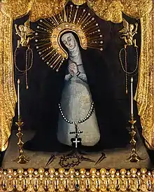
Aside from the celebrations of town fiestas, the province of Cavite celebrates festivals as forms of thanksgiving for a bountiful harvest. Some of these festivals are also observed in honor of the historical legacies passed from one generation to another generation. In fact, the province fetes the renowned Kalayaan Festival which is given a great social importance in commemoration of the heroism of its people. The annual Fiesta de la Reina del Provincia de Cavite is a grandiose fiesta celebration in honor of the patroness of the province, the Nuestra Señora de la Soledad de Porta Vaga. The image is enshrined at San Roque Church in Cavite City. Her feastday is celebrated every 2nd and 3rd Sunday of November.
Traditions and fiesta celebrations include Mardicas, a war dance held in Ternate town. Karakol street dancing with a fluvial procession is usually held in coastal towns. There is also a pre-colonial ritual called the Sanghiyang as a form of thanksgiving and to heal the sick. Another cultural tradition is the Live via Crucis or Kalbaryo ni Hesus held during Holy Week. The Maytinis or word prayer that is annually held in Kawit every December 24 before the beginning of the midnight Mass.
Festivals
| Event | Location | Description |
|---|---|---|
| Fiesta de la Reina de Caracol | Rosario | Held every 3rd weekend of May and 1st weekend of October. It celebrates the feast of the town patroness Nuestra Señora Virgen del Santissimo Rosario, Reina de Caracol starting with the traditional Caracol or "Karakol", which traditionally has two parts, the "Caracol del Mar" or fluvial procession and the "Caracol dela Tierra" or "karakol sa lupa". Caracol started in the town of Rosario and after how many years it spread to the whole province. |
| Fiesta de la Reina de Cavite | Cavite City | Celebrated every 2nd and 3rd Sunday of November in honor of Cavite city's patroness, Nuestra Señora de la Soledad de Porta Vaga. It is also known as Cavite City fiesta. |
| Valenciana Festival | General Trias | A month-long celebration held in honor of the Blessed Virgin Mary. Church is decorated with flowers. Every month of May. This festival also showcases the Filipino paella-like dish called Valenciana which is a local delicacy in General Trias. |
| Irok Festival | Indang | Done during the celebration of Indang Day. Float parade, street dancing, sports activities, lantern contest made out of irok leaves and a grand parade are held in the town plaza. Celebrated every November 30 to December 2. |
| Kabutenyo Festival | General Mariano Alvarez | Celebration and thanksgiving for bountiful mushrooms. Activities includes street dancing, trade fair and culinary contest with mushroom as main ingredients. Every March 13. |
| Kakanindayog Festival | Imus | The festival is celebrated to promote the native kakanin & other delicacies which the city is well known for such as Puto Lansong. Celebrates every month of October in honor of the city's patroness Nuestra Señora del Pilar and the founding anniversary of the city through street dancing and the traditional "Karakol" procession. |
| Kalayaan Festival | Provincewide | It is a 2-week-long province wide event held annually from May 28 to June 12. As its name suggests, the series of events for the festival are held to celebrate the independence day season. |
| Kawayan Festival | Maragondon | Held every 7th day of September wherein a group of street dancers parade in indigenous materials. An exhibit of bamboo products likewise done in the town plaza. |
| Marching Band Festival | Bacoor | To promote the musical heritage of the city & boost tourism through its number of marching bands around the country. Celebrated every 2nd weekend of May in honor of St. Michael the Archangel & Our Lady of the Most Holy Rosary. |
| Mardicas | Ternate | Fluvial parades carrying the image of Santo Niño are held and continue in the streets of the municipality and ends in the churchyard. Karakol and street dancing in colorful costumes with brass band music. Every 3rd weekend of January. |
| Maytinis | Kawit | Re-enactment of Christ's birth on midnight of December 24 through a procession of colorful floats & costumes. |
| Pahimis Festival | Amadeo | Also Called the "Coffee Festival" as way of thanksgiving for abundant harvest of coffee in the municipality. Trade fair, street dancing, beauty pageant, coffee convention are the usual activities done during the occasion. Free flowing drinking of coffee is offered to everybody. Celebrates every 2nd week of February |
| Paskuhan sa Imus | Imus | A month-long festival of Christmas holiday. The city is decorated with thousands of lights, a dazzling array of lanterns of all shapes and a food fair featuring the best of Cavite products. |
| Pista ng mga Puso | Tagaytay | Festival held annually on Valentine's Day in honor of the city's patroness Our Lady of Lourdes. There are Karakol dancers parading and marching all over the city. |
| Regada Festival | Cavite City | Also called the "Water Festival", the festival consists of games, street dancing, photo exhibit, trade fair, concert and water splashing. The festival is done three days from June 22–24 done in celebration of St. John the Baptist. |
| Sapyaw Festival | Tanza | Street dancing are done all over the streets of the municipality with their attractive and very colorful costumes. Various barangays join the dancing in honor of St. Augustine. Every 20th day of August. |
| Silang Prutas Festival | Silang | Celebration and thanksgiving for bountiful fruits harvested in the said municipality. Activities includes street dancing, trade fair and culinary contest with fruits as the main source of income. Celebrates every February 2 in honor of the town's patroness Our Lady of Candelaria. |
| Sorteo ng Bukid | Carmona | Local festival held every three years of February to relive the old practice of distributing agricultural lots to deserving farmers through raffle draws. |
| Sumilang Festival | Silang | Recognized as an agriculture event. The occasion is participated in by dancers who come from the agricultural sector. Every February 1 to 3 in celebration of the feast of Our Lady of Candelaria. |
| Tahong Festival | Bacoor | Different cuisines with tahong as main ingredient are on exhibit at the town plaza. Culinary contest are held annually. Various activities are done such as beauty contest. Tahong symposium and seminars are held for culture of Tahong. Every September 29. |
| Tinapa Festival | Rosario | The festival is celebrated to promote and perpetuate the image of Rosario as the place where smoked fish called "Tinapang Salinas" originates. Celebrates every month of October in honor of the town's patroness Nuestra Señora del Santissimo Rosario Reina de Caracol. |
| Wagayway Festival | Imus | Every 28th day of May, household display of Philippine flag is encouraged during the festival, and simultaneous waving of flags in the streets of Cavite. Different activities such as exhibits, trade fair, product displays are held. It also commemorates the Battle of Alapan and as a kick-off celebration of the provincewide Kalayaan Festival. |
| Paru-paro Festival | Dasmariñas | Every 26th day of November, it commemorates the city of Dasmariñas. |
Special events
- Foundation Day
Cavite Province celebrates its foundation every March 10
- Birthday of Gen. Emilio Aguinaldo
This is celebrated every March 22 in commemoration of the birth of the First President of the Republic.
- Independence Day
This is celebrated every June 12 in Kawit as a re-enactment of the historic proclamation of Philippine independence at the mansion of Gen. Emilio Aguinaldo.
Economy
Agriculture
The province is predominantly an agriculture province. The province's economy is largely dependent on agriculture. Despite urbanization and industrialization, still, a significant number of inhabitants are engaged into agribusinesses. The data gathered from Office of the Provincial Agriculturist shows that though the province lies in the industrial belt, the agricultural land is about 49.38 percent or 70,466.53 hectares (174,126.6 acres) of the total land area of the Province. This is 1,176.5 hectares (2,907 acres) bigger than that of the declared agricultural lands in 2008 (69,290.03 hectares).
The municipality of Maragondon has the biggest area intended for agriculture, accounts for 14.57% of the total provincial agricultural lands while Cavite City has no longer available land for agriculture related activities and industries. If based on total agricultural lands, we may say that the major players in agriculture in the province are Maragondon, Silang, Indang, Naic and Alfonso. Of the eight districts in the province, the top three with the widest agricultural area are District VII comprising 43,587.01 hectares or 61.85 percent of the total agricultural areas with 27,115 farmers followed by District VI with 17.40 percent or 12,257.71 hectares (30,289.5 acres) having 8,701 farmers and District V comprising 10,248.55 hectares (25,324.7 acres) with 10,295 farmers. The municipality of Silang has the most farmers. The municipality of Maragondon only ranks 3rd in terms of number of farmers. This can be attributed to highly mechanized operations and vast plantations of rice. The same is true with General Trias and Naic, known as the rice producing municipalities in Cavite. The number of farmers increased by 6.5% that corresponds to around 3,097 farmers. The increase in the number of farmers was due to worldwide recession which led to work displacement of some inhabitants. Silang is dominated by pineapple and coffee plantations as well as with cutflower production.[47]
Industry and commerce
Cavite has twelve economic zones. The largest economic zone under development is located in Gen. Trias, the PEC Industrial Park with 177 hectares intended for garments, textiles, semiconductors, food processing and pharmaceuticals.[47]
Township Developments (Completed and Ongoing Projects)
- Vista City / Villar Land (Vista Land) 2,500 hectares — Bacoor and Dasmariñas (shared with Las Piñas and Muntinlupa)
- Lancaster New City (PRO-Friends Inc.) 2,100 hectares — Imus, Kawit, General Trias and Tanza
- Aera (Ayala Land) 900 hectares — Carmona and Silang
- Vermosa (Ayala Land) 770 hectares — Imus and Dasmariñas
- Eagle Ridge Golf & Residential Estates (Sta. Lucia) 700 hectares — General Trias
- Riverpark (Federal Land and SM Development Corp.) 700 hectares — General Trias
- Southwoods City (Megaworld) 561 hectares — Carmona (shared with Biñan, Laguna)
- Suntrust Ecotown (Megaworld) 350 hectares — Tanza
- Arden Botanical Estate (Megaworld) 251 hectares — Trece Martires and Tanza
- Evo City (Ayala Land) 250 hectares — Kawit
- South Forbes City (Cathay Land) 250 hectares — Silang
- Golden Horizon (HG-III Construction and Development Corp.) 250 hectares — Trece Martires
- SM Smart City (SM Development Corp.) 200 hectares — Carmona
- NOMO Garden City (Vista Land) 180 hectares — Bacoor
- Antel Grand (Antel Holdings) 170 hectares — General Trias
- Maple Grove (Megaworld) 140 hectares — General Trias
- Stanza (Vista Land) 110 hectares — Tanza
- Crosswinds (Vista Land) 100 hectares — Tagaytay
- Mallorca City (Cathay Land) 100 hectares — Silang and Carmona
- POGO City (PAGCOR) 70 hectares — Kawit
- Idesia City (Hankyu Hanshin Holdings Inc.) 31 hectares — Dasmariñas
- Crest Key Estates (Cathay Land) 19 hectares — Silang
Tourism
.jpg.webp)
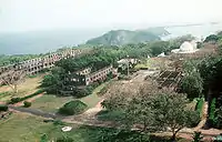
Tagaytay serves as the main tourist center in the province. Historical attraction and sites are Fort San Felipe and Sangley Point, both in Cavite City; Corregidor Island; General Trias; Calero Bridge, Noveleta; Battle of Alapan Marker and Flag in Imus; Zapote Bridge in Bacoor; Battle of Binakayan Monument in Kawit; Tejeros Convention Site in Rosario; and Aguinaldo Shrine, the site of the declaration of Philippine Independence in Kawit. Several old churches stand as glorious reminders of how the Catholic faith has blossomed in the Province of Cavite. Existing museums include Geronimo de los Reyes Museum, General Trias; Museo De La Salle, Dasmariñas; Philippine Navy Museum, Cavite City; Baldomero Aguinaldo Museum, Kawit; and Cavite City Library Museum, Cavite City. There are eight world-class golf courses in the province. Natural wonders are mostly found in the upland areas such as Tagaytay Ridge, Macabag Cave in Maragondon, Balite Falls in Amadeo, Malibiclibic Falls in General Aguinaldo-Magallanes border, Mts. Palay-Palay and Mataas na Gulod National Park in Ternate and Maragondon, Sitio Buhay Unclassified Forest in Magallanes and flowers, vegetables and coffee farms.
The Aguinaldo Shrine and Museum in Kawit is where the independence of the Philippines was proclaimed on June 12, 1898, by General Aguinaldo, the Philippines' first president. The multi-level structure includes a mezzanine and tower, and spans 14,000 square feet. Today, the ground floor serves as a museum, which houses historical artifacts. The tomb of Aguinaldo lies in a garden behind the house.
The Andrés Bonifacio House in General Trias is the former home of the country's revolutionary leader. The site of his court martial in Maragondon is also preserved. Other historical sites include the Battle of Alapan and Battle of Julian Bridge Markers, the House of Tirona, and Fort San Felipe.
The main churches of the province are the Imus Cathedral, San Roque Parish in Cavite City where the miraculous image of Nuestra Señora de la Soledad de Porta Vaga enshrined., Bacoor, Silang, Naic, Tanza, Ternate, Indang, General Trias, Kawit and Maragondon Catholic Churches. The Shrines of Our Lady of La Salette in Silang, and St. Anne, Tagaytay, also attract pilgrims.
Corregidor is an island fortress where Filipino and American forces fought against the Japanese invaders in 1942. It has become a tourist attraction with tunnels, cannons and other war structures still well-preserved. The famous line of General Douglas MacArthur said is associated with Corregidor: "I shall return!"
There are first class hotels, inns and lodging houses to accommodate both foreign and local tourists. Conference facilities can be found in several convention centers, hotels and resorts in the province. Restaurants and specialty dining places offer mushroom dishes, native delicacies and exotic cuisines. Seafoods, fruits, coffee, organic vegetables, tinapa, handicrafts, ornamental plants also abound in the province.

Mountain climbing is also one of the outdoor activities in Cavite. This includes Mount Pico De Loro which is within the towns of Ternate and Maragondon (and some parts of it are already part of Batangas), which is a part of the Palay-Palay and Mataas na Gulod protected landscape. Mt. Pico De Loro is the highest part of Cavite at 664 meters above sea level and is noted for its 360-degree view at its summit and a cliff known as Parrot's Beak or Monolith that mountaineers would also like to climb.[48] Mt. Marami, within the same mountain range, located at Magallanes town is also a mountaineering location due to its "silyang bato" (en. Chair of rocks) at its summit.[49]
There are twenty-two accredited tourism establishments and three accredited tour guides. There are also tour packages being arranged with the Department of Tourism. Centuries old traditions and the very rich culture of Cavite have been the source of great pride to Caviteños.
Transportation
During the Spanish colonial period, Cavite hosted the principal port of Manila and served as the country's gateway to the world.[50][51]
In the mid-19th century, Cavite, particularly the Cavite Peninsula in the north, was a stop for ships from South America before free trade opened up.[11]
Roads
Cavite's total road network comprises roughly 1,973 kilometers (1,226 mi). Of these, the 407.7-kilometer (253.3 mi) national roads are mostly paved with concrete or asphalt and are relatively in good condition with some portions in need of rehabilitation. Provincial roads stretches to an approximate total length of 335.1 kilometers (208.2 mi). Most of these roads are concrete, some are paved with asphalt and the rest remain gravel roads. Majority of the municipal/city roads are paved with concrete, while barangay roads consist of 46.7% concrete and asphalt roads and 53.3% earth and gravel roads.
There are three main highways traversing the province: Aguinaldo Highway runs in a general north–south direction which includes the Tagaytay–Nasugbu Highway segment in the south; the Governor's Drive runs in a general east–west direction; the Antero Soriano Highway runs within the coastal towns on the northwest. The existing road length computed in terms of road density with respect to population at the standard of 2.4 kilometers (1.5 mi) per 1,000 population has a deficit of 3,532.71 kilometers (2,195.12 mi).
In 1985, the Cavite Expressway (CAVITEx) was opened, which lessened the heavy volume of vehicles on Aguinaldo Highway in Bacoor. This project decreased the traffic congestion in Aguinaldo Highway in Bacoor, so travel time from Imus to Baclaran/Pasay is lessened to only one hour.
In 2013, the Kaybiang Tunnel, the country's longest underground highway tunnel at 300 meters (980 ft) was opened along the Ternate–Nasugbu Road piercing through Mt. Pico De Loro's north ridge, and shortens the travel time from Manila to the western coves of Cavite and Nasugbu, Batangas.[52]
Last July 24, 2015, the Muntinlupa–Cavite Expressway (MCX), a 4 km (2.5 mi) long access-controlled toll expressway linking the southern province of Cavite to Muntinlupa in the Philippines, was opened to the public. The road is expected to reduce travel time by an average of 45 minutes from Daang Hari to Alabang Interchange as well as decongest traffic in Cavite, Las Piñas and Muntinlupa.
Currently, Cavite province is served by three DPWH offices: Cavite 1st, Cavite 2nd and Cavite Sub District Engineering Offices.
Sangley International Airport
The Department of Transportation had "no objection" to an offer building a ₱508-billion airport complex on reclaimed land in Sangley Point. The upcoming international airport was pursued as a joint venture between investors, including Chinese enterprises, and the Cavite LGU.[53]
Cavite–Laguna and Cavite–Tagaytay–Batangas Expressways
The Cavite–Laguna Expressway (CALAEx) is an under-construction expressway that will cross the provinces of Cavite and Laguna in the Philippines. The construction of the four-lane 47-kilometer (29 mi) long expressway will connect CAVITEx in Kawit to SLEx – Interchange. When constructed, it is expected to ease the traffic in the Cavite–Laguna region, particularly in Aguinaldo Highway, Santa Rosa–Tagaytay Road and Governor's Drive.
Cavite–Tagaytay–Batangas Expressway is also a proposed expressway connects with CALAEx from Silang, Cavite to Nasugbu, Batangas. CTBEx is a future alternative route for tourists going to Tagaytay and Nasugbu.
LRT Line 1 South Extension Project
The LRT Line 1 South Extension Project or Cavite Extension Project through southern Metro Manila to the Province of Cavite has been identified as an integral link of the Rail Transit Network by Metro Manila Urban Transportation Integration Study (MMUTIS). It is one of the priority projects of the Department of Transportation and Communications (DOTC) and LRTA. It is also a flagship project of the Office of the President.
The project aims to expand the existing LRT Line 1 service southward to the cities of Parañaque, Las Piñas and the city of Bacoor in the Cavite Province. The 11.7 km (7.3 mi) route of the light railway system that will start from Baclaran to Niog was planned to carry a capacity of 40,000 passengers per direction per hour. The extension will have 48 air-conditioned coaches, 12-four car trains, 8 passenger stations and a satellite depot in Cavite. The groundbreaking of LRT Line 1 South Extension Project was held on Thursday, May 4, 2017. The actual construction officially started on Tuesday, May 7, 2019, because the Right-of-way is "free and clear" from obstructions. Once it is fully operational, Cavite will be served by the LRT-1 (via Niog station). The extension is slated for partial operations by late 2024 or early 2025 and full operations by second quarter of 2027. This is the second project outside Metro Manila after the planned MRT-7 that starts from North Avenue, Quezon City and it will end in San Jose Del Monte, Bulacan. The said project will serve approximately 1.9 million commuters based in Pasay, Paranaque, Las Piñas and Bacoor.
LRT Line 6 Project
The proposed LRT Line 6 project would further extend the LRT system by another 19 kilometers all the way to Dasmariñas from the proposed end in Niog in Bacoor, Cavite.
The mass transit system would pass along the Aguinaldo Highway and would have stations in Niog, Tirona station, Imus station, Daang Hari station, Salitran station, Congressional Avenue station, and Governor's Drive station. The project will improve passenger mobility and reduce the volume of vehicular traffic in the Cavite area by providing a higher capacity mass transit system. It also aims to spur economic development along the extension corridor.
Ferry services
There is one ferry service: Metrostar Ferry, from Cavite City to SM Mall of Asia in Pasay.
Local government
Governor
- Juanito Victor Remulla (NUP)
Vice Governor
- Athena Tolentino (National Unity Party)
Board members
| District | Member (party) | Member (party) | ||
|---|---|---|---|---|
| 1st | Davey Christian R. Chua (Lakas-CMD) |
Romel R. Enriquez (NUP) | ||
| 2nd | Ram Revilla Bautista (Lakas-CMD) |
Edwin E. Malvar (Lakas-CMD) | ||
| 3rd | Arnel Cantimbuhan (NUP) |
Shernan Jaro (NUP) | ||
| 4th | Fulgencio C. dela Cuesta Jr. (NUP) |
Nickol Austria (NUP) | ||
| 5th | Macoy Amutan (Nacionalista) |
Aidel Paul Belamide (Independent) | ||
| 6th | Morit Sison (NUP) |
Kerby J. Salazar (NUP) | ||
| 7th | Angelito H. Langit (Nacionalista) |
Crispin Diego D. Remulla (Nacionalista) | ||
| 8th | Reyniel A. Ambion (PDP–Laban) |
Virgilio P. Varias (PDP–Laban) | ||
Ex-officio members
| Position | Member (party) | |
|---|---|---|
| Provincial Councilor League | Francisco A. Barzaga (Dasmariñas) (NUP) | |
| Liga ng mga Barangay | Francisco Paolo P. Crisostomo (Silang) | |
| SK Provincial Federation | Neil Frederick B. Magallanes (Maragondon) | |
House of Representatives
| District | Representative | Party | |
|---|---|---|---|
| 1st District | Ramon Jolo Revilla III | Lakas-CMD | |
| 2nd District (Bacoor) |
Lani Mercado | NUP | |
| 3rd District (Imus) |
Adrian Jay C. Advincula | NUP | |
| 4th District (Dasmariñas) |
Elpidio Barzaga, Jr. | NUP | |
| 5th District (CarSiGMA) |
Roy Loyola | NPC | |
| 6th District (General Trias) |
Antonio Ferrer | NUP | |
| 7th District | Vacant | ||
| 8th District | Aniela Bianca Tolentino | NUP | |
Notable people
National heroes and patriots
- Emilio Aguinaldo, First President of the Philippines
- Mariano Álvarez, Philippine Revolutionary General
- Mariano Trias, Philippine Revolutionary General
- Pascual Álvarez, Philippine Revolutionary General
- Santiago Álvarez, Philippine Revolutionary General
- Baldomero Aguinaldo, Philippine Revolutionary General
- Crispulo Aguinaldo, Philippine Revolutionary General
- Licerio Topacio, Philippine Revolutionary General
- Tomás Mascardo, Philippine Revolutionary General
- Mariano Noriel, served as general under Emilio Aguinaldo's revolutionary army during the 1896 Philippine Revolution
- José Tagle, Filipino military officer who participated in the Battle of Imus during the Philippine Revolution.
- Julián Felipe, composer of the Philippine National Anthem & Reina de Cavite
- Román Basa, Second president of the Katipunan
- Ladislao Diwa, one of the founders of Katipunan
- Thirteen Martyrs of Cavite, Filipino patriots
- Felipe Calderón y Roca, lawyer, considered the Father of the Malolos Constitution
- Mariano Castañeda, Cavite Governor 1944, General of the Filipino-American Cavite Guerilla Forces FACGF the liberators of Cavite during the Japanese Occupation and Chief of Staff of the Armed Forces of the Philippines in 1947.
Science and education
- Olivia Salamanca, Filipino physician who trained in the United States at the Woman's Medical College of Pennsylvania in Philadelphia and was the second female physician from the Philippines.
- Paulo C. Campos, National Scientist of the Philippines for Nuclear Medicine
- Hilario Lara, National Scientist of the Philippines for Public Health [54]
- Jose R. Velasco, National Scientist of the Philippines for Plant Physiology
- Lourdes J. Cruz, National Scientist of the Philippines for Biochemistry
- Francisca Tirona, educator, humanitarian, civic leader, and administrator, and co-founder of the Philippine Women's University.[55]
- Nemesio Prudente, educator, political activist, and human rights defender revered for serving as President of the Polytechnic University of the Philippines.
Literature and the arts
- Pascual H. Poblete, revolutionary and writer
- Alejandro G. Abadilla, poet, Father of Modern Philippine Poetry
- Rogelio Ordoñez, multi-awarded Filipino fiction writer, poet, activist, journalist and educator
- Efren Abueg, novelist, short story writer, essayist, fictionist
- Mars Ravelo, graphic novelist
- Eros Atalia, author, professor and journalist
- Wilfredo Alicdan, artist
- George Canseco, composer, songwriter
- Josefino Cenizal, composer
Religion
- Cardinal Luis Antonio Tagle, Archbishop Emeritus of Manila, Bishop Emeritus of the Diocese of Imus, President of Caritas Internationalis and Prefect of the Congregation for the Evangelization of Peoples[56]
- Archbishop Rolando Joven Tria Tirona, Archbishop of the Archdiocese of Caceres and Bishop Emeritus of Prelature of Infanta and Diocese of Malolos
- Bishop Cirilo Almario, Second bishop of the Roman Catholic Diocese of Malolos
Politics and government
- Cesar Virata, former prime minister of the Philippines
- Serafin R. Cuevas, 106th Associate Justice of the Supreme Court of the Philippines and 50th Secretary of the Department of Justice
- Jose Portugal Perez, 167th Associate Justice of the Supreme Court of the Philippines
- Jose C. Mendoza, 168th Associate Justice of the Supreme Court of the Philippines
- Antero Soriano, former senator and former Cavite governor
- Justiniano S. Montano, former senator and representative 6th District of Cavite
- Ramon Revilla Sr., actor and former Senator
- Panfilo Lacson, senator and 7th Chief of the Philippine National Police
- Bong Revilla, actor, Senator, former Cavite governor, and vice governor
- Francis Tolentino, Senator, former Metropolitan Manila Development Authority chairman and mayor of Tagaytay
- Manuel Earnshaw, former Resident Commissioner to the U.S. House of Representatives from the Philippine Islands
- Leonides Sarao Virata, 15th Secretary of the Department of Trade and Industry
- Epimaco Velasco, 16th Secretary of the Department of the Interior and Local Government, former NBI director and former Cavite governor
- Joseph Emilio Abaya, former Department of Transportation and Communications secretary and former representative 1st District of Cavite
- Irineo "Ayong" Maliksi, PCSO chairman, former Representative 3rd District of Cavite, former Cavite Governor and former City Mayor of Imus
- Leon Guinto, former mayor of the City of Manila during the Japanese occupation
- Lani Mercado, actress, Bacoor city mayor and former representative of the 2nd congressional district of Cavite
- Gilbert Remulla, TV host, news anchor, reporter, former representative the 1st congressional district of Cavite
- Strike Revilla, Representative 2nd District of Cavite former councilor & mayor of Bacoor and former Cavite board member & former PCSO chairman
- Abraham Tolentino, politician, sportsperson
Philanthropy
- Efren Peñaflorida, CNN Hero of the Year for 2009.
- Luis Yangco, Filipino-Chinese businessman and philanthropist
Entertainment
- Leopoldo Salcedo, actor
- Celeste Legaspi, singer, actress
- Bayani Agbayani, comedian, TV host
- Jasmine Trias, sensational singer; American Idol grand champion 3rd runner up
- Louise delos Reyes, actress
- Bella Santiago, singer
- Christian Bables, actor
- Kaye Abad, actress
- Nash Aguas, Actor and Star Circle Kid Quest Grand Questor
- Arra San Agustin, actress
- Christian Bautista, singer, actor, and host
- Miguel Tanfelix, actor
- Bugoy Cariño, Child Actor
- Olivia Cenizal, actress
- Lyca Gairanod, The Voice Kids (Philippines season 1) Champion
- Seth Fedelin, actor
- Roxanne Guinoo, actress and Star Circle Teen Quest Finalist
- Diether Ocampo, actor, singer, and model
- Sugar Mercado, actress, former SexBomb Girls member
- Marcelito Pomoy, singer, Pilipinas Got Talent grand winner
- Marian Rivera, actress
Sports
- Wesley So, chess grandmaster and 8th youngest chess grandmaster in history
- Joseph Eric Buhain, chairman of the Philippines' Games and Amusement Board. swimmer
- Terrence Romeo, Professional basketball player in the Philippine Basketball Association (PBA). Currently playing for the GlobalPort Batang Pier and Gilas Pilipinas. Former college player of the FEU Tamaraws
- Ranidel de Ocampo, Professional basketball player in the Philippine Basketball Association, currently plays for the Talk 'N Text Tropang Texters
- Yancy de Ocampo, athlete
Others
- Leonardo Manicio, aka Nardong Putik Filipino gangster turned folk hero
Notes
- Although Imus is the officially-designated capital and seat of government by P.D. 1163, the provincial government functions and remains in Trece Martires.
- Tagalog pronunciation: [ˈkäbite̞], [käˈbiːte̞] or [käˈbitɛː]
References
- Tejero, Constantino C. (August 16, 2015). "Cavite and what they're selling there". Philippine Daily Inquirer. Retrieved March 18, 2016.
Caviteños take pride in claiming an assortment of titles for their province: Historical Capital of the Philippines, Home of the Brave, Heartland of the Philippine Revolution, Cradle of Noble Heroes.
- "Brief History of Cavite" Archived July 3, 2013, at the Wayback Machine. Official Website of the Provincial Government of Cavite. Retrieved on June 25, 2013.
- Census of the Philippine Islands (1920). "Census of the Philippine Islands Vol. I, 1918", pg. 132. Bureau of Printing, Manila.
- "Official Provincial 2013 Election Results". Intramuros, Manila, Philippines: Commission on Elections (COMELEC). September 11, 2013. Retrieved October 28, 2013.
- "List of Provinces". PSGC Interactive. Makati City, Philippines: National Statistical Coordination Board. Archived from the original on January 11, 2013. Retrieved October 28, 2013.
- "Quick Facts" Archived July 7, 2012, at the Wayback Machine. Cavite Official Website. Retrieved on June 30, 2012.
- Census of Population (2020). Table B - Population and Annual Growth Rates by Province, City, and Municipality - By Region. PSA. Retrieved July 8, 2021.
- History of Cavite: the mother ground of the Philippine Revolution, independence, flag, and national anthem by: Alfredo B Saulo; Esteban A De Ocampo; Cavite Historical Society. p. 22
- Vignettes of Philippine History by Teodoro Agoncillo p.41 ISBN 978-9718851074
- Official Website of the Provincial Government of Cavite – Cavite City Archived March 1, 2009, at the Wayback Machine
- Roberts, Edmund (1837). Embassy to the Eastern Courts of Cochin-China, Siam, and Muscat. New York: Harper & Brothers. p. 59.
- Fish, Shirley (2011). The Manila-Acapulco Galleons: The Treasure Ships of the Pacific. AuthorHouse. p. 65,69,128–132,274. ISBN 9781456775421.
- Galaup "Travel Accounts" page 375.
- "Forced Migration in the Spanish Pacific World" By Eva Maria Mehl, page 235.
- (Page 10) Pérez, Marilola (2015). Cavite Chabacano Philippine Creole Spanish: Description and Typology (PDF) (PhD). University of California, Berkeley. Archived from the original on January 14, 2021.
The galleon activities also attracted a great number of Mexican men that arrived from the Mexican Pacific coast as ships’ crewmembers (Grant 2009: 230). Mexicans were administrators, priests and soldiers (guachinangos or hombres de pueblo) (Bernal 1964: 188) many though, integrated into the peasant society, even becoming tulisanes ‘bandits’ who in the late 18th century "infested" Cavite and led peasant revolts (Medina 2002: 66). Meanwhile, in the Spanish garrisons, Spanish was used among administrators and priests. Nonetheless, there is not enough historical information on the social role of these men. In fact some of the few references point to a quick integration into the local society: "los hombres del pueblo, los soldados y marinos, anónimos, olvidados, absorbidos en su totalidad por la población Filipina." (Bernal 1964: 188). In addition to the Manila-Acapulco galleon, a complex commercial maritime system circulated European and Asian commodities including slaves. During the 17th century, Portuguese vessels traded with the ports of Manila and Cavite, even after the prohibition of 1644 (Seijas 2008: 21). Crucially, the commercial activities included the smuggling and trade of slaves: "from the Moluccas, and Malacca, and India… with the monsoon winds" carrying "clove spice, cinnamon, and pepper and black slaves, and Kafir [slaves]" (Antonio de Morga cf Seijas 2008: 21)." Though there is no data on the numbers of slaves in Cavite, the numbers in Manila suggest a significant fraction of the population had been brought in as slaves by the Portuguese vessels. By 1621, slaves in Manila numbered 1,970 out of a population of 6,110. This influx of slaves continued until late in the 17th century; according to contemporary cargo records in 1690, 200 slaves departed from Malacca to Manila (Seijas 2008: 21). Different ethnicities were favored for different labor; Africans were brought to work on the agricultural production, and skilled slaves from India served as caulkers and carpenters.
- The Philippines Glimpsed in the First Latin-American "Novel" By James S. Cummins
- (2001). "Merriam-Webster Geographical Dictionary, 3rd Edition.", pg. 119. Google Books.
- "Village Green – Winnetka Park District". Winnetka Park District. Retrieved August 3, 2017.
- "Local Government Report 2015: Province of Cavite" (PDF). The Official Website of the Provincial Government of Cavite. Archived from the original (PDF) on October 3, 2016. Retrieved September 29, 2016.
- "Physical and Natural Resources" Archived September 11, 2011, at the Wayback Machine. Province of Cavite Official Website.
- "Provincial Disaster Risk Reduction and Management Plan 2011–2016" (PDF). Humanitarian and Emergency Affairs. Retrieved September 29, 2016.
- "Mount Sungay elevation". Google maps. Retrieved on February 4, 2012.
- Census of the Philippine Islands (1920). "Census of the Philippine Islands Vol. I, 1918", pg. 131. Bureau of Printing, Manila.
- "Ternate Website". Ternate Cavite Website. Retrieved on October 28, 2011.
- "History" Archived September 4, 2012, at archive.today. Island Cove Hotel and Leisure Park. Retrieved on October 28, 2011.
- U.S. Army (1916). "United States military reservations, National cemeteries, and military parks", p. 344. Government Printing Office, Washington.
- "General Information" Archived January 31, 2012, at the Wayback Machine. Cavite Official Website.
- "Province: Cavite". PSGC Interactive. Quezon City, Philippines: Philippine Statistics Authority. Retrieved January 8, 2016.
- Census of Population (2015). Highlights of the Philippine Population 2015 Census of Population. PSA. Retrieved June 20, 2016.
- "Cavite, Philippines Köppen Climate Classification (Weatherbase)". Weatherbase.
- "Weatherbase.com". Weatherbase. 2013. Retrieved on August 3, 2013.
- Census of Population and Housing (2010). Population and Annual Growth Rates for The Philippines and Its Regions, Provinces, and Highly Urbanized Cities (PDF). NSO. Retrieved June 29, 2016.
- Census of Population and Housing (2010). "Region IV-A (Calabarzon)". Total Population by Province, City, Municipality and Barangay. NSO. Retrieved June 29, 2016.
- "Cavite population balloons to 3.3 million". Manila Bulletin.
- Father, Silouan (August 10, 2019). "Hierarchal Liturgy at Tagaytay". Philippine Mission of the Russian Orthodox Church.
- "RUSSIAN CHURCH ESTABLISHES FOUR DIOCESES IN SOUTHEAST ASIA". Orthodox Christianity. February 27, 2019.
- "Manila Philippines Temple District (Map View)". churchofjesuschristtemples.org. Retrieved March 17, 2018.
- "Cavite Satellite Field Office | Seventh-Day Adventists". clc.adventist.ph. Retrieved March 17, 2018.
- Morrow, Paul (November 1, 2007). "Chabacano". Pilipino Express. Retrieved on June 25, 2013.
- "Poverty incidence (PI):". Philippine Statistics Authority. Retrieved December 28, 2020.
- https://psa.gov.ph/sites/default/files/NSCB_LocalPovertyPhilippines_0.pdf; publication date: 29 November 2005; publisher: Philippine Statistics Authority.
- https://psa.gov.ph/sites/default/files/2009%20Poverty%20Statistics.pdf; publication date: 8 February 2011; publisher: Philippine Statistics Authority.
- https://psa.gov.ph/sites/default/files/Table%202.%20%20Annual%20Per%20Capita%20Poverty%20Threshold%2C%20Poverty%20Incidence%20and%20Magnitude%20of%20Poor%20Population%2C%20by%20Region%20and%20Province%20%20-%202006%2C%202009%2C%202012%20and%202015.xlsx; publication date: 27 August 2016; publisher: Philippine Statistics Authority.
- https://psa.gov.ph/sites/default/files/Table%202.%20%20Annual%20Per%20Capita%20Poverty%20Threshold%2C%20Poverty%20Incidence%20and%20Magnitude%20of%20Poor%20Population%2C%20by%20Region%20and%20Province%20%20-%202006%2C%202009%2C%202012%20and%202015.xlsx; publication date: 27 August 2016; publisher: Philippine Statistics Authority.
- https://psa.gov.ph/sites/default/files/Table%202.%20%20Annual%20Per%20Capita%20Poverty%20Threshold%2C%20Poverty%20Incidence%20and%20Magnitude%20of%20Poor%20Population%2C%20by%20Region%20and%20Province%20%20-%202006%2C%202009%2C%202012%20and%202015.xlsx; publication date: 27 August 2016; publisher: Philippine Statistics Authority.
- https://psa.gov.ph/sites/default/files/Table%202.%20%20Updated%20Annual%20Per%20Capita%20Poverty%20Threshold%2C%20Poverty%20Incidence%20and%20Magnitude%20of%20Poor%20Population%20with%20Measures%20of%20Precision%2C%20by%20Region%20and%20Province_2015%20and%202018.xlsx; publication date: 4 June 2020; publisher: Philippine Statistics Authority.
- "Agriculture" Archived April 15, 2012, at the Wayback Machine. Cavite Official Website.
- "Mt. Pico de Loro". Maragondon Municipal Government. Archived from the original on October 26, 2014. Retrieved May 24, 2015.
- "Mt. Marami". Maragondon Municipal Government. Archived from the original on August 21, 2014. Retrieved May 24, 2015.
- The Edinburgh Encyclopaedia. J. and E. Parker. 1832.
- Jose, Regalado Trota (1987). "The Eight Churches of Cavite Puerto (1586-1800)". Philippine Quarterly of Culture and Society. 15 (4): 311–351. ISSN 0115-0243. JSTOR 29791934.
- "The nearness of Pico de Loro". Philippine Daily Inquirer. January 23, 2015. Retrieved May 24, 2015.
- "New tack for Sangley airport project". Inquirer Business. June 14, 2019. Retrieved October 7, 2019.
- Angelo, Mikael (January 15, 2015). "Dr. Hilario D. G. Lara: The Pioneer Of Modern Public Health In The Philippines". Flipscience.ph. Retrieved January 15, 2022.
- "FRANCISCA TIRONA-BENITEZ" (PDF). National Historical Institute of the Philippines. Archived from the original (PDF) on May 27, 2014. Retrieved July 19, 2016.
- (2013-01-31)"TAGLE Card. Luis Antonio Gokim". Holy See Press Office.
External links
 Geographic data related to Cavite at OpenStreetMap
- Chisholm, Hugh, ed. (1911). . Encyclopædia Britannica. Vol. 5 (11th ed.). Cambridge University Press. p. 582.
- Official website

Trece Martires (de facto capital), Imus (de jure capital) | |
| Municipalities |
|
| Component cities |
|
| ||||||||||||||||||||||||||||||||||||||||||||||||||||||||||||||||||||||||||||||||||||||||||||||||||||
.svg.png.webp)
