Aires protégées du Pakistan
Il y a actuellement 157 aires protégées[Quand ?] au Pakistan qui sont reconnues par l'UICN.
Statistiques
| Catégorie | Total | Superficie totale | Source |
|---|---|---|---|
| Parcs nationaux | 14 | 1 191 323 ha | wdpa.org |
| Wildlife sanctuaries (Sanctuaires de vies sauvages) | 72 | 4 912 531 ha | wdpa.org |
| Domaines de chasses | 66 | 3 026 842 ha | wdpa.org |
| Zones humides protégées par la convention de Ramsar | 19 | 1 343 627 ha | ramsar.org |
| Aires protégées marines et littorales | 9 | 1 186 437 ha | southasiamcpaportal.org |
| Réserves de biosphère | 2 | 177 643 ha | unesco.org |
Catégories UICN
| Catégorie UICN | Total |
|---|---|
| Catégorie UICN Ia: Réserves naturelles | 0 |
| Catégorie UICN Ib: Zones de nature sauvage | 0 |
| Catégorie UICN II: Parcs nationaux | 5 |
| Catégorie UICN III: Monuments naturels | 0 |
| Catégorie UICN IV: Wildlife sanctuaries | 62 |
| Catégorie UICN V: Protected landscapes/seascapes | 5 |
| Catégorie UICN VI: Managed resource protected area | 2 |
| Zones non classées | 83 |
| Toutes catégories UICN confondues | 157 |
Listes par type
Parcs nationaux
| Parc national | Photo | Création | Superficie | District(s) | Province | Coordonnées |
|---|---|---|---|---|---|---|
| Ayubia |  |
— | 931 ha | Rawalpindi | Punjab | 33° 34′ 00″ N, 73° 30′ 00″ E |
| Shandure-Phander | 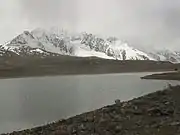 |
2012 | 3 312 ha | Ghizer | Gilgit-Baltistan | 33° 51′ 55″ N, 73° 08′ 20″ E |
| Vallée de Broghil | 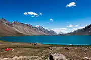 |
2010 | 134 744 ha | Chitral | Khyber Pakhtunkhwa | 36° 50′ 28″ N, 73° 20′ 09″ E |
| Karakoram central | 1993 | 1 390 100 ha | Gilgit et Skardu | Gilgit-Baltistan | 36° 53′ 52″ N, 75° 05′ 37″ E | |
| Chinji | 1987 | 6 095 ha | Chakwal | Punjab | 33° 00′ 37″ N, 72° 29′ 31″ E | |
| Chitral Gol | 1984 | 7 750 ha | Chitral | Khyber Pakhtunkhwa | 35° 55′ 59″ N, 71° 40′ 14″ E | |
| Deosai | 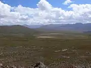 |
1993 | 358 400 ha | Skardu | Gilgit-Baltistan | 34° 58′ 21″ N, 75° 23′ 47″ E |
| Deva Vatala | 2009 | 2 993 ha | Bhimber | Azad Kashmir | 32° 53′ 33″ N, 74° 18′ 11″ E | |
| Ghamot | 2004 | 27 271 ha | Neelum | Azad Kashmir | 35° 00′ 25″ N, 74° 12′ 01″ E | |
| Gurez | 2009 | 52 815 ha | Neelum | Azad Kashmir | 34° 43′ 53″ N, 74° 47′ 12″ E | |
| Hazarganji-Chiltan | 1980 | 15 555 ha | Quetta | Baloutchistan | 30° 17′ 09″ N, 67° 12′ 08″ E | |
| Hingol | 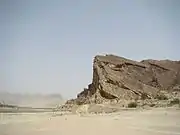 |
1988 | 165 004 ha | Awaran, Gwadar et Lasbela | Baloutchistan | 25° 31′ 34″ N, 65° 05′ 10″ E |
| K2 | — | 233 468 ha | Gilgit | Gilgit-Baltistan | 35° 47′ 17″ N, 76° 10′ 58″ E | |
| Kala Chitta | 2009 | 36 965 ha | Attock | Punjab | 33° 38′ 34″ N, 72° 24′ 03″ E | |
| Khunjerab | 1975 | 226 913 ha | Gilgit | Gilgit-Baltistan | 36° 30′ 03″ N, 75° 38′ 37″ E | |
| Kirthar | 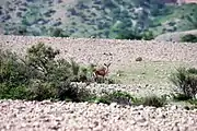 |
1974 | 308 733 ha | Dadu | Sindh | 25° 39′ 29″ N, 67° 32′ 56″ E |
| Lal Suhanra | 1972 | 87 426 ha | Bahawalpur | Punjab | 29° 23′ 51″ N, 72° 01′ 33″ E | |
| Lulusar-Dudipatsar | 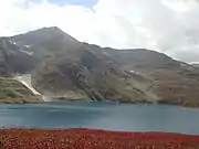 |
2003 | 30 375 ha | Mansehra | Khyber Pakhtunkhwa | 35° 05′ 27″ N, 73° 55′ 47″ E |
| Machiara | 1996 | 13 532 ha | Muzaffarabad | Azad Kashmir | 34° 30′ 24″ N, 73° 33′ 55″ E | |
| Collines Margalla | 1980 | 17 386 ha | Rawalpindi | Punjab | 33° 45′ 16″ N, 72° 57′ 23″ E | |
| Murree-Kotli Sattian-Kahuta | 2009 | 57 581 ha | Rawalpindi | Punjab | ? | |
| Pir Lasura | 2005 | 5 625 ha | Kotli | Azad Kashmir | 33° 38′ 21″ N, 73° 50′ 48″ E | |
| Poonch River Mahaseer | 2010 | 4 500 ha | Kotli, Mirpur et Poonch | Azad Kashmir | 33° 33′ 19″ N, 73° 54′ 58″ E | |
| Qurumber | 2011 | 74 000 ha | Ghizer | Gilgit-Baltistan | 36° 51′ 47″ N, 73° 46′ 52″ E | |
| Saiful Muluk | 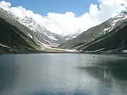 |
2003 | 4 867 ha | Mansehra | Khyber Pakhtunkhwa | 34° 52′ 51″ N, 73° 41′ 54″ E |
| Sheikh Buddin | 1993 | 15 540 ha | Dera Ismail Khan | Khyber Pakhtunkhwa | 32° 22′ 56″ N, 70° 56′ 59″ E | |
| Toli Pir |  |
2005 | 5 045 ha | Poonch | Azad Kashmir | 34° 07′ 15″ N, 73° 37′ 59″ E |
| Panjal Mastan |  |
2005 | 5 045 ha | Bagh | Azad Kashmir | 34° 03′ 27″ N, 73° 44′ 17″ E |
Réserves de biosphère
Le Pakistan possède deux réserves de biosphère reconnues par l'Unesco[1] :
- Lal Suhanra, 1977
- Forêt de Ziarat Juniper, 2013
Sites Ramsar
La convention de Ramsar est entrée en vigueur au Pakistan le 23 novembre 1976.
En janvier 2020, le pays compte 19 sites Ramsar, couvrant une superficie de 13 438,07 km2.
Notes et références
- (en) « Pakistan | United Nations Educational, Scientific and Cultural Organization », sur www.unesco.org (consulté le )
- (en) Cet article est partiellement ou en totalité issu de l’article de Wikipédia en anglais intitulé « Protected areas of Pakistan » (voir la liste des auteurs).
- (en) Cet article est partiellement ou en totalité issu de l’article de Wikipédia en anglais intitulé « List of national parks of Pakistan » (voir la liste des auteurs).
- Portail de la conservation de la nature
- Portail du Pakistan
Cet article est issu de Wikipedia. Le texte est sous licence Creative Commons - Attribution - Partage dans les Mêmes. Des conditions supplémentaires peuvent s'appliquer aux fichiers multimédias.