Troisdorf
Troisdorf (German pronunciation: [ˈtʁoːsdɔʁf] ⓘ) is a city in the Rhein-Sieg-Kreis (district), in North Rhine-Westphalia, Germany.
Troisdorf | |
|---|---|
 City hall of Troisdorf | |
 Coat of arms | |
Location of Troisdorf within Rhein-Sieg-Kreis district  | |
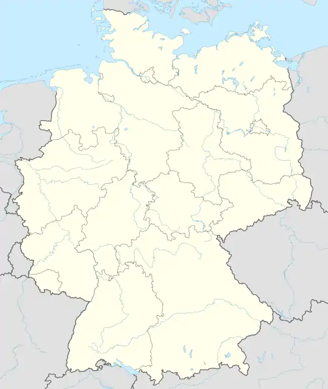 Troisdorf  Troisdorf | |
| Coordinates: 50°48′58″N 07°09′20″E | |
| Country | Germany |
| State | North Rhine-Westphalia |
| Admin. region | Köln |
| District | Rhein-Sieg-Kreis |
| Subdivisions | 12 |
| Government | |
| • Mayor (2020–25) | Alexander Biber[1] (CDU) |
| Area | |
| • Total | 62.17 km2 (24.00 sq mi) |
| Elevation | 55 m (180 ft) |
| Population (2021-12-31)[2] | |
| • Total | 75,222 |
| • Density | 1,200/km2 (3,100/sq mi) |
| Time zone | UTC+01:00 (CET) |
| • Summer (DST) | UTC+02:00 (CEST) |
| Postal codes | 53840, 53842, 53844 |
| Dialling codes | 02241, 02203, 02246, 0228 |
| Vehicle registration | SU |
| Website | www.troisdorf.de |
Geography
Troisdorf is located approximately 22 kilometers south of Cologne and 13 kilometers north east of Bonn.[3]
Division of the city
Troisdorf consists of 12 districts (population as of April 2014):[3]
- Troisdorf-Mitte (16,414 inhabitants)
- Altenrath (2,292 inhabitants)
- Bergheim (5,750 inhabitants)
- Eschmar (3,078 inhabitants)
- Friedrich-Wilhelms-Hütte (7,161 inhabitants)
- Kriegsdorf (3,129 inhabitants)
- Müllekoven (1,793 inhabitants)
- Oberlar (6,100 inhabitants)
- Rotter See (3,918 inhabitants)
- Sieglar (8,668 inhabitants)
- Spich (12,765 inhabitants)
- West (5,367 inhabitants)
- Total: 76,435 inhabitants
History
Troisdorf became a free city in 1952. In 1969, the urban area expanded with the annexation of the township of Sieglar and the villages of Altenrath and Friedrich-Wilhelms-Hütte (total population in 1969: about 51,000). The first large settlements in this area go back to the 9th and 10th century (Eschmar and Sieglar 832, Bergheim 987). The first churches in this area were built around 700 AD in Bergheim (St. Lambertus).
Troisdorf is home to about 9,600 foreign nationals. The two most numerous foreign national groups are Turks (3,100) and Greeks (1,600). On June 4, 1972, Troisdorf founded the first advisory council for foreign citizens in Germany. In the years following the Peaceful Revolution and German reunification of 1989/1990 many migrants from Russia and other East European countries settled in Troisdorf.
Demographics
In April 2014, Troisdorf had a population of 76,435 according to official records.[3] 11% of the population were foreign migrants.
Troisdorf has a predominantly Christian population: Roman Catholics, Protestants, Baptists, Jehovah's Witnesses and other Christian denominations, along with Muslim, Orthodox Christian and Jewish populations of non-indigenous origin. Troisdorf is one of the German cities whose mosque includes a minaret; it was built for the local Islamic community.
Mayors
Notable places
Europe's only picture-book museum is located in Troisdorf at the Wissem Castle.
Twin towns – sister cities
 Évry-Courcouronnes, France (1972)
.svg.png.webp) Genk, Belgium (1990)
Genk, Belgium (1990) Heidenau, Germany (1990)
 Redcar and Cleveland, United Kingdom (1990)
 Corfu, Greece (1996)
 Nantong, China (1997)
 Özdere, Turkey (2004)
Notable people
- John Siberch (c. 1476–1554), pioneering printer and friend of Erasmus
- Walter Stern (1896–1970), art critic and broadcaster
- Paul Schäfer (1921–2010), cult leader, founder of Colonia Dignidad
- Rupert Neudeck (1939–2016), humanitarian worker, founder of the Cap Anamur
- Tom Buhrow (born 1958), news anchor
- Sebastian Pufpaff (born 1976), comedian
- Lena Schöneborn (born 1986), pentathlonist, Olympic champion
- Sabine Lisicki (born 1989), tennis player
- Mitchell Weiser (born 1994), footballer
- Fabian Schiller (born 1997), racing driver
References
- Wahlergebnisse in NRW Kommunalwahlen 2020, Land Nordrhein-Westfalen, accessed 29 June 2021.
- "Bevölkerung der Gemeinden Nordrhein-Westfalens am 31. Dezember 2021" (in German). Landesbetrieb Information und Technik NRW. Retrieved 20 June 2022.
- "Willkommen in Troisdorf / Zahlen – Daten – Fakten" (PDF) (in German). Stadt Troisdorf. p. 3. Retrieved 25 March 2015.
- "Partner- und Patenstädte". troisdorf.de (in German). Troisdorf. Retrieved 2021-03-17.
External links
- Official website (in English)
- Official website (in German)