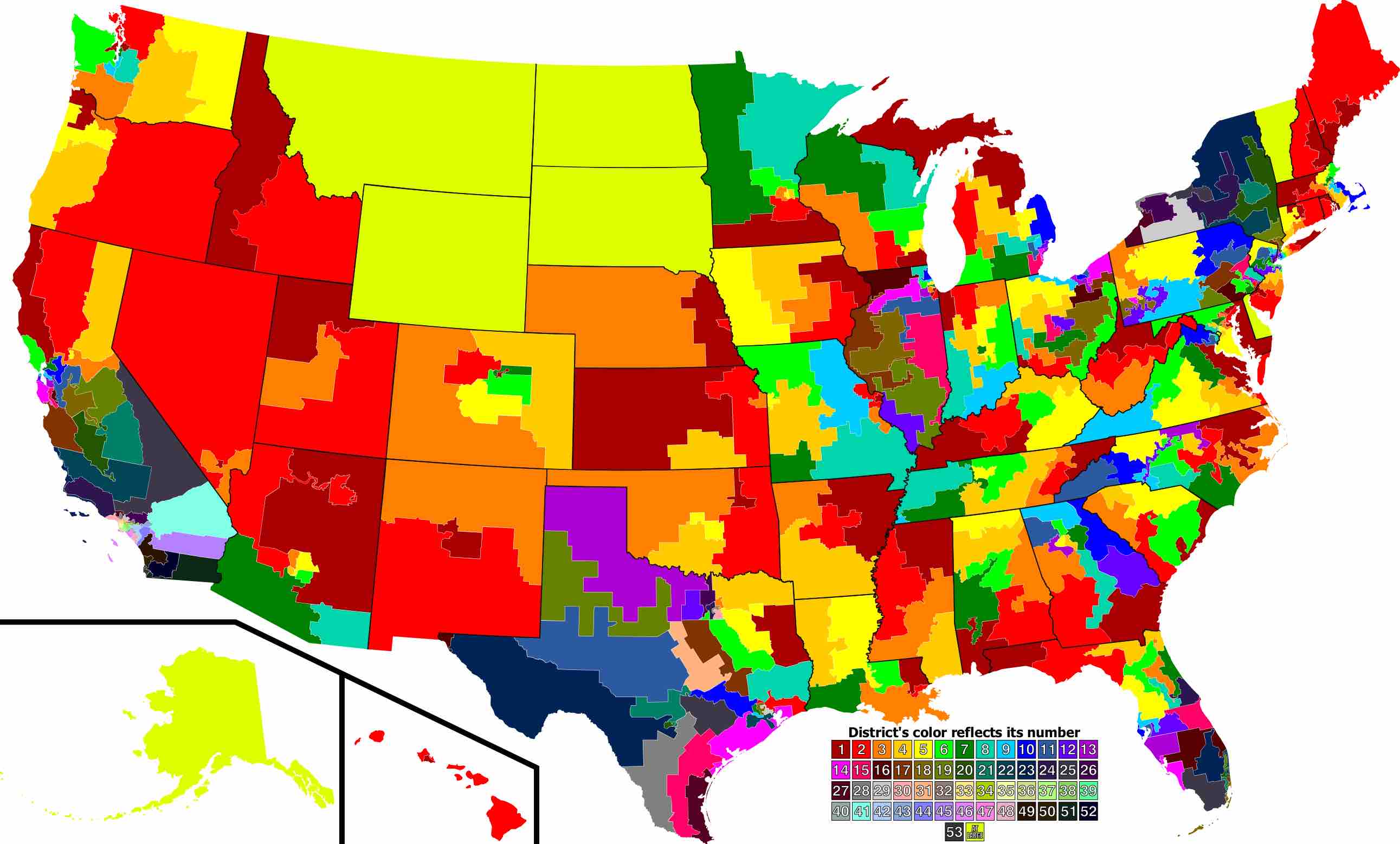
Congressional Districts
The quantity (apportionment) and boundaries (redistricting) of districts are determined after each census, although in some cases states have changed the boundaries more than once per census. The census is used to gauge each state's population and thus, proportional need for representation. Due to the shifts in population a state may gain or lose congressional districts. For example, since the 2000 census, Nebraska has had three districts, but it used to have as many as six. Texas currently has 32 districts, but will be adding 4 due to reapportionment as a result of the 2010 census. Other states will lose districts since the number of congressional seats has been set at 435 by statute.
The boundaries of districts often shift with each redistricting. Over time, the region and demographics represented in a district can change substantially. Furthermore, districts sometimes retain the same boundaries while changing their district numbers.

U.S. District Map
This map shows the U.S. Congress House Districts for the 110th-112th Congresses.
As of the 2000 census, the average population per district is 646,946 people. California had the most, at 53 districts. States with only one district include Alaska, Delaware, Montana, North Dakota, South Dakota, Vermont, and Wyoming. Alaska, Delaware, and Wyoming are the only states that have never had more than one district. Alaska is the district with the greatest area and New York's 15th district has the smallest area. Montana's district has the largest number of people (905,316) and Wyoming has the fewest number of people (495,304). Delaware is the oldest district; It has had the same geographical borders since 1789.