Mining Publication: Assessment of Ground Conditions Near a Mine Portal Using Ground Penetrating Radar
Original creation date: August 2005
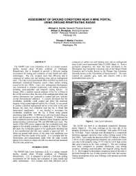
The NIOSH Lake Lynn Laboratory is a unique research facility located about 50 miles southeast of Pittsburgh, PA, that is designed to provide a full-scale mining environment for testing and evaluating mine health and safety technologies. Lake Lynn occupies more than 400 acres and is composed of surface test and training areas and an underground mine. The Lake Lynn Experimental Mine (LLEM) was built at an abandoned commercial limestone quarry where surface mining ceased in the late 1960s. Later, new underground development was constructed to simulate modern-day coal mining scenarios, including room-and-pillar and longwall mining layouts. In January 1994, a sinkhole opened southeast of the No. 4 portal of the LLEM. Since then, the area of the underground failure and surface deformation has continued to expand and now includes several interconnected sinkholes. A concern developed that the overburden instability could expand and affect the structural integrity of the nearby highwall and the No. 4 portal. It was unsafe to conduct a detailed underground survey of the mine in this area because the mine roof conditions near the No. 4 portal had deteriorated significantly. It was decided to investigate the overburden conditions near the No. 4 portal using ground penetrating radar (GPR). A GPR survey grid was located along an access road that passes over the top of the portal. To delineate the mine conditions near the portal, antennas whose frequency spectra produced pulses centered near 100 and 200 MHz were used. The results of the GPR survey suggest that the overburden rock units seem to be laterally consistent to a depth of about 15 ft. Below that point, the overburden seems to be significantly disturbed, and it was hypothesized that this area contains a large roof fall. A followup ground truth survey of the mine roof conditions was conducted from the mouth of the portal. It is concluded that the observations and measurements made from the radar records seem to be correct, as a large roof fall was observed and measured from the mine portal area.
Authors: MA Trevits, WD Monaghan, TP Mucho
Conference Paper - August 2005
NIOSHTIC2 Number: 20029035
Proceedings of the 24th International Conference on Ground Control in Mining, Morgantown, West Virginia, August 2-5, 2005. Morgantown, WV: West Virginia University, 2005 Aug; :380-387
See Also
- Advances in Remote Sensing Techniques for Monitoring Rock Falls and Slope Failures
- Application of Ground Penetrating Radar to Evaluate the Extent of Polyurethane Grout Infiltration for Mine Roof Control: A Case Study
- Make it Safer with Roof Screen
- Optimizing Secondary Roof Support with the NIOSH Support Technology Optimization Program (STOP)
- Overview of Coal Mine Ground Control Issues in the Illinois Basin
- Roof Screening: Best Practices and Roof Bolting Machines
- Technology News 483 - Safety Training Tools for Rock Scaling Personnel
- Technology News 502 - A New Training Video for Aggregate Operators: Aggregate Training for the Safety Impaired
- Toolbox Training on Flyrock Awareness
- Video Motion Detection for Real-Time Hazard Warnings in Surface Mines
- Page last reviewed: 9/21/2012
- Page last updated: 9/21/2012
- Content source: National Institute for Occupational Safety and Health, Mining Program


 ShareCompartir
