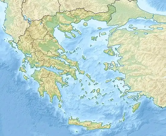
1883 Çeşme earthquake
The 1883 Çeşme earthquake occurred at 12:30 local time on October 15. This earthquake shook a wide area and was felt in the neighboring islands as well as in modern-day Western Turkey. It had a magnitude of 6.8 on the moment magnitude scale and a maximum felt intensity of IX (Violent) on the Mercalli intensity scale.[1] Many homes in small towns between Çeşme and Urla were destroyed and, according to various sources, 53 to 90 people were killed. This was the biggest earthquake ever experienced by Çeşme in its history. The aftershocks of this quake, like the previous event 2 years before, lasted for a long period, continuing for around 5 more months.[2]
 Istanbul Athens Çeşme | |
| UTC time | 12:30 |
|---|---|
| Local date | 15 October 1883 |
| Local time | 15:30[1] |
| Duration | 15 seconds[2] |
| Magnitude | 6.8 Mw[1] |
| Epicenter | 38.30°N 26.43°E |
| Areas affected | Chios, Urla, Çeşme and surrounding areas |
| Max. intensity | IX (Violent)[1] |
| Casualties | 53–120 dead, 200+ injured[2][3] |
Tectonic setting
The Aegean Sea region is one of the most seismically active areas in the Alpide Belt. The northern boundary of the Aegean Sea Plate is the western portion of the North Anatolian Fault Zone and in the south there is a convergent boundary with the African Plate, which is being subducted below the Aegean Sea Plate along the Hellenic subduction zone.[4]
The Chios Island-Karaburun region is one of the most seismically active parts of the Aegean area. The region has a complex geographical profile and is surrounded by uneven bays and seas. Rapid changes in tectonic patterns occur due to the relative motions of the surrounding tectonic plates. The mountains and faults in the area are mostly directed NE-SW and N-S.[4] This event, similar to the fault directions, ruptured in a N-S direction.[2]
Impact
Structural impact near the epicenter was high however, despite the high magnitude and intensity, there were few casualties.
Damage
Following the strong shaking, more than 3,000 homes collapsed, most of them being in the epicentral area and more than 17,000 people were left homeless. Tens of villages were almost completely flattened, with 14 of them left uninhabitable.[2]
Response
The Ottoman Government and local governments' response to the earthquake and damage was considered successful. A large amount of food and materials for barracks were donated. Charities that were hosted managed to collect up to 224,183 kuruş. Government and army officials were allocated to the most damaged towns and villages. Following the arrival of helping officials or groups, 710 tents were set up for the people who survived. However later on, as there were too many left without homes to settle into tents, several barracks were built in 20 to 25 days and the housing issues for the homeless were mostly solved. The victims' problems with residing and basic needs were solved as quickly and efficiently possible for them to return to their normal and daily lives with no major issues. The emperor at the time, Abdul Hamid II visited the destroyed villages and victims and made a speech of motivation. Kermises were hosted with the 2,500 Ottoman liras that Abdulhamid donated. He also paid 3 more visits in the following months.[2]
References
- "15 October 1883, 15:30 Cesme". emidius.eu. European Archive of Historical Earthquake Data. Retrieved 25 July 2022.
- Satilmis, Selahattin (2012). "Osmanlı'da Bir Afet Yönetimi Örneği: 1883 Çeşme ve Urla Depremi" (PDF). History Studies. 4 (1): 25. doi:10.9737/hist_459. Retrieved 25 July 2022.
- NCEI. "Significant Earthquake Information". Retrieved 25 July 2022.
- Altinok, Yildiz; Alpar, Bedri; Ozer, Naside; Gazioglu, Cem (23 September 2005). "1881 and 1949 earthquakes at the Chios-Cesme Strait (Aegean Sea) and their relation to tsunamis". Natural Hazards and Earth System Sciences. 5 (5): 9. Bibcode:2005NHESS...5..717A. doi:10.5194/nhess-5-717-2005. Retrieved 25 July 2022.