1912 Mürefte earthquake
The 1912 Mürefte earthquake occurred at 03:29 local time on 9 August. It had an estimated magnitude of 7.4 Mw and a maximum intensity of X (Extreme) on the Modified Mercalli intensity scale, causing from 216–3000 casualties.[4][5]
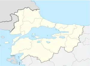
 Location of epicenter in the Marmara region | |
| UTC time | 1912-08-09 01:29:03 |
|---|---|
| ISC event | 16958205 |
| USGS-ANSS | ComCat |
| Local date | 9 August 1912 |
| Local time | 03:29 |
| Magnitude | 7.4 Mw[1] |
| Depth | 15 km[2] |
| Epicenter | 40.70°N 27.20°E[3] |
| Areas affected | Turkey |
| Max. intensity | X (Extreme) [4] |
| Casualties | 216–3000 |
References
- Aksoy, M.E.; Meghraoui, M.; Vallée, M.; Çakır, Z. (2010). "Rupture characteristics of the A.D. 1912 Mürefte (Ganos) earthquake segment of the North Anatolian fault (western Turkey)". Geology. 38 (11): 991–994. Bibcode:2010Geo....38..991A. doi:10.1130/G31447.1.
- "M 7.1 - 29 km SSE of Malkara, Turkey". earthquake.usgs.gov. USGS. Retrieved 6 July 2021.
- Ambraseys, N.N.; Jackson, J.A. (2000). "Seismicity of the Sea of Marmara (Turkey) since 1500". Geophysical Journal International. 141 (3): F1–F6. doi:10.1046/j.1365-246x.2000.00137.x.
- Boğaziçi Üniversitesi. "Bogazici University Kandilli Observatory and Earthquake Research Institute National Earthquake Monitoring Center (NEMC) List of earthquakes 1900–2004 (Büyük Depremler)" (in Turkish). Retrieved 28 August 2010.
- NGDC (1972). "Significant Earthquake Information". National Geophysical Data Center / World Data Service (NGDC/WDS): Significant Earthquake Database. National Geophysical Data Center, NOAA. National Geophysical Data Center, NOAA. doi:10.7289/V5TD9V7K. Retrieved 28 August 2010.
External links
- The International Seismological Centre has a bibliography and/or authoritative data for this event.
This article is issued from Wikipedia. The text is licensed under Creative Commons - Attribution - Sharealike. Additional terms may apply for the media files.