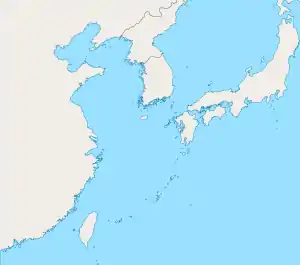
1910 Taiwan earthquake
On April 12, 1910, an earthquake struck with an epicenter off the northern coast of Taiwan. The earthquake measuring Mw 8.1 had a hypocenter depth of 235.0 km (146.0 mi).[1] In Taipei and Hsinchu, 13 homes totally collapsed, two partially collapsed, and an additional 57 were damaged.[2] At least 204 homes were destroyed or damaged in Keelung, Shenkeng and Taoyuan. Sixty people died or were injured.[2] Shaking was felt across Taiwan and the Penghu Islands; strong shaking was felt in the northern half of the island. The intermediate-depth of the earthquake suggest it originated from within the subducting Philippine Sea Plate which undergoes subduction.[3]
 1910 Taiwan earthquake (East China Sea) | |
| UTC time | 1910-04-12 00:22:24 |
|---|---|
| ISC event | 16958079 |
| USGS-ANSS | ComCat |
| Local date | April 12, 1910 |
| Local time | 08:22:13 |
| Magnitude | 8.1 Mw |
| Depth | 235.0 km (146.0 mi) |
| Epicenter | 25.967°N 124.304°E |
| Max. intensity | 5 (Strong) |
| Casualties | 60 dead or injured |
References
- ISC (2022), ISC-GEM Global Instrumental Earthquake Catalogue (1904–2018), Version 9.1, International Seismological Centre
- National Geophysical Data Center / World Data Service (NGDC/WDS) (1972), Significant Earthquake Database (Data Set), National Geophysical Data Center, NOAA, doi:10.7289/V5TD9V7K
- Kanamori, Hiroo; Lee, William H. K.; Ma, Kuo-Fong (2012). "The 1909 Taipei earthquake—implication for seismic hazard in Taipei". Geophysical Journal International. 191 (1): 126–146. doi:10.1111/j.1365-246X.2012.05589.x.
This article is issued from Wikipedia. The text is licensed under Creative Commons - Attribution - Sharealike. Additional terms may apply for the media files.