1991 Kalabahi earthquakes
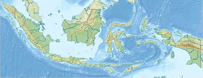
The 1991 Kalabahi earthquakes struck the sea adjacent to Timor on July 4, leaving twenty three people dead and injuring 181. The two quakes, which took place two-and-a-half seconds apart, measured 6.9 on the Mw scale.
 | |
| UTC time | 1991-07-04 11:43:10 |
|---|---|
| ISC event | 324844 |
| USGS-ANSS | ComCat |
| Local date | July 4, 1991 |
| Local time | 20:43 |
| Magnitude | 6.9 Mw |
| Depth | 33.3 km (20.7 mi) |
| Epicenter | 8.099°S 124.681°E |
| Type | Reverse[1] |
| Areas affected | Alor Island, Indonesia |
| Max. intensity | VII (Very strong) |
| Casualties | 23 fatalities |
Geography
Kalabahi was the epicenter of the earthquake, 2,000 kilometres (1,243 mi) east from Jakarta, the Indonesian capital.[2] With a calculated depth of 33.3 kilometres (21 mi),[3] the earthquake was in the ocean between the Timor and Alor islands.[4]
Damage and casualties
The earthquake struck Timor with a magnitude of 6.9.[4] The earthquake caused 3 fatalities on Alor alone,[5] and 181 injuries. 1,150 buildings were destroyed and at least 5,400 civilians were left homeless.[4]
Damage by the epicenter was estimated at 1991 USD $7,700,000.[4]
References
- USGS (September 4, 2009), PAGER-CAT Earthquake Catalog, Version 2008_06.1, United States Geological Survey
- "21 people die as earthquake hits Indonesia". Toronto Star. July 5, 1991. Retrieved September 20, 2009.
- "Indonesia Earthquake Jul 1991 UNDRO Information Report 1". United Nations Department of Humanitarian Affairs. July 8, 1991. Retrieved September 20, 2009.
- "Significants Earthquakes of the World: 1991". United States Geological Survey. July 16, 2008. Archived from the original on 2009-03-02. Retrieved September 20, 2009.
- "Earthquake In Indonesia Kills 5, Hurts 20". St. Louis Post-Dispatch. July 5, 1991. Retrieved September 20, 2009.
External links
- The International Seismological Centre has a bibliography and/or authoritative data for this event.
This article is issued from Wikipedia. The text is licensed under Creative Commons - Attribution - Sharealike. Additional terms may apply for the media files.