Abrams (CDP), Wisconsin
Abrams is an unincorporated community census-designated place located in the town of Abrams, Oconto County, Wisconsin, United States. Abrams is located near U.S. Route 41 and U.S. Route 141 8 miles (13 km) south-southeast of Oconto Falls. Abrams has a post office with ZIP code 54101.[4] As of the 2020 census, its population was 358.[5]
Abrams, Wisconsin | |
|---|---|
 Abrams, Wisconsin | |
| Coordinates: 44°46′45″N 88°03′35″W | |
| Country | United States |
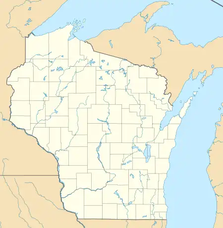
| State | Wisconsin |
| County | Oconto |
| Area | |
| • Total | 0.82 sq mi (2.14 km2) |
| • Land | 0.82 sq mi (2.14 km2) |
| • Water | 0.00 sq mi (0.00 km2) |
| Elevation | 676 ft (206 m) |
| Population | |
| • Total | 358 |
| Time zone | UTC-6 (Central (CST)) |
| • Summer (DST) | UTC-5 (CDT) |
| ZIP code | 54101 |
| Area code | 920 |
| GNIS feature ID | 1560668[3] |
History
Abrams was first settled in 1854 when Richard B. Yeaton built a sawmill on the Pensaukee River.[6] A community formed and he called the place West Pensaukee. It was renamed Abrams in the 1880s after W. J. Abrams, a former state representative and former mayor of Green Bay. Abrams owned land where a railroad depot was built.[6]
Notable people
- C. J. Greaves, off-road racer
- Johnny Greaves, off-road racer
- Lyle Lahey, cartoonist
- Pee Wee King, pioneer in the country and western music industry; wrote "Tennessee Waltz" and was inducted into the Country Music Hall of Fame in 1974
- Bob Wickman, former relief pitcher for the New York Yankees, Milwaukee Brewers, Cleveland Indians, Atlanta Braves, and Arizona Diamondbacks
- Arthur J. Whitcomb, Wisconsin State Representative and lawyer
References
- "2016 U.S. Gazetteer Files". United States Census Bureau. Retrieved July 19, 2017.
- "U.S. Census website". United States Census Bureau. Retrieved January 19, 2023.
- U.S. Geological Survey Geographic Names Information System: Abrams (CDP), Wisconsin
- ZIP Code Lookup Archived June 15, 2011, at the Wayback Machine
- "U.S. Census website". U.S. Census Bureau. Retrieved March 29, 2011.
- "Oconto County Time Line". Oconto County Historical Society. Retrieved September 21, 2020.
- "Census of Population and Housing". Census.gov. Retrieved June 4, 2016.
External links
Adjacent communities near Abrams, Wisconsin | |
|---|---|
Municipalities and communities of Oconto County, Wisconsin, United States | ||
|---|---|---|
| Cities | 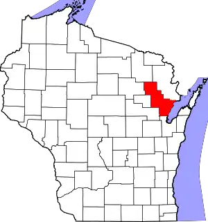 | |
| Villages | ||
| Towns | ||
| CDPs | ||
| Other communities | ||
| Indian reservation | ||
| Footnotes | ‡This populated place also has portions in an adjacent county or counties | |
| Core city |  | |
|---|---|---|
| Largest municipalities over 10,000 in 2010 | ||
| Municipalities under 10,000 in 2010 | ||
| Counties | ||
This article is issued from Wikipedia. The text is licensed under Creative Commons - Attribution - Sharealike. Additional terms may apply for the media files.