Abrams Creek (Virginia)
Abrams Creek is an 11.2-mile-long (18.0 km)[6] tributary stream of Opequon Creek in Frederick County and the independent city of Winchester in Virginia. Abrams Creek rises north of Round Hill and flows in a southeasterly direction through Winchester. From Winchester, Abrams Creek flows east into Opequon Creek. The stream was originally known as Abraham's Creek.[3]
| Abrams Creek Tributary to Opequon Creek | |
|---|---|
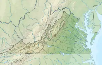 Location of Abrams Creek mouth  Abrams Creek (Virginia) (the United States) | |
| Location | |
| Country | United States |
| State | Virginia |
| County | Frederick |
| City | Winchester |
| Physical characteristics | |
| Source | Gap Run divide |
| • location | Approximately 1 mile north=northeast of Round Hill, Virginia |
| • coordinates | 39°11′59″N 078°13′21″W[1] |
| • elevation | 880 ft (270 m)[2] |
| Mouth | Opequon Creek |
• location | about one mile east of Winchester, Virginia |
• coordinates | 39°10′51″N 078°04′29″W[1] |
• elevation | 505 ft (154 m)[3] |
| Length | 10.53 mi (16.95 km)[4] |
| Basin size | 18.86 square miles (48.8 km2)[5] |
| Discharge | |
| • location | Opequon Creek |
| • average | 25.46 cu ft/s (0.721 m3/s) at mouth with Opequon Creek[5] |
| Basin features | |
| Progression | Opequon Creek → Potomac River → Chesapeake Bay → Atlantic Ocean |
| River system | Potomac River |
| Tributaries | |
| • left | Town Run Ash Hollow Run |
| • right | unnamed tributaries |
| Bridges | US 50, Round Hill Road, VA 37, Merrimans Lane, Willow Grove Lane, W Jubal Early Drive (x2), Valley Avenue, S Loudoun Street, US 17, I-81, Ralph Shockley Drive, Senseny Road, Greenwood Road, Channing Drive, Valley Mill Road, VA 7 |
Variant names
According to the Geographic Names Information System, it has also been known historically as:[1]
- Abraham's Creek
Course
Abrams Creek rises approximately one-half mile north-northeast of Round Hill, in Frederick County and then flows generally east to join Opequon Creek approximately one mile east of Winchester.[7]
Watershed
Abrams Creek drains 18.86 square miles (48.8 km2) of area, receives about 38.9 in/year of precipitation, has a wetness index of 443.80, and is about 16% forested.[5]
See also
References
- "GNIS Detail - Abrams Creek". geonames.usgs.gov. US Geological Survey. Retrieved 11 June 2021.
- Winchester, VA, 7.5 Minute Topographic Quadrangle, USGS, 1997
- U.S. Geological Survey Geographic Names Information System: Abrams Creek (Virginia)
- "ArcGIS Web Application". epa.maps.arcgis.com. US EPA. Retrieved 11 June 2021.
- "Abrams Creek Watershed Report". US EPA Geoviewer. US EPA. Retrieved 11 June 2021.
- U.S. Geological Survey. National Hydrography Dataset high-resolution flowline data. The National Map Archived 2012-03-29 at the Wayback Machine, accessed August 15, 2011
- "Get Maps". USGS Topoview. US Geological Survey. Retrieved 11 June 2021.