Adelphi, London
Adelphi (/əˈdɛlfi/; from the Greek ἀδελφοί adelphoi, meaning "brothers") is a district of the City of Westminster in London.[1] The small district includes the streets of Adelphi Terrace, Robert Street and John Adam Street.[1] Of rare use colloquially, Adelphi is grouped with Aldwych as the greater Strand district (a main street of London between the two areas and those immediately adjoining) which for many decades formed a parliamentary constituency and civil registration district.


Adelphi Buildings
.jpg.webp)
%252C_Adelphi%252C_John_Adam_Street.jpg.webp)
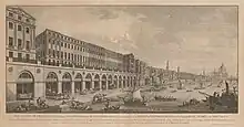
The district is named after the Adelphi Buildings, a block of 24 unified neoclassical terrace houses that occupied the land between The Strand and the River Thames in the parish of St Martin in the Fields, which also included a headquarters building for the "Society for the Encouragement of Arts, Manufactures and Commerce" (now generally known as the Royal Society of Arts). They were built between 1768 and 1772 by the Adam brothers (John, Robert, James and William Adam), to whom the buildings' Greek-derived name refers. The ruins of Durham House on the site were demolished for their construction.
Robert Adam was influenced by his extensive visit to Diocletian's Palace in Split, Croatia (previously Dalmatia), and he applied some of this influence to the design of the neoclassical Adelphi Buildings.[2][3] The nearby Adelphi Theatre is named after the Adelphi Buildings.
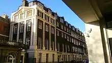
Many of the Adelphi Buildings were demolished in the early 1930s and replaced with the New Adelphi, a monumental Art Deco building designed by the firm of Collcutt & Hamp. Buildings remaining from the old Adelphi include 11 Adelphi Terrace (formerly occupied by numismatic specialists A.H. Baldwin & Sons Ltd) and the Royal Society of Arts headquarters (which has expanded to incorporate two of the former houses). Benjamin Pollock's Toy Shop was located here in the 1940s.
Notable residents
South Australian Colonization Commission
The South Australian Colonization Commission (1834–1843) had their offices at 6 Adelphi Terrace in 1840.[4] Rowland Hill was secretary to this body, and it was during this period that he devised his penny postage scheme.[5]
London School of Economics
The London School of Economics (LSE) held its first classes in October 1895, in rooms at 9 John Street, Adelphi,[6] before setting up more permanent operations in Number 10 Adelphi Terrace. By 1920, the LSE had moved a few blocks east, to its current Clare Market address. While in Adelphi, the LSE’s scholars and students were active in the surrounding neighbourhood and community.
Street name etymologies
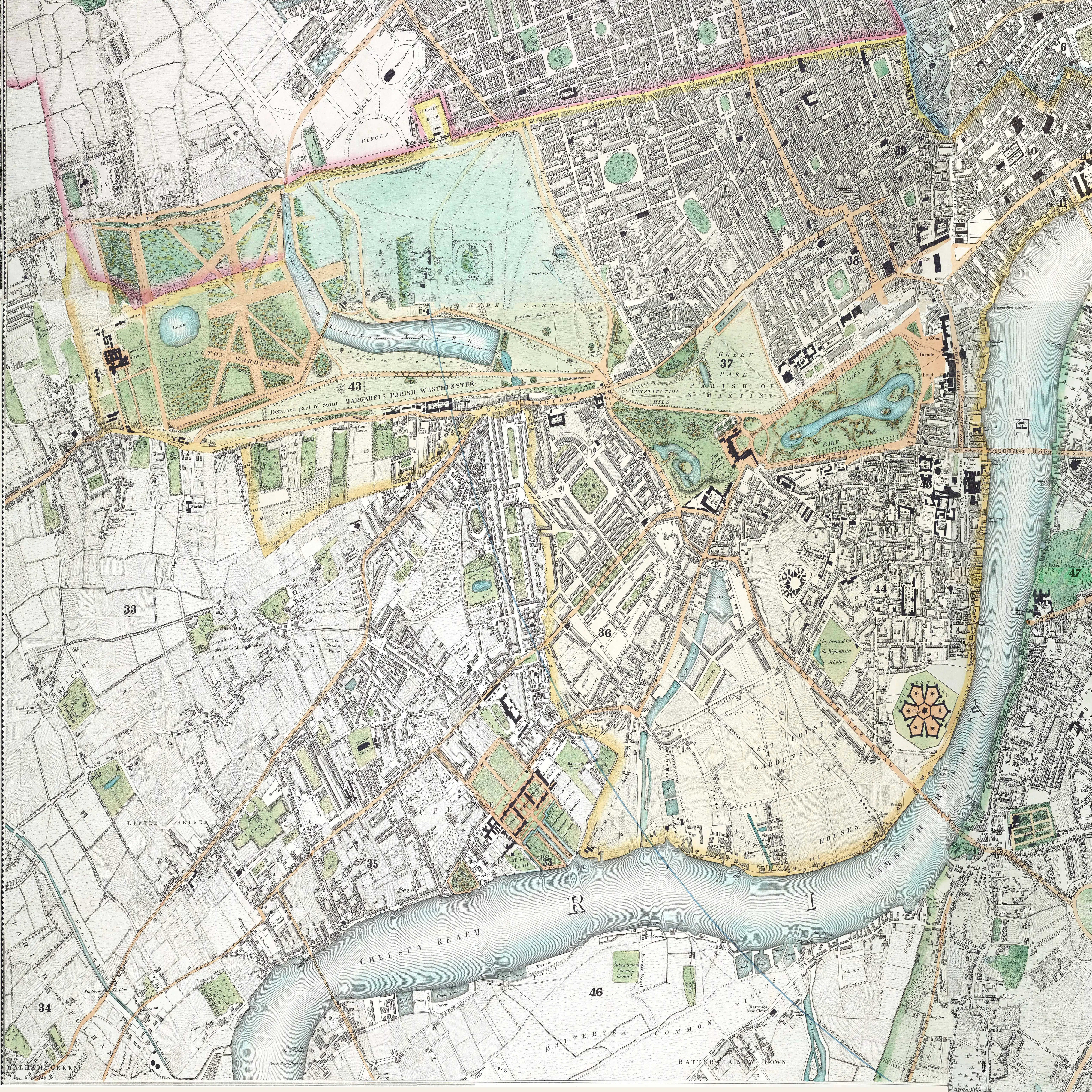
Adelphi has no formally defined boundaries, though they are generally agreed to be: Strand to the north, Lancaster Place to the east, Victoria Embankment to the south and Charing Cross station to the west. The small set of streets east of Northumberland Avenue are included here for convenience.
Several streets are or were named using the words George Villiers, Duke of Buckingham after the first Duke, 17th century courtier, who acquired York House which formerly stood on this site; his son sold the area to developers on condition that his father and titles were commemorated on the new streets.[7]
- Adam Street – after John and Robert Adam, who built the Adelphi development in the 1760s[8][9]
- Adelphi Terrace – the area was developed by the brothers John and Robert Adam, in the 1760s, and was named after adelphos, the Greek for 'brother'[10][9]
- The Arches – presumably descriptive, after the railway arches here
- Buckingham Arcade and Buckingham Street – after George Villiers, 1st Duke of Buckingham[7][11]
- Carting Lane – thought to be from the carts that brought good to and from the wharf formerly located here; until the 1830s it was called Dirty Lane[12]
- Charing Cross – after the Eleanor cross at Charing, from the Old English word "cierring", referring to a bend in the River Thames[13][14]
- Corner House Street – unknown
- Craven Passage and Craven Street – after William Craven, 3rd Baron Craven, who owned the land when the street was built in the 1730s[15][16]
- Durham House Street – this was the former site of Durham House, a palace belonging to the bishops of Durham in medieval times[17][18]
- Embankment Place – after the Thames Embankment, built in the Victorian era[19]
- George Court – after George Villiers, 1st Duke of Buckingham[11]
- Hungerford Lane – after the Hungerford family, who owned a house on this site in the 15th century, later sold due to debts to create Hungerford Market, before the building of Charing Cross station[20][12][21]
- Ivybridge Lane – named after a former ivy-covered bridge that crossed an old watercourse on this spot; the bridge was demolished sometime before 1600[22][23]
- John Adam Street – after John Adam, who built the Adelphi development with his brother Robert in the 1760s,[24][9] a combination of the previous John Street and Duke Street with the latter named after the 1st Duke of Buckingham
- Lancaster Place – former site of the Savoy Palace. It passed into the ownership of the earls of Lancaster in the 13th century, the most famous of which was John of Gaunt, who owned the palace at the times of its destruction in Peasant’s Revolt of 1381[25][26]
- Northumberland Avenue and Northumberland Street – site of the former Northumberland House, built originally in the early 17th century for the earls of Northampton and later acquired by the earls of Northumberland[27][28]
- Robert Street and Lower Robert Street – after Robert Adam, who built the Adelphi development with his brother John in the 1760s[29]
- Savoy Buildings, Savoy Court, Savoy Hill, Savoy Place, Savoy Row, Savoy Steps, Savoy Street and Savoy Way – the former site of the Savoy Palace, built for Peter II, Count of Savoy in 1245[30][31]
- Strand and Strand Lane – from Old English 'stond', meaning the edge of a river; the river Thames formerly reached here prior to the building of the Thames Embankment[32][33]
- Victoria Embankment – after Queen Victoria, reigning queen at the time of the building of the Thames Embankment[34][35]
- Villiers Street – after George Villiers, 1st Duke of Buckingham[11]
- Watergate Walk – after a former watergate built in 1626 for George Villiers, 1st Duke of Buckingham as an entrance for the former York House[36][37]
- York Buildings and York Place – a house was built on this site in the 14th century for the bishops of Norwich – in the reign of Queen Mary it was acquired by the archbishops of York and named 'York House'; York Place was formerly 'Of Alley', after the 1st Duke of Buckingham[38][11]
Notable residents
- Sir J. M. Barrie (1860–1937), playwright and novelist, author of Peter Pan, at Adelphi Terrace
- Edward Litt Laman Blanchard, writer, lived in Adelphi Terrace from 1876 to 1889
- Charles Booth, shipyard owner, philanthropist and author
- Richard D'Oyly Carte, Victorian impresario
- John Galsworthy, novelist, author of The Forsyte Saga
- David Garrick lived for his final seven years, and died in 1779, in the centre house of the buildings (no. 5)[39][40]
- James Graham, electrical quack sexologist, lived at 4 Adelphi Terrace from 1778 to 1781, opening his Temple of Health there in 1780[40]
- Thomas Hardy, English novelist
- Thomas Monro, physician to George III and art patron, owned a house in Adelphi Terrace
- George Bernard Shaw, Irish playwright, Fabian socialist, co-founder of the London School of Economics and Political Science (LSE)
In media
- David Copperfield, created by Charles Dickens, lived on Buckingham Street in Adelphi.
- Fictional detective Gideon Fell, created by John Dickson Carr, lived at no. 1, Adelphi Terrace.
- The 1930s Adelphi building was used for some scenes in ITV's Agatha Christie's Poirot episode "The Theft of the Royal Ruby",[41] and in episode "The Plymouth Express".[42]
- In an instalment of E.M. Delafield’s semi-autobiographical Diary of a Provincial Lady series, entitled ‘The Provincial Lady in Wartime, the eponymous protagonist works in the canteen of an air raid shelter located under the Adelphi during the Phoney War. Much of the narrative is dedicated to describing the atmosphere and inhabitants of the building and the surrounding area, and many of the events of the book take place here.[43]
References
- Mills, A., Oxford Dictionary of London Place Names, (2001)
- Peter De Bolla, The Education of the Eye: Painting, Landscape, and Architecture, 2003, Stanford University Press. 296 pages ISBN 0-8047-4800-4
- C. Michael Hogan, "Diocletian's Palace", The Megalithic Portal, Andy Burnham ed, 6 Oct. 2007
- The British Almanac of The Society for the Diffusion of Useful Knowledge, for the year of our Lord 1840. Charles Knight & Co. 1840. p. 59. Retrieved 10 December 2020.
- "Adelphi Terrace". British History Online. 10 December 2020. Retrieved 10 December 2020.
- "LSE 1895". London School of Economics. 2000. Archived from the original on 5 August 2009. Retrieved 23 July 2009.
- Fairfield, S. The Streets of London – A dictionary of the names and their origins, p47
- Fairfield, S. The Streets of London – A dictionary of the names and their origins, p2
- Bebbington, G. (1972) London Street Names, p16
- Fairfield, S. The Streets of London – A dictionary of the names and their origins, p3
- Bebbington, G. (1972) London Street Names, p62-3
- Bebbington, G. (1972) London Street Names, p74
- Fairfield, S. The Streets of London – A dictionary of the names and their origins, p65
- Bebbington, G. (1972) London Street Names, p81
- Fairfield, S. The Streets of London – A dictionary of the names and their origins, p85
- Bebbington, G. (1972) London Street Names, p102
- Fairfield, S. The Streets of London – A dictionary of the names and their origins, p105
- Bebbington, G. (1972) London Street Names, p118
- Bebbington, G. (1972) London Street Names, p123
- Fairfield, S. The Streets of London – A dictionary of the names and their origins, p167
- Bebbington, G. (1972) London Street Names, p179-80
- Fairfield, S. The Streets of London – A dictionary of the names and their origins, p170
- Bebbington, G. (1972) London Street Names, p184
- Fairfield, S. The Streets of London – A dictionary of the names and their origins, p172
- Fairfield, S. The Streets of London – A dictionary of the names and their origins, p186
- Bebbington, G. (1972) London Street Names, p194
- Fairfield, S. The Streets of London – A dictionary of the names and their origins, p229
- Bebbington, G. (1972) London Street Names, p236
- Fairfield, S. The Streets of London – A dictionary of the names and their origins, p267
- Fairfield, S. The Streets of London – A dictionary of the names and their origins, p288
- Bebbington, G. (1972) London Street Names, p295-6
- Fairfield, S. The Streets of London – A dictionary of the names and their origins, p306
- Bebbington, G. (1972) London Street Names, p312
- Fairfield, S. The Streets of London – A dictionary of the names and their origins, p328
- Bebbington, G. (1972) London Street Names, p332
- Fairfield, S. The Streets of London – A dictionary of the names and their origins, p334
- Bebbington, G. (1972) London Street Names, p337-8
- Fairfield, S. The Streets of London – A dictionary of the names and their origins, p349
- 'The Strand, southern tributaries – continued', Old and New London: Volume 3 (1878), pp. 100–110 accessed: 30 May 2008
- Gater, G H; Wheeler, E P, eds. (1937), "Adelphi Terrace", Survey of London: Volume 18, St Martin-in-The-Fields II: the Strand, London, pp. 103–108, retrieved 1 October 2019
{{citation}}: CS1 maint: location missing publisher (link) - Eirik (4 July 2013). "Investigating Agatha Christie's Poirot: Episode-by-episode: The Theft of the Royal Ruby". Investigatingpoirot.blogspot.ch. Retrieved 16 February 2016.
- "On Location with Poirot - The Plymouth Express". www.tvlocations.net. Retrieved 8 March 2018.
- Delafield, E.M. (May 2014). The Diary of a Provincial Lady. London: Penguin Classics.
Further reading
- Brereton, Austin. The literary history of the Adelphi and its neighbourhood (New York: Duffield, 1909). Illustrated.


