Ajirkot Rural Municipality
Ajirkot Rural Municipality (Nepali :अजिरकोट गाँउपालिका) is a Gaunpalika in Gorkha District in Gandaki Province of Nepal. On 12 March 2017, the government of Nepal implemented a new local administrative structure, with the implementation of the new local administrative structure, VDCs have been replaced with municipal and Village Councils. Ajirkot is one of these 753 local units.[1][2][3][4]
Ajirkot Rural Municipality
अजिरकोट गाँउपालिका | |
|---|---|
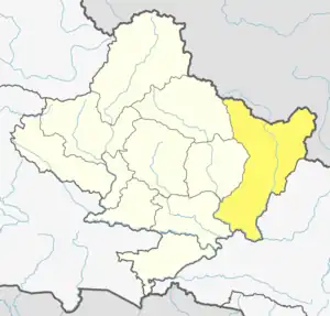
 Ajirkot Rural Municipality Location in Nepal | |
| Coordinates: 28.164791°N 84.633159°E | |
| Country | |
| Province | Gandaki |
| District | Gorkha District |
| Area | |
| • Total | 198.05 km2 (76.47 sq mi) |
| Population | |
| • Total | 18,802 |
| • Density | 95/km2 (250/sq mi) |
| Time zone | UTC+5:45 (Nepal Time) |
| Website | http://ajirkotmun.gov.np/ |
Demographics
At the time of the 2011 Nepal census, Ajirkot Rural Municipality had a population of 15,602. Of these, 56.8% spoke Nepali, 30.7% Gurung, 10.5% Tamang, 1.0% Newar, 0.3% Ghale, 0.2% Sherpa, 0.1% Yolmo and 0.4% other languages as their first language.[5]
In terms of ethnicity/caste, 34.6% were Gurung, 21.1% Hill Brahmin, 12.9% Tamang, 8.2% Sarki, 7.1% Kami, 4.0% Chhetri, 3.2% Damai/Dholi, 2.4% Magar, 2.1% Newar, 1.9% Ghale, 1.5% Gharti/Bhujel, 0.2% Sherpa, 0.1% other Dalit, 0.1% Marwari, 0.1% Musalman, 0.1% Sanyasi/Dasnami, 0.1% Tharu and 0.3% others.[6]
In terms of religion, 60.0% were Hindu, 38.8% Buddhist, 0.9% Christian and 0.1% Muslim.[7]
In terms of literacy, 66.7% could both read and write, 2.9% could read but not write and 30.3% could neither read nor write.[8]
References
- "अजिरकोट गाउँपालिका, गाउँकार्यपालिकाको कार्यालय | "दिगो विकास हाम्रो सोच, सुन्दर, शान्त, समृद्ध अजिरकोट"". ajirkotmun.gov.np. Retrieved 2020-07-06.
- Collegenp. "Ajirkot Rural Municipality, Gorkha". www.collegenp.com. Retrieved 2020-07-06.
- "Ajirkot Rural Municipality runs nutritious food programme for new mothers". kathmandupost.com. Retrieved 2020-07-06.
- "अजिरकोट गाँउपालिका- Ajirkot Rural Municipality". www.facebook.com. Retrieved 2020-07-06.
- NepalMap Language
- NepalMap Caste
- NepalMap Religion
- NepalMap Literacy