Chumanuwri Rural Municipality
Chumanuwri (Nepali: चुमनुव्री गाउँपालिका) is a Gaunpalika (rural municipality) in Gorkha District in Gandaki Province of Nepal. It is divided into 7 wards.
Tsum Nubri
चुम नुरबी गाँउपालिका | |
|---|---|
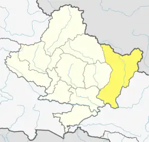
 Tsum Nubri Location in Nepal  Tsum Nubri Tsum Nubri (Nepal) | |
| Coordinates: 28.518191°N 84.846204°E | |
| Country | |
| Province | Gandaki |
| District | Gorkha District |
| Established | 10 March 2017 |
| Government | |
| • Type | Rural council |
| Area | |
| • Total | 1,648.65 km2 (636.55 sq mi) |
| • Rank | 4th largest (Nepal) 1st largest (Gandaki) |
| Population (2011) | |
| • Total | 6,923 |
| • Density | 4.2/km2 (11/sq mi) |
| Time zone | UTC+5:45 (Nepal Time) |
| Website | chumanuwrimun |
On 10 March 2017, the government of Nepal implemented a new local level administrative structure merging the former VDCs. Chumanuwri is one of these 753 local units.[1][2]
Demographics
At the time of the 2011 Nepal census, Chumanuwri Rural Municipality had a population of 7,417. Of these, 54.7% spoke Tamang, 33.7% Gurung, 6.7% Yolmo, 3.5% Nepali, 0.3% Sign language and 0.8% other languages as their first language.[3]
In terms of ethnicity/caste, 55.4% were Tamang, 39.5% Gurung, 1.7% Hill Brahmin, 1.3% Ghale, 0.7% Kami, 0.6% Chhetri, 0.3% Thakuri and 0.6% others.[4]
In terms of religion, 93.2% were Buddhist, 4.0% Hindu, 2.4% Christian and 0.3% others.[5]
In terms of literacy, 33.6% could both read and write, 4.1% could read but not write and 62.2% could neither read nor write.[6]
References
- "Tsum Nubri Rural Municipality चुम नुब्री गाउँपालिका". www.facebook.com. Retrieved 2020-07-06.
- Sapkota, Narahari. "Gorkha locals head to Tibet to buy food stuff". My Republica. Retrieved 2020-07-06.
- NepalMap Language
- NepalMap Caste
- NepalMap Religion
- NepalMap Literacy