Akto Town
Akto Town (Chinese: 阿克陶镇; pinyin: Ākètáo Zhèn) is a town and the county seat of Akto County in Xinjiang Uygur Autonomous Region, China. Located in the northeast of the county, the town covers an area of 136 square kilometers with a population of 21,560 (as of 2017). It has 19 communities and 9 villages under its jurisdiction,[2] its seat is at Gongbaitierik (拱拜提艾日克村).[1]
Akto
阿克陶镇 Aketao | |
|---|---|
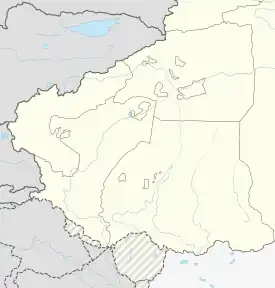
 Akto Location of the town | |
| Coordinates: 39.1349334697°N 75.9337319218°E | |
| Country | People's Republic of China |
| Autonomous region | Xinjiang |
| Prefecture | Kizilsu |
| County | Akto |
| Area | |
| • Total | 136 km2 (53 sq mi) |
| Population (2017)[1] | |
| • Total | 21,560 |
| Time zone | UTC+8 (China Standard Time) |
| Area code | 653022 100 |
| Website | www.xjakt.gov.cn |
Name
The name of Akto is from Kyrgyz language, meaning “White Mountain” (白山) and named after the oasis located under a snowy mountain.[3]
Geography
The town of Akto is located in the middle of the alluvial fan of the Kushan River (库山河) and its terrain is slowly inclined from the southwest to the northeast. The town is bordered by Pilal Township with the Baishikan Channel (拜什坎水渠) to the north, by Yumai Township to the southeast and by Baren Township with the Qiereke Channel (切热克水渠) to the west. Its maximum length is 11 kilometers west to east, the maximum length is 16 kilometers north to south, the total area is 136 square kilometers and the arable land area is 1,618.44 hectares. The town has an average elevation of 1,300 to 1,400 meters. It is a typical temperate continental arid climate with four distinct seasons, dry and less rain, with an average annual temperature of 11.2 °C and a frost-free period of 221 days. Farmland is distributed near urban areas.
Administrative divisions
The town has 19 communities and 9 villages under its jurisdiction.[2][3]
- 19 communities
- Baishanlu Community (白山路社区)
- Beijingbeilu Community (北京北路社区)
- Beijingnanlu Community (北京南路社区)
- Binghudong Community (湖滨东社区)
- Binghuxi Community (湖滨西社区)
- Gonggerlu Community (公格尔路社区)
- Guangminglu Community (光明路社区)
- Hexielu Community (和谐路社区)
- Kunlunlu Community (昆仑路社区)
- Laocheng Community (老城街社区)
- Letaoyuan Community (乐陶苑社区)
- Mushitagelu Community (慕士塔格路社区)
- Pami'erlu Community (帕米尔路社区)
- Renminlu Community (人民路社区)
- Tuanjielu Community (团结路社区)
- Wenhualu Community (文化路社区)
- Xingfudonglu Community (幸福东路社区)
- Xingfulu Community (幸福路社区)
- Youyilu Community (友谊路社区)
- Aodaerik Village (奥达艾日克村)
- Barinerik Village (巴仁艾日克村)
- Gongbaitierik Village (拱拜提艾日克村)
- Kayiqaerik Village (喀依恰艾日克村)
- Nokuqierik Village (诺库其艾日克村)
- Qikerterek Village (其克尔铁热克村)
- Yagiqak Village (亚格恰克村)
- Yangqimahala Village (央其买里村)
- Yingqikaierik Village (英其开艾日克村)
- Ayagmahalla (阿亚克买里)
- Aydingkol (阿依丁库勒)
References
- 阿克陶镇(概况). xjakt.gov.cn. 2018-06-04. Retrieved 2019-10-31.
- 2018年阿克陶镇行政区划代码. National Bureau of Statistics of China. 2018-10-31. Retrieved 2019-11-01.
- 阿克陶县行政区划和居民地名称. xjkz.gov.cn. 2018-05-04. Archived from the original on April 28, 2021. Retrieved 2019-11-08.