Pilal
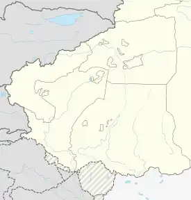
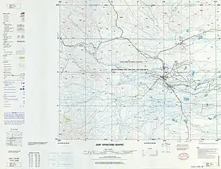
Pilal[3][4] (Uyghur: پىلال يېزىسى;[5] from Mandarin Chinese Pilale[6] Chinese: 皮拉勒乡; pinyin: Pílālè Xiāng or 皮拉力乡[7]) is a township of Akto County in Xinjiang Uygur Autonomous Region, China. Located in the west of the northeastern part of the county, the township covers an area of 186 square kilometers with a population of 46,981 (as of 2015[1]). It has 22 administrative villages and a farm under its jurisdiction. Its seat is at Pilal Village (皮拉勒村).[8]
Pilal
پىلال يېزىسى 皮拉勒乡 Pilale | |
|---|---|
 Pilal Location of the township | |
| Coordinates: 39.18982671°N 75.8546808469°E | |
| Country | People's Republic of China |
| Autonomous region | Xinjiang |
| Prefecture | Kizilsu |
| County | Akto |
| Area | |
| • Total | 186 km2 (72 sq mi) |
| Population (2015) | |
| • Total | 46,981 |
| [1] | |
| Ethnic groups | |
| • Major ethnic groups | Uyghur[2] |
| Time zone | UTC+8 (China Standard Time) |
| postal code | 845551 |
| Area code | 653022 201 |
| Website | www.xjakt.gov.cn |
Name
The name of Piral is from Uighur language, that evolved from the word "pul-al", meaning "paying" or "pay money" (拿钱来). The place was named Pilal because there used to be a market in this place 270 years ago (about 1750s).[9]
History
In 1958, Pilal Commune was established (皮拉勒公社).[2]
In 1967 during the Cultural Revolution, Pilal Commune was renamed Hongqi Commune (literally 'Red Flag Commune'; 红旗公社).[2]
In 1984, the commune became Pilal Township.[2]
In September 2017, it was reported that a policewoman from Pilal had claimed that "several thousand detainees" were in the Xinjiang re-education camps system in Akto County, saying the facilities were "closed schools" where authorities keep internees "detained day and night, and they continuously receive political and ideological education." She further commented that, "A few people are released after two or three months. But most detainees are sent to the camps indefinitely."[10]
Geography and resources
The township of Pilal is located between 75°45′- 76°01′ east longitude and 38°08′- 39°16′ north latitude and in the alluvial plain of Gez River to the northwest of the county seat. It is bordered by Tortayi Farm to the east, by Barin Township, Akto Town and Ujme Township to the south, by Buraksu Township of Shufu County to the west, by the 41st Regiment (41团) of the XPCC across Yuepuhu River (岳普湖河) to the north. Its maximum distance is 24 kilometers from west to east and 11 kilometers from north to south. It has an area of 186 square kilometers with an area of 6 118 hectares of arable land. The distance between the seat of the township and the county seat is 11 kilometers.
The township has a temperate continental arid climate with a long frost-free period. Its annual average temperature is 12 °C, the average temperature in January is -7.4 °C, and the average temperature in July is 24.9 °C. Its terrain is flat with sufficient water source. It is rich in mineral resources, mainly iron, copper, gold, aluminum, zinc and coal.
The soil is fertile, part of which are silt and salt soil. The natural conditions for developing agriculture are very advantageous. Pilal Township has a long history of planting rice. It is known as the “Plateau Rice land” (高原稻乡) and is the main rice producing area in Akto County.
Administrative divisions

The township has 22 administration villages and a farm under its jurisdiction.[11][12][2]
- Aktiqi Village (Aketiqi, Aktiqicun;[13] 阿克提其村) 39°09′51″N 075°52′42″E
- Aktu Village (Aketu, Aketucun;[14] 阿克土村) 39°10′03″N 075°56′07″E
- Beshterek Village (Baishitiereke; 拜什铁热克村)
- Dongdore Village (Dundure; 墩都热村)
- Hoiraldi Village (Huoyila'aledi; 霍伊拉阿勒迪村 / 霍依拉阿勒迪村)
- Karasu Village (Kalasu; 喀拉苏村)
- Kosula Village (Kuosala; 阔苏拉村)
- Paraqi Village (Palaqi; 帕拉其村)
- Pilal Village[15] (Pilale; 皮拉勒村)
- Qarbag Village (Qia'erbage; 恰尔巴格村)
- Qongbash Village (Qiongbashi; 琼巴什村)
- Suluk Village (سۇلۇق كەنت;[16] Suluke, Sulukecun;[17] 苏鲁克村) 39°13′14″N 075°53′04″E
- Tazilk Village (Tazileke; 塔孜勒克村)
- Togqi Village (Tuogeqi; 托格其村)
- Tograk Village (Tuogelake; 托格拉克村)
- Tuanjie Village (团结村)
- Wuzunra Village (Wuzunla; 乌尊拉村)
- Yengarpa Village (Ying'a'erpa; 英阿尔帕村)
- Yengbag Village (Yingbage; 英巴格村)
- Yikqil Village (Yikeqilai; 依克其来村)
- Yinak Village (Yinake; 依纳克村)
- Yiyelgan Village (依也勒干村)
- a farm
- Qingnian Farm (青年农场 / 青年农场生活区)
- Karlik (喀尔勒克)
Demographics
| Year | Pop. | ±% p.a. |
|---|---|---|
| 2000 | 34,498 | — |
| 2010 | 43,228 | +2.28% |
| [7] | ||
Economy
Water resources are plentiful. Japonica rice is produced in abundance and Pilal is the main rice producing area of Akto County.[3]
References
- 皮拉勒乡(概况). xjakt.gov.cn. 2018-06-04. Retrieved 2019-11-10.
- 1997年阿克陶县行政区划 [1997 Akto County Administrative Divisions] (in Simplified Chinese). XZQH.org. 31 December 2010. Retrieved 14 September 2020.
皮拉勒乡 1958年成立皮拉勒公社,1967年更名红旗公社,1984年改设皮拉勒乡。位于县城西北10千米。面积186平方千米,人口3.2万,其中维吾尔族占93.1%,辖喀拉苏、英阿尔帕、尤喀克英阿尔帕、阿克孜其、霍伊拉阿勒迪、琼巴什、墩都热、拜什铁热克、苏鲁克、阿克美其特、阔苏拉、帕拉其、恰尔巴格、依克其来、阿克土、塔孜勒克、乌尊拉、博来克其18个行政村。
- Xie Yuzhong 解玉忠 (2003). 地名中的新疆 (in Simplified Chinese). Ürümqi: 新疆人民出版社. p. 192. ISBN 7-228-08004-1.
- Adrian Zenz (24 November 2019). "China Didn't Want Us to Know. Now Its Own Files Are Doing the Talking". New York Times. Retrieved 15 September 2020.
Another spreadsheet from September 2018 shows lists of loan defaulters in Pilal Township, Akto County. In 80 percent of the cases where the reason for default was listed as "internment," most of the borrowed funds were shown to still be in the bank.
- ياقۇپجان تۇرسۇن, ed. (21 May 2020). نامراتلىقتىن قۇتۇلۇشقا كۈچىمىز بار، نامراتلىق قالپىقىنى چۆرۈپ تاشلاشقا ئىشەنچىمىز بار. Tianshannet (in Uyghur). Archived from the original on 16 June 2020. Retrieved 15 September 2020.
ئاقتۇ ناھىيەسى پىلال يېزىسى
- Pilale (Approved - N) at GEOnet Names Server, United States National Geospatial-Intelligence Agency
- 阿克陶县历史沿革 [Akto County Historical Development] (in Simplified Chinese). XZQH.org. 29 January 2015. Retrieved 16 September 2020.
2000年第五次人口普查,阿克陶县常住总人口163024人,其中:{...}皮拉力乡34498人{...}2010年第六次人口普查,阿克陶县常住总人口199065人,其中:{...}皮拉力乡43228人,
- 阿克陶县行政区划和居民地名称. xjkz.gov.cn. 2018-05-04. Archived from the original on April 28, 2021. Retrieved 2019-11-10.
- 克孜勒阿克陶县民生地理. monseng.com. 2019-03-04. Retrieved 2019-11-11.
- "China detains thousands of Muslims in re-education camps". Union of Catholic Asian News. 13 September 2017. Retrieved 15 September 2020.
- 2018年皮拉勒乡行政区划代码. National Bureau of Statistics of China. 2018-10-31. Archived from the original on 28 October 2019. Retrieved 2019-11-10.
霍依拉阿勒迪村委会{...}青年农场
- 2019年皮拉勒乡行政区划代码. National Bureau of Statistics of China. 2019. Archived from the original on 15 September 2020. Retrieved 15 September 2020.
霍伊拉阿勒迪村委会{...}青年农场生活区
- Aketiqicun (Approved - N) at GEOnet Names Server, United States National Geospatial-Intelligence Agency
- Aketucun (Approved - N) at GEOnet Names Server, United States National Geospatial-Intelligence Agency
- Stuart Leavenworth (30 November 2014). "Terrorists attack China's Xinjiang region, despite stronger security". Sydney Morning Herald. Retrieved 15 September 2020.
Oppressive regime: surveillance cameras on the road entering the village of Pilal in Akto County, Xinjiang.
- Amangul Abdurrahman ئامانگۈل ئابدۇراخمان, ed. (16 June 2019). شىنجاڭ: پەن-تېخنىكا ئارقىلىق يېزا ئىگىلىكىگە ياردەم بېرىپ، ئەلگە نەپ يەتكۈزۈش. Tianshannet (in Uyghur). Archived from the original on 12 July 2019. Retrieved 15 September 2020.
پىلال يېزىسى سۇلۇق كەنت
- Sulukecun (Approved - N) at GEOnet Names Server, United States National Geospatial-Intelligence Agency