Annapurna Rural Municipality, Myagdi
Annapurna Rural Municipality, Myagdi (Nepali : अन्नपूर्ण गाउँपालिका) is a Gaunpalika in Myagdi District in Gandaki Province of Nepal. On 12 March 2017, the government of Nepal implemented a new local administrative structure, with the implementation of the new local administrative structure, VDCs have been replaced with municipal and Village Councils. Annapurna is one of these 753 local units.[1][2]
Annapurna Rural Municipality
अन्नपूर्ण गाउँपालिका | |
|---|---|
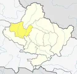
 Annapurna Rural Municipality Location in Nepal | |
| Coordinates: 28.352178°N 83.707148°E | |
| Country | |
| Province | Gandaki |
| District | Myagdi District |
| Area | |
| • Total | 556.41 km2 (214.83 sq mi) |
| Population | |
| • Total | 13,315 |
| • Density | 24/km2 (62/sq mi) |
| Time zone | UTC+5:45 (Nepal Time) |
| Website | http://annapurnamunmyagdi.gov.np/ |
Demographics
At the time of the 2011 Nepal census, Annapurna Rural Municipality had a population of 13,337. Of these, 98.3% spoke Nepali, 0.8% Kham, 0.3% Sign language, 0.1% Magar and 0.4% other languages as their first language.[3]
In terms of ethnicity/caste, 69.3% were Magar, 12.9% Chhetri, 8.2% Kami, 4.5% Damai/Dholi, 1.3% Hill Brahmin, 1.0% Thakali, 0.8% Gurung, 0.5% Tamang, 0.2% Badi, 0.2% Newar, 0.2% Rai, 0.2% Sanyasi/Dasnami, 0.2% Sarki, 0.1% Gaine, 0.1% Sherpa and 0.4% others.[4]
In terms of religion, 81.4% were Hindu, 9.5% Buddhist, 6.3% Prakriti, 1.8% Christian, 0.1% Bon and 0.9% others.[5]
In terms of literacy, 71.9% could read and write, 1.4% could only read and 26.7% could neither read nor write.[6]
References
- Collegenp. "Annapurna Rural Municipality | Collegenp". www.collegenp.com. Retrieved 2020-07-06.
- "अन्नपूर्ण गाउँपालिका, गाउँ कार्यपालिकाको कार्यालय | पोखरेबगर, म्याग्दी, गण्डकी प्रदेश, नेपाल "खेलकुद, जलविद्युत र पर्यटन पुर्वाधार :अन्नपुर्ण सम्वृद्धिको आधार"". annapurnamunmyagdi.gov.np. Retrieved 2020-07-06.
- NepalMap Language
- NepalMap Caste
- NepalMap Religion
- NepalMap Literacy