Myagdi District
Myagdi District (Nepali: म्याग्दी जिल्ला ⓘ), a part of Gandaki Province, is one of the seventy-seven districts of Nepal. The district, with Beni as its district headquarters, covers an area of 2,297 km2 (887 sq mi), had a population of 114,447 in 2001 and 113,641 in 2011.[1]
Myagdi District
(म्याग्दी जिल्ला)
| |
|---|---|
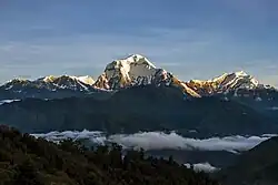
 View of Dhaulagiri from Ghorepani | |
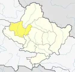
 Location of Myagdi (dark yellow) in Gandaki Province | |
| Country | |
| Province | Gandaki Province |
| Admin HQ. | Beni |
| Government | |
| • Type | Coordination committee |
| • Body | DCC, Myagdi |
| Area | |
| • Total | 2,297 km2 (887 sq mi) |
| Population (2021) | |
| • Total | 107,372 |
| • Density | 47/km2 (120/sq mi) |
| Time zone | UTC+05:45 (NPT) |
| Telephone Code | 069 |
| Main Language(s) | Nepali • Magar Kham |
Geography and climate
This district can experience 7 types of climates
| Climate Zone[2]
i |
Elevation Range | % of Area |
|---|---|---|
| Upper Tropical | 300 to 1,000 meters 1,000 to 3,300 ft. |
0.1% |
| Subtropical | 1,000 to 2,000 meters 3,300 to 6,600 ft. |
17.5% |
| Temperate | 2,000 to 3,000 meters 6,400 to 9,800 ft. |
28.0% |
| Subalpine | 3,000 to 4,000 meters 9,800 to 13,100 ft. |
21.1% |
| Alpine | 4,000 to 5,000 meters 13,100 to 16,400 ft. |
17.8% |
| Nival | above 5,000 meters | 13.9% |
| Trans-Himalayan | 3,000 to 6,400 meters 9,800 to 21,000 ft. |
1.6% |
Demographics
At the time of the 2011 Nepal census, Myagdi District had a population of 113,641.
As their first language, 94.4% spoke Nepali, 2.2% Magar, 1.0% Kham, 0.9% Chhantyal, 0.6% Newari, 0.1% Bhojpuri, 0.1% Gurung, 0.1% Hindi, 0.1% Maithili, 0.1% Sanskrit, 0.1% Sign language, 0.1% Thakali and 0.2% other languages.[4]
Ethnicity/caste: 39.6% were Magar, 17.0% Chhetri, 15.4% Kami, 8.0% Hill Brahmin, 5.8% Damai/Dholi, 3.5% Chhantyal, 3.4% Sarki, 2.0% Thakuri, 1.3% Newar, 1.0% Gurung, 0.9% Thakali, 0.5% Kisan, 0.2% Sanyasi/Dasnami, 0.2% Tamang, 0.1% Badi, 0.1% other Dalit, 0.1% Musalman, 0.1% Rai and 0.3% others.[5]
Religion: 87.2% were Hindu, 10.3% Buddhist, 1.3% Christian, 0.8% Prakriti, 0.2% Muslim and 0.2% others.[6]
Literacy: 71.5% could read and write, 2.3% could only read and 26.1% could neither read nor write.[7]
| Census year | Pop. | ±% p.a. |
|---|---|---|
| 1981 | 96,904 | — |
| 1991 | 100,552 | +0.37% |
| 2001 | 114,447 | +1.30% |
| 2011 | 113,641 | −0.07% |
| 2021 | 107,372 | −0.57% |
| Source: Citypopulation[8] | ||
Administration
The district consists of 6 Municipalities, out of which one is an urban municipality and five are rural municipalities. These are as follows:[9]
- Beni Municipality
- Annapurna Rural Municipality
- Dhaulagiri Rural Municipality
- Mangala Rural Municipality
- Malika Rural Municipality
- Raghuganga Rural Municipality
Former Village Development Committees
Prior to the restructuring of the district, Myagdi District consisted of the following municipalities and Village development committees:

- Arman
- Arthunge
- Baadook
- Babiyachaur
- Baranja
- Begkhola
- Beni Municipality
- Bhakilmi
- Bhanbare
- Bima
- Chimkhola
- Dagnam
- Dana
- Darwang
- Devisthan
- Doba
- Ghar
- Ghatan
- Gurja Khani
- Histhan Mandali
- Jhin
- Jyamrukot
- Khibang
- Kuhunkot
- Kuinemangale
- Lulang
- Malkwang
- Marang
- Mudi
- Muna
- Nangi
- Narchyang
- Niskot
- Okharbot
- Pakhapani
- Patlekhet
- Pulachaur
- Rakhu Bhagawati
- Rakhupiple
- Ramche
- Ratnechaur
- Shikha
- Singa
- Takam
- Tatopani
- Ruma
Notable people
- Min Bahadur Sherchan, who was the oldest man to summit Mount Everest for about 5 years, was born in Myagdi district of Nepal was born here.[10]
- Nirmal Purja MBE, a mountaineer and former Gurkha and Special Boat Service (SBS) soldier.
- Mahabir Pun, Man who provided internet to remote villages and Leader Of National Innovation Center.
Infrastructures
- Tatopani Hydropower Station (2 MW)
See also
References
- "National Population and Housing Census 2011 (National Report)" (PDF). Central Bureau of Statistics. Archived from the original (PDF) on 2013-05-25. Retrieved June 1, 2015.
- The Map of Potential Vegetation of Nepal - a forestry/agroecological/biodiversity classification system (PDF), Forest & Landscape Development and Environment Series 2-2005 and CFC-TIS Document Series No.110., 2005, ISBN 87-7903-210-9, retrieved November 22, 2013
- 2011 Nepal Census, Social Characteristics Tables
- NepalMap Language
- NepalMap Caste
- NepalMap Religion
- NepalMap Literacy
- "NEPAL: Administrative Division". www.citypopulation.de.
- "स्थानिय तह" (in Nepali). Ministry of Federal Affairs and General Administration. Archived from the original on 31 August 2018. Retrieved 1 September 2018.
- "Nepal's 86yo climber announces to attempt Everest again". The Himalayan Times. 2017-03-06. Retrieved 2018-07-12.
"Districts of Nepal". Statoids.