Anosibe An'ala
Anosibe An'ala is a city in Anosibe An'ala District, Alaotra-Mangoro Region, Madagascar. It is situated at 186 km from Antananarivo and 72 km from Moramanga to which it is linked by the unpaved road RIP23[2] that is only suitable for 4x4 driven cars.
Anosibe An'ala | |
|---|---|
City | |
 Anosibe An'ala | |
| Coordinates: 19°09′S 48°14′E | |
| Country | Madagascar |
| Region | Alaotra-Mangoro |
| District | Anosibe An'ala |
| Area | |
| • Total | 2,660 km2 (1,030 sq mi) |
| Elevation | 800 m (2,600 ft) |
| Highest elevation | 1,325 m (4,347 ft) |
| Population (2018) | |
| • Total | 27,191 |
| • Density | 10/km2 (26/sq mi) |
| [1] | |
| Climate | Cwa |
The Sandrangato river flows near this town where it also forms the Niagarakely falls.[3] The town is also close to the rivers Menakoranga and Menambolosa. Also the Manampotsy has its springs in the commune.[4]
Education
The town disposes of 58 elementary schools, 4 secondary schools and 1 Lycée.[5] The scolarisation rate is 74%.
Religion
- FJKM - Fiangonan'i Jesoa Kristy eto Madagasikara (Church of Jesus Christ in Madagascar)
- EEM - Eklesia Episkopaly Malagasy (Anglican Church of Madagascar)
- Roman Catholic Church
Agriculture
Main crops are rice, manioc, coffee (1895 ha), sugar cane (895 ha), Cloves (50 ha), peanuts (25 ha) and honey.
Capital: Ambatondrazaka | ||
| Ambatondrazaka (21) | 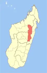 | |
| Amparafaravola (21) | ||
| Andilamena (8) | ||
| Anosibe An'ala (11) | ||
| Moramanga (22) | ||
5 districts; 82 communes | ||
References
- TROISIEME RECENSEMENT GENERAL DE LA POPULATION ET DE L’HABITATION
- [Lecitoyen.mg http://lecitoyen.mg/?p=8144 Archived 2017-02-03 at the Wayback Machine]
- "Anosibe An'Ala - Hazavana". Archived from the original on 2017-02-03. Retrieved 2017-02-03.
- MINISTERE DE L’AGRICULTURE, DE L’ELEVAGE et DE LA PECHE
- MINISTERE DE L’AGRICULTURE
This article is issued from Wikipedia. The text is licensed under Creative Commons - Attribution - Sharealike. Additional terms may apply for the media files.