Augusta metropolitan area
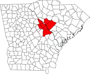
The Augusta metropolitan area is a metropolitan area in the U.S. states of Georgia and South Carolina centered on the principal city of Augusta. The U.S. Office of Management and Budget, Census Bureau and other agencies define Augusta's Metropolitan Statistical Area, the Augusta-Richmond County, GA-SC Metropolitan Statistical Area, as comprising Richmond, Burke, Columbia, Lincoln, and McDuffie counties in Georgia and Aiken and Edgefield counties in South Carolina. The official 2021 U.S. Census estimate for the area was 615,963 residents.[1][2]
Augusta-Richmond County, GA-SC Metropolitan Statistical Area | |
|---|---|
 Map of the Augusta-Richmond County MSA | |
| Country | |
| State | |
| Largest city | Augusta |
| Area | |
| • Total | 4,045 sq mi (10,480 km2) |
| • Land | 3,932 sq mi (10,180 km2) |
| • Water | 113 sq mi (290 km2) 2.8% |
| Population (2021) | |
| • Total | 615,963 (est.)[1][2] |
| • Rank | 96th[3] |
| Time zone | UTC-5 (EST) |
| • Summer (DST) | UTC-4 (EDT) |
| Area codes | 478, 706, 762, 803, 839, 864 |

Counties
In Georgia
| County | Population (2014) |
|---|---|
| Richmond County | 201,554 |
| Columbia County | 156,714 |
| Burke County | 22,423 |
| McDuffie County | 21,531 |
| Lincoln County | 7,915 |
| Total: | 410,127 |
In South Carolina
| County | Population (2014) |
|---|---|
| Aiken County | 169,401 |
| Edgefield County | 27,052 |
| Total: | 196,453 |
Communities
Places with more than 100,000 inhabitants
- Augusta-Richmond County (balance), Georgia (Principal city) Pop: 197,872
Places with 10,000 to 40,000 inhabitants
- Martinez, Georgia Pop: 35,795
- Aiken, South Carolina Pop: 29,884
- Evans, Georgia Pop: 29,011
- North Augusta, South Carolina Pop: 21,873
- Grovetown, Georgia Pop: 14,473
Places with 5,000 to 10,000 inhabitants
- Thomson, Georgia Pop: 6,718
- Belvedere, South Carolina Pop: 5,792
- Waynesboro, Georgia Pop: 5,816
Places with 1,000 to 5,000 inhabitants
- Edgefield, South Carolina Pop: 4,690
- Barnwell, South Carolina Pop: 4,500
- Clearwater, South Carolina Pop: 4,370
- Hephzibah, Georgia Pop: 4,021
- Gloverville, South Carolina Pop: 2,831
- Burnettown, South Carolina Pop: 2,673
- Harlem, Georgia Pop: 2,779
- Johnston, South Carolina Pop: 2,362
- New Ellenton, South Carolina Pop: 2,052
- Jackson, South Carolina Pop: 1,700
- Lincolnton, Georgia Pop: 1,520
Places with fewer than 1,000 inhabitants
- Sardis, Georgia Pop: 995
- Wagener, South Carolina Pop: 631
- Blythe, Georgia Pop: 744
- Dearing, Georgia Pop: 529
- Salley, South Carolina Pop: 329
- Keysville, Georgia (partial) Pop: 300
- Midville, Georgia Pop: 385
- Monetta, South Carolina (partial) Pop: 205
- Perry, South Carolina Pop: 194
- Trenton, South Carolina Pop: 200
- Girard, Georgia Pop: 184
- Windsor, South Carolina Pop: 115
- Vidette, Georgia Pop: 103
Demographics
As of the census[4] of 2000, there were 499,684 people, 184,801 households, and 132,165 families residing within the MSA. The racial makeup of the MSA was 60.81% White, 35.09% African American, 0.32% Native American, 1.42% Asian, 0.08% Pacific Islander, 0.85% from other races, and 1.43% from two or more races. Hispanic or Latino of any race were 2.40% of the population.
The median income for a household in the MSA was $36,933, and the median income for a family was $42,869. Males had a median income of $34,574 versus $22,791 for females. The per capita income for the MSA was $17,652.
References
- "Metropolitan and Micropolitan Statistical Areas Population Totals and Components of Change: 2010-2019". United States Census Bureau, Population Division. April 2019. Retrieved April 18, 2020.
- "Metropolitan and Micropolitan Statistical Areas Population Totals and Components of Change: 2010-2019". United States Census Bureau, Population Division. March 26, 2020. Retrieved April 26, 2020.
- "Table 1. Annual Estimates of the Population of Metropolitan and Micropolitan Statistical Areas: April 1, 2010 to July 1, 2012". 2012 Population Estimates. United States Census Bureau, Population Division. March 2013. Archived from the original (CSV) on 2013-04-01. Retrieved 2013-06-05.
- "U.S. Census website". United States Census Bureau. Retrieved 2008-01-31.