Azewijn
Azewijn is a village in the Dutch province of Gelderland and the municipality Montferland, and is about 3 km east of the town of 's-Heerenberg.
Azewijn | |
|---|---|
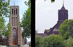 St Matthew's Church, Azewijn | |
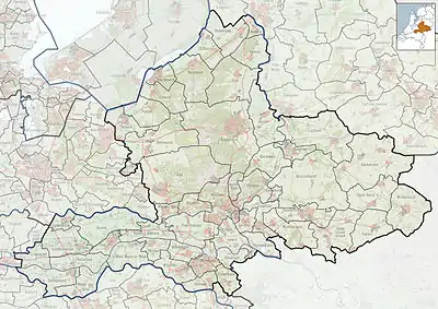 Azewijn Location in the Netherlands  Azewijn Azewijn (Netherlands) | |
| Coordinates: 51°53′8″N 6°18′15″E | |
| Country | Netherlands |
| Province | Gelderland |
| Municipality | Montferland |
| Area | |
| • Total | 12.96 km2 (5.00 sq mi) |
| Elevation | 15 m (49 ft) |
| Population (2021)[1] | |
| • Total | 910 |
| • Density | 70/km2 (180/sq mi) |
| Time zone | UTC+1 (CET) |
| • Summer (DST) | UTC+2 (CEST) |
| Postal code | 7045[1] |
| Dialing code | 0314 |
The larger part of Azewijn is known as "Groot-Azewijn" (Greater Azewijn), with the hamlet "Klein-Azewijn" (Lesser Azewijn) about 1 km to the north.[3]
Azewijn was first mentioned in 1025 as 'Asawon'; but the etymology is unclear.[4] The village belonged to the Kingdom of Prussia before it became part of the Netherlands in 1816.[5] Population in 1840 was 525.[3] St Matthews Church at Azewijn was built in 1891. It was burnt down by Germans on 31 March 1945, and was rebuilt in 1950–1951.[3]
References
- "Kerncijfers wijken en buurten 2021". Central Bureau of Statistics. Retrieved 23 March 2022.
two entries
- "Postcodetool for 7045AA". Actueel Hoogtebestand Nederland (in Dutch). Het Waterschapshuis. Retrieved 23 March 2022.
- "Azewijn". Plaatsengids (in Dutch). Retrieved 23 March 2022.
- "Azewijn - (geografische naam)". Etymologiebank (in Dutch). Retrieved 23 March 2022.
- "Azewijn, als vroegste vermelding van Berghse buurtschap in de geschreven bronnen". Heemkundekring Bergh (in Dutch). Retrieved 23 March 2022.
This article is issued from Wikipedia. The text is licensed under Creative Commons - Attribution - Sharealike. Additional terms may apply for the media files.