Loerbeek
Loerbeek is a village in the eastern Netherlands, near the German border. It's close to Beek and Nieuw-Dijk. There's a big forest called Bergherbos, where people can walk, mountain-bike and ride horse.
Loerbeek | |
|---|---|
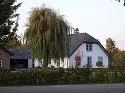 Farm in Loerbeek | |
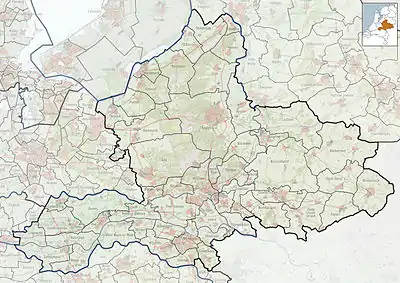 Loerbeek Location in the Netherlands  Loerbeek Loerbeek (Netherlands) | |
| Coordinates: 51°55′16″N 6°11′41″E | |
| Country | Netherlands |
| Province | Gelderland |
| Municipality | Montferland |
| Area | |
| • Total | 4.25 km2 (1.64 sq mi) |
| Elevation | 18 m (59 ft) |
| Population (2021)[1] | |
| • Total | 695 |
| • Density | 160/km2 (420/sq mi) |
| Time zone | UTC+1 (CET) |
| • Summer (DST) | UTC+2 (CEST) |
| Postal code | 7036 & 7037[1] |
| Dialing code | 0316 |
It was first mentioned in 1240 as Loberke. The etymology is unknown.[3]
Gallery
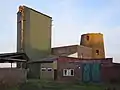 Remains of the former windmill (1845)
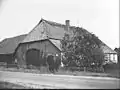 Farm in Loerbeek
References
- "Kerncijfers wijken en buurten 2021". Central Bureau of Statistics. Retrieved 23 March 2022.
- "Postcodetool for 7037AA". Actueel Hoogtebestand Nederland (in Dutch). Het Waterschapshuis. Retrieved 23 March 2022.
- "Loerbeek - (geografische naam)". Etymologiebank (in Dutch). Retrieved 23 March 2022.
Wikimedia Commons has media related to Loerbeek.
This article is issued from Wikipedia. The text is licensed under Creative Commons - Attribution - Sharealike. Additional terms may apply for the media files.