Bílá Hlína
Bílá Hlína is a municipality and village in Mladá Boleslav District in the Central Bohemian Region of the Czech Republic. It has about 100 inhabitants.
Bílá Hlína | |
|---|---|
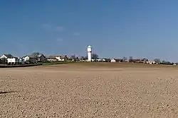 Fields in front of Bílá Hlína | |
 Bílá Hlína Location in the Czech Republic | |
| Coordinates: 50°31′57″N 14°55′31″E | |
| Country | |
| Region | Central Bohemian |
| District | Mladá Boleslav |
| Founded | 1712 |
| Area | |
| • Total | 8.57 km2 (3.31 sq mi) |
| Elevation | 278 m (912 ft) |
| Population (2023-01-01)[1] | |
| • Total | 113 |
| • Density | 13/km2 (34/sq mi) |
| Time zone | UTC+1 (CET) |
| • Summer (DST) | UTC+2 (CEST) |
| Postal code | 295 01 |
| Website | www |
Etymology
The name means "white clay" and is derived from the white clay soil where the village was founded.[2]
Geography
Bílá Hlína is located about 12 kilometres (7 mi) west of Mladá Boleslav and 55 km (34 mi) northeast of Prague. It lies in the Jizera Table. Most of the municipal territory is formed by the Klokočka deer park.
History
Bílá Hlína was founded in 1712 and belongs to the youngest villages in the region.[2]
Sights
There are no cultural monuments.[3]
References
- "Population of Municipalities – 1 January 2023". Czech Statistical Office. 2023-05-23.
- "Historie" (in Czech). Obec Bílá Hlína. Retrieved 2022-05-02.
- "Výsledky vyhledávání: Kulturní památky, okres Mladá Boleslav". Ústřední seznam kulturních památek (in Czech). National Heritage Institute. Retrieved 2023-03-14.
This article is issued from Wikipedia. The text is licensed under Creative Commons - Attribution - Sharealike. Additional terms may apply for the media files.