Bagley Junction, Wisconsin
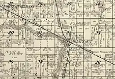
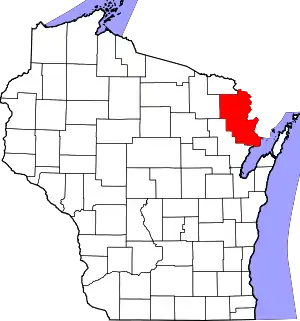
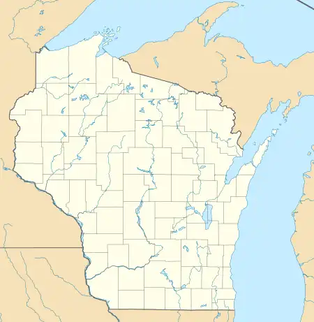
Bagley Junction is an unincorporated community located in the town of Porterfield, Marinette County, Wisconsin, United States.[1]
Bagley Junction, Wisconsin | |
|---|---|
 | |
 Bagley Junction, Wisconsin  Bagley Junction, Wisconsin | |
| Coordinates: 45°08′18″N 87°45′04″W | |
| Country | |
| State | |
| County | Marinette |
| Elevation | 190 m (630 ft) |
| Time zone | UTC-6 (Central (CST)) |
| • Summer (DST) | UTC-5 (CDT) |
| Area codes | 715 & 534 |
| GNIS feature ID | 1577500[1] |
Geography
Bagley Junction is located on Bagley Road on the left bank of the Peshtigo River, at the north end of the Potato Rapids Reservoir,[2][3] at an elevation of 630 feet (190 m).[1] It is connected by road to Walsh to the north, Porterfield to the west (via Grasser Road), Peshtigo to the south (via Right of Way Road), and Marinette to the east (via Wisconsin Highway 64).
Name
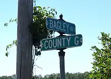
Bagley Junction and Bagley Road, which passes through the community, are named for John Bagley (June 20, 1852 Quebec – August 17, 1920 Tacoma, Washington),[4][5] a lumberman.[6][7] After his early activity in Wisconsin, Bagley was active in Washington and later became president of the Tacoma Eastern Railroad.[4] There is another Bagley Junction, also named after John Bagley, in King County, Washington.[8][9]
History

Bagley Junction was inhabited by Native Americans before the arrival of white settlers. Four oval burial mounds known as the Bagley Junction Mounds were mapped by Harvey O. Younger (1889–1956) in 1913,[10] when he also discovered a stone hoe at the site.[11] Shell content indicates that the mounds were formed from soil taken from the bank of the Peshtigo River.[12] The mounds may be associated with a Late Woodland habitation.[10] The burial mounds were further investigated in 2007 during an archaeological survey for a road project. The survey identified two mounds about 75 feet (23 m) apart between Bagley Road and the Peshtigo River; the southern mound measures 30 by 18.5 feet (9.1 m × 5.6 m) and is about 15 inches (380 mm) high, and the northern mound measures 22 by 19 feet (6.7 m × 5.8 m) and is about 18 inches (460 mm) high. There is no surface evidence of the other two mounds mapped in 1913; it is believed they were destroyed by a former driveway that is now used as a snowmobile trail.[10]
In 1894, the Wisconsin & Michigan Railway opened an office[13] and established workshops at Bagley Junction, employing up to sixty men.[14] That year the company also erected coal sheds and water tanks at the site.[15] From 1894 to 1938, the site was a railroad junction for a line that ran north to Walsh and onward to Iron Mountain, Michigan.[16] The line was built using surplus rail from the Chicago World's Fair, which had closed in 1893.[17] The line to Walsh was removed in 1938,[16][18][19] but an east-west branch line that belonged to the former Milwaukee Road still exists.[20] The track is currently owned by Escanaba and Lake Superior Railroad.[21]
In the early 20th century a lumber camp and sawmill operated in Bagley Junction.[22][23] In the 1920s, Andrew Jackson Smith (1832–1929), a resident of the community and a Civil War veteran, was jocularly known as the "mayor" of Bagley Junction.[24][25][26]
Bagley Junction had three houses in 2010, when it was also the site of the USCA National Canoe and Kayak Championships.[27]
References
- "Bagley Junction, Wisconsin". Geographic Names Information System. United States Geological Survey, United States Department of the Interior.
- Peshtigo River Multiple Project: Environmental Impact Statement. Washington, DC: Federal Energy Regulatory Commission. 1997. pp. 3–42.
- Porterfield Quadrangle, Wisconsin—Marinette Co., 7.5-Minute Series (Topographic). 1982. Map, 1:24,000. Reston, VA: United States Department of the Interior Geological Survey.
- "John Bagley" (obituary). Chicago Lumberman 39, page 45.
- Washington Death Certificates, 1907–1960
- Callary, Edward (2016). Place Names of Wisconsin. Madison, WI: University of Wisconsin Press. p. 19. ISBN 978-0-299-30964-0.
- Lalk, E. A. 1922. "The Ranier National Park Branch." The Milwaukee Employes' Magazine (sic), June: 12–15. Page 12.
- "Bagley Junction, Washington". Geographic Names Information System. United States Geological Survey, United States Department of the Interior.
- North Bend Quadrangle, Washington—King Co., 7.5-Minute Series (Topographic). 1953. Map, 1:24,000. Denver, CO: U. S. Geological Survey.
- Kuehn, Steven R. (2007). "Archaeology around Wisconsin". The Wisconsin Archaeologist. 88 (2): 148.
- "Research Trip Is Full of Success". The Post-Crescent. September 17, 1913. p. 4. Retrieved April 20, 2020 – via Newspapers.com.

- Titus, William A. (1930). History of the Fox River Valley, Lake Winnebago, and the Green Bay Region. Chicago: S.J. Clarke Publishing Company. p. 44.
- "A large and fine new locomotive ..." The Neenah Daily Times. June 11, 1894. p. 4. Retrieved April 19, 2020 – via Newspapers.com.

- "The Wisconsin & Michigan Railroad". The Centralia Enterprise and Tribune. September 1, 1894. p. 8. Retrieved April 19, 2020 – via Newspapers.com.

- "The Wisconsin & Michigan Railway". The Journal Times. May 12, 1894. p. 4. Retrieved April 19, 2020 – via Newspapers.com.

- McLeod, Richard (1968). "History of the Wisconsin and Michigan Railway". The Railway and Locomotive Historical Society Bulletin. 118: 7–20.
- King, Beverly & Deacon, Dan (1987). Faithorn Centennial, 1887–1987. Faithorn, MI: Author. p. 13.
- "Seek Permission to Abandon Lines". The Oshkosh Northwestern. April 10, 1937. p. 17. Retrieved August 2, 2019 – via Newspapers.com.

- "Approve Wisconsin and Michigan Ry. Line Abandonment". The Daily Tribune. January 20, 1938. p. 5. Retrieved August 2, 2019 – via Newspapers.com.

- Official Guide of the Railways. New York City: National Railway Publishing Company. June 1941.
- Wisconsin Department of Transportation (January 2020). Wisconsin Railroads & Harbors 2020 (PDF) (Map).
- "Alfred Rudolph". The La Crosse Tribune. November 18, 1908. p. 8. Retrieved April 19, 2020 – via Newspapers.com.

- "Steal Machines from Sawmills". The Post-Crescent. September 16, 1920. p. 6. Retrieved April 19, 2020 – via Newspapers.com.

- "Andrew J. Smith". The Sheboygan Press. August 17, 1926. p. 6. Retrieved April 19, 2020 – via Newspapers.com.

- "Two More Marinette G.A.R. Members Die". The La Crosse Tribune. December 4, 1929. p. 2. Retrieved April 19, 2020 – via Newspapers.com.

- "Bagley Junction 'Mayor' Is Buried". The Sheboygan Press. December 5, 1929. p. 13. Retrieved April 19, 2020 – via Newspapers.com.

- Harpt, Jerry (June 4, 2010). "Paddlers in the Mist". EagleHerald. p. A9.
External links
 Media related to Bagley Junction, Wisconsin at Wikimedia Commons
| Preceding station | Milwaukee Road | Following station | ||
|---|---|---|---|---|
| Porterfield towards Crivitz |
Crivitz – Menominee | Marinette towards Menominee | ||
