Bang Phlap, Nonthaburi
Bang Phlap (Thai: บางพลับ, pronounced [bāːŋ pʰláp]) is one of the twelve subdistricts (tambon) of Pak Kret District, in Nonthaburi Province, Thailand. Neighbouring subdistricts are (from north clockwise) Lahan, Khlong Khoi, Khlong Phra Udom, Ko Kret, Om Kret and Phimon Rat. In 2020, it had a total population of 10,899 people.[2]
Bang Phlap Subdistrict
ตำบลบางพลับ | |
|---|---|
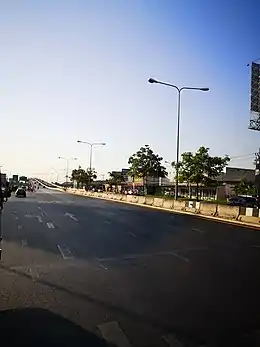 Chaiyaphruek Road in the subdistrict | |
| Country | |
| Province | Nonthaburi |
| District | Pak Kret |
| Area | |
| • Total | 8.31 km2 (3.21 sq mi) |
| Population (2020)[2] | |
| • Total | 10,899 |
| • Density | 1,311.55/km2 (3,396.9/sq mi) |
| Time zone | UTC+7 (ICT) |
| Postal code | 11120 |
| TIS 1099 | 120611 |
Administration
Central administration
The subdistrict is subdivided into 5 administrative villages (muban).[3]
| No. | Name | Thai |
|---|---|---|
| 1. | Ban Khung Nam Won | บ้านคุ้งน้ำวน |
| 2. | Ban Bang Phlap Yai (Ban Bang Phlap) | บ้านบางพลับใหญ่ (บ้านบางพลับ) |
| 3. | Ban Rahaeng | บ้านระแหง |
| 4. | Ban Bang Phlap (Ban Bang Wat) | บ้านบางพลับ (บ้านบางวัด) |
| 5. | Ban Bang Phum | บ้านบางภูมิ |
Local administration
The whole area of the subdistrict is covered by Bang Phlap Subdistrict Municipality (เทศบาลตำบลบางพลับ).
References
- Bang Phlap Subdistrict Municipality. ประวัติความเป็นมา. Bang Phlap Subdistrict Municipality (in Thai). Retrieved 18 December 2021.
- "Population statistics 2020" (in Thai). Department of Provincial Administration. Retrieved 18 December 2021.
- ประกาศกระทรวงมหาดไทย เรื่อง การกําหนดเขตตําบลในท้องที่อําเภอปากเกร็ด จังหวัดนนทบุรี (ฉบับที่ ๒) พ.ศ. ๒๕๕๖ (PDF). Royal Gazette (in Thai). 130 (special 122D): 16–21. 23 September 2013. Archived from the original (PDF) on March 4, 2016.
This article is issued from Wikipedia. The text is licensed under Creative Commons - Attribution - Sharealike. Additional terms may apply for the media files.