Bardsir County
Bardsir County (Persian: شهرستان بردسیر) is in Kerman province, Iran. Its capital is the city of Bardsir.
Bardsir County
Persian: شهرستان بردسیر | |
|---|---|
County | |
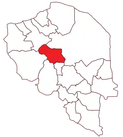 Location of Bardsir County in Kerman province | |
 Location of Kerman province in Iran | |
| Coordinates: 29°48′N 56°40′E[1] | |
| Country | Iran |
| Province | Kerman |
| Capital | Bardsir |
| Districts | Central, Golzar, Lalehzar, Negar |
| Population (2016)[2] | |
| • Total | 81,983 |
| Time zone | UTC+3:30 (IRST) |
| Website | web |
| Bardsir County can be found at GEOnet Names Server, at this link, by opening the Advanced Search box, entering "9206654" in the "Unique Feature Id" form, and clicking on "Search Database". | |
At the 2006 census, the county's population was 84,543 in 18,650 households.[3] The following census in 2011 counted 73,738 people in 19,632 households.[4] At the 2016 census, the county's population was 81,983 in 25,315 households.[2]
Administrative divisions
The population history and structural changes of Bardsir County's administrative divisions over three consecutive censuses are shown in the following table. The latest census shows four districts, eight rural districts, and five cities.[2]
| Administrative Divisions | 2006[3] | 2011[4] | 2016[2] |
|---|---|---|---|
| Central District | 75,070 | 51,880 | 42,238 |
| Golzar Rural District | 3,242 | ||
| Kuh Panj Rural District | 2,898 | 2,459 | 6,040 |
| Mashiz Rural District | 18,900 | 8,409 | 7,812 |
| Negar Rural District | 2,807 | ||
| Bardsir (city) | 31,801 | 31,870 | 25,152 |
| Dashtkar (city) | 3,234 | ||
| Golzar (city) | 6,131 | 3,411 | |
| Negar (city) | 9,291 | 5,731 | |
| Golzar District | 2,473 | 8,271 | |
| Golzar Rural District | 837 | 677 | |
| Shirinak Rural District | 1,636 | 2,149 | |
| Golzar (city) | 5,445 | ||
| Lalehzar District | 9,473 | 8,762 | 13,407 |
| Lalehzar Rural District | 5,543 | 2,673 | 3,239 |
| Qaleh-ye Asgar Rural District | 3,930 | 3,144 | 5,739 |
| Lalehzar (city) | 2,945 | 4,429 | |
| Negar District | 8,509 | 17,171 | |
| Narp Rural District | 6,100 | 6,112 | |
| Negar Rural District | 2,409 | 3,459 | |
| Negar (city) | 7,600 | ||
| Total | 84,543 | 73,738 | 81,983 |
Wikimedia Commons has media related to Bardsir County.
References
- OpenStreetMap contributors (26 June 2023). "Bardsir County" (Map). OpenStreetMap. Retrieved 26 June 2023.
- "Census of the Islamic Republic of Iran, 1395 (2016)". AMAR (in Persian). The Statistical Center of Iran. p. 08. Archived from the original (Excel) on 20 October 2020. Retrieved 19 December 2022.
- "Census of the Islamic Republic of Iran, 1385 (2006)". AMAR (in Persian). The Statistical Center of Iran. p. 08. Archived from the original (Excel) on 20 September 2011. Retrieved 25 September 2022.
- "Census of the Islamic Republic of Iran, 1390 (2011)" (Excel). Iran Data Portal (in Persian). The Statistical Center of Iran. p. 08. Retrieved 19 December 2022.
| Capital |  | |
|---|---|---|
| Counties and cities | ||
| Sights |
| |
| Places | ||
This article is issued from Wikipedia. The text is licensed under Creative Commons - Attribution - Sharealike. Additional terms may apply for the media files.