Varagung Muktichhetra Rural Municipality
Varagung Muktichhetra (Nepali: वारागुङ मुक्तिक्षेत्र), earlier Bahragaun Muktichhetra is a rural municipality situated in Mustang District of Gandaki Province of Nepal[1] The rural municipality is situated on the southern part of the Mustang, surrounded by Dalome rural municipality on the north, Gharpajhong and Thasang rural municipality on the south, Manang District on the east and Dolpa District on the west, north-southern border of the rural municipality touches border with Myagdi District.
Varagung Muktichhetra
वारागुङ मुक्तिक्षेत्र | |
|---|---|
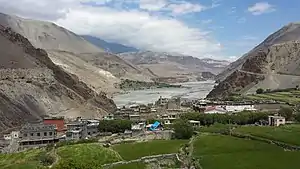 Kagbeni, the admin center of Baragung Muktichhetra | |
 | |
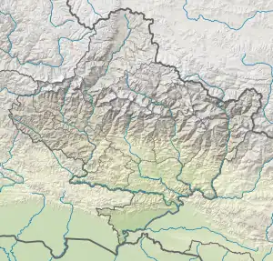 Varagung Muktichhetra Location in province 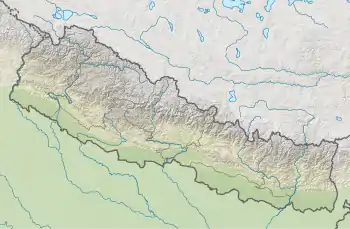 Varagung Muktichhetra Varagung Muktichhetra (Nepal) | |
| Coordinates: 28°50′12″N 83°46′59″E | |
| Country | |
| Province | Gandaki Province |
| District | Mustang |
| Wards | 5 |
| Established | 10 March 2017 |
| Government | |
| • Type | Rural council |
| • Body | Barhagaun Muktichhetra Rural Council |
| • Chairperson | Mr. Fenchok Chhepten Gurung (NC) |
| • Deputy-Chairperson | Dhiki Gurung (NCP) |
| Area | |
| • Total | 885.78 km2 (342.00 sq mi) |
| Highest elevation | 5,310 m (17,420 ft) |
| Lowest elevation | 2,800 m (9,200 ft) |
| Population (2011) | |
| • Total | 2,330 |
| • Density | 2.6/km2 (6.8/sq mi) |
| Time zone | UTC+5:45 (Nepal Time) |
| Headquarters | Kagbeni |
| Website | varagungmuktichhetramun |
The total area of the rural municipality is 885.78 square kilometres (342.00 sq mi) and total population of the rural municipality according to 2011 Nepal census is 2,330 individuals. The rural municipality is divided into 5 wards. The admin center of the rural municipality is at Kagbeni.[2]
Kagbeni, Jhong, Chhusang and Muktinath Village development committees were Incorporated while established this rural municipality.[2] The rural municipality came into existence on 10 March 2017, fulfilling the requirement of the new Constitution of Nepal 2015, Ministry of Federal Affairs and General Administration replaced all old VDCs and Municipalities into 753 new local level bodies.[3][4]
Etymology
The rural municipality was named Bahrachhetra Muktinath at the time of establishment of this rural municipality. The rural municipality had to named Varagung Muktichhetra but by mistake it spelled to Bahragaun Muktichhetra, so in the first meeting of this rural council on 17 July 2017, it was decided to send a request to related office to make the corrections in the name of the rural municipality.[5]
Demographics
At the time of the 2011 Nepal census, Varagung Muktichhetra Rural Municipality had a population of 2,704. Of these, 59.8% spoke Gurung, 18.7% Thakali, 15.2% Nepali, 2.4% Magar, 1.9% Tamang, 1.2% Sherpa and 0.8% other languages as their first language.[6]
In terms of ethnicity/caste, 60.5% were Gurung, 19.1% Thakali, 4.5% Kami, 3.8% Magar, 3.1% Hill Brahmin, 2.3% Chhetri, 2.1% Tamang, 1.5% Thakuri, 1.1% Sherpa, 0.5% Damai/Dholi and 1.6% others.[7]
In terms of religion, 79.3% were Buddhist, 16.6% Hindu, 3.3% Bon, 0.5% Christian, 0.1% Kirati and 0.2% others.[8]
In terms of literacy, 56.0% could read and write, 1.8% could only read and 42.2% could neither read nor write.[9]
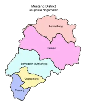
Administrative divisions
Varagung Muktichhetra is divided into 5 wards:
| Ward No. | Ward Name | Area (KM2) | Population | Ward Councillor |
|---|---|---|---|---|
| 1 | Muktinath | 59.55 | 628 | Mr. Bir Bahadur Gurung |
| 2 | Jhong | 50.01 | 253 | Mr. Chhin Namagga Gurung |
| 3 | Chhusang | 490.78 | 512 | Mr. Nabin Kumar Gurung |
| 4 | Kagbeni | 58.3 | 555 | Mr. Tenzing Nagyal Gurung |
| 5 | Phalyak | 227.15 | 382 | Mr. Rapke Gurung |
- Baragung Muktichhetra
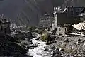 Jhong Khola in Kagbeni
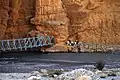 Kali Gandaki bridge in Tsele
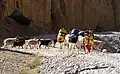 Trek from Chusang to Tsele
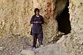 Metsin Lhakhang in Chhusang
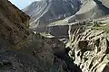 Gorge at Ghyakar
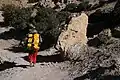 Porter on his way to Samar
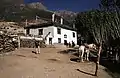 Guesthouse in Samar
 Apple farm in Tangbe
References
- "स्थानीय तहहरुको विवरण" [Details of the local level bodies]. www.mofald.gov.np/en (in Nepali). Ministry of Federal Affairs and Local Development. Archived from the original on 31 August 2018. Retrieved 17 July 2018.
- "District Corrected Last for RAJAPATRA" (PDF). www.mofald.gov.np. Retrieved 17 July 2018.
- "New local level structure comes into effect from today". www.thehimalayantimes.com. The Himalayan Times. 10 March 2017. Retrieved 17 July 2018.
- "New local level units come into existence". www.kathmandupost.ekantipur.com. 11 March 2017. Retrieved 18 July 2018.
- "बाह्रगाउँ मुक्तिक्षेत्र गाउँपालिकाको संक्षिप्त परिचय" (PDF). Archived from the original (PDF) on 2018-09-22. Retrieved 2018-09-22.
- NepalMap Language
- NepalMap Caste
- NepalMap Religion
- NepalMap Literacy
External links
Headquarters: Jomsom (today part of Gharpajhong Rural Municipality) | ||
| Rural municipalities |  | |