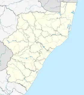
Bluff, KwaZulu-Natal
Bluff or The Bluff is a geographical area, containing eight suburbs in Durban, eThekwini Metropolitan Municipality, KwaZulu-Natal Province, South Africa. The Bluff forms a large part of the South Durban Basin, a sub-region located south of Durban.
Bluff | |
|---|---|
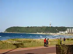 The Bluff as seen from Greens Walk, Durban | |
 Bluff 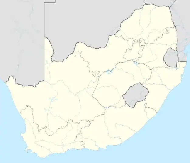 Bluff | |
| Coordinates: 29°55′29″S 31°0′14″E | |
| Country | South Africa |
| Province | KwaZulu-Natal |
| Municipality | eThekwini |
| Main Place | Durban |
| Area | |
| • Total | 21.68 km2 (8.37 sq mi) |
| Population (2011)[1] | |
| • Total | 68,124 |
| • Density | 3,100/km2 (8,100/sq mi) |
| Racial makeup (2011) | |
| • Black African | 15.6% |
| • Coloured | 36.6% |
| • Indian/Asian | 30.1% |
| • White | 17.1% |
| • Other | 0.6% |
| First languages (2011) | |
| • English | 79.8% |
| • Zulu | 8.1% |
| • Afrikaans | 7.2% |
| • Xhosa | 1.7% |
| • Other | 3.3% |
| Time zone | UTC+2 (SAST) |
| Postal code (street) | 4052 |
| PO box | 4036 |
History
The promontory on which Bluff is situated is Durban's most prominent natural landmark. Accordingly, it probably served as an important visual reference for navigational approaches into Durban Harbour.[2]
Between 1907 and 1975, the exposed south-east side of The Bluff housed a whaling station. Since the mid-Nineteenth Century, the region has been purposed for navigational and military uses. This use has provided protection for much of the area's native vegetation. Today, the area is considered important in the ecological management of Durban and environment.[2]
Etymology
The traditional Zulu name for Bluff is isibubulungu, meaning a long, round-shaped ridge. It also means "white man’s bluff", which may be a reference to habitation by shipwreck survivors.[2]
The name of the area is derived from the long bluff - two ancient sand dunes on which most of the suburbs lie.
Geography
The Bluff promonotory is a remnant of an extensive coastal dune system that formed along the shoreline of KwaZulu-Natal between two and five million years ago.[2]
Lying just south of the Durban city centre, the Bluff is one of the main enclosing elements of the Port of Durban from the Indian Ocean, and forms the southern quayside of the port. The coastal area is bounded by the Port of Durban (Island View) to the northwest, the defunct Durban International Airport and the SAPREF Petrochemical Refinery to the south, Mobeni to the southwest and the Port of Durban (Bayhead) and Clairwood to the west.
Within the area referred to as "The Bluff" lie the suburbs of Brighton Beach, Fynnland, Grosvenor, Jacobs, Merebank, Ocean View, Treasure Beach and Wentworth.
Beaches
The Bluff is a popular holiday destination, with extensive accommodation and plentiful seaside recreation. The area is known for its abundant sea life, including dolphins, and, in the winter months, whales.[3]
The Bluff has access to six beaches including Ansteys Beach, Brighton Beach, Cuttings Beach, Garvies Beach and Treasure Beach. Amongst these beaches Ansteys and Brighton beaches are the most popular with Ansteys Beach home to two pools and Brighton Beach to three pools including one tidal pool. Most of the other beaches along the Bluff remain quiet and unspoilt.
Economy
At the south end of the Bluff are two main residential suburbs: Wentworth and Merebank. Interspersed among the houses are a number of industries, including two of South Africa's largest oil refineries (Sapref and Engen facilities), the Mondi Paper Mill and other smaller factories. Durban's main airport was nearby until 2010. Durban International Airport moved and changed its name on 1 May 2010, relocating from the South Durban Basin to near Verulam, on the North Coast.
The mixture of residential homes and large industries in the basin creates a challenge for all those who live and work in the area. Air pollution, water pollution, overcrowding and litter are some of the problems that residents and industries need to deal with. Community groups are attempting to resolve the issue by working with the large industries in the area.
Transport
The M4 freeway (Inkosi Albert Luthuli Freeway) runs west of the Bluff leading northwards from the interchange with the N2 (to the South Coast) and the R102 (to Isipingo) known as the Reunion Interchange towards the city centre of Durban. The M7 leads westwards from Brighton Beach towards Rossburgh, Queensburgh and Pinetown as Solomon Mahlangu Drive (previously Edwin Swales VC Drive), Bluff Road, Old Mission Road and Grays Inn Road.
There are two arterial routes that intersect the Bluff which include the coastal road, Marine Drive, connecting Merebank and the coastal suburbs of Treasure Beach, Brighton Beach and Ocean View and the inland land, running parallel to Marine Drive connecting Merebank and the suburbs of Jacobs, Wentworth, Grosvenor and Fynnlands.
Amenities
The Bluff is served by four shopping centers namely Bluff Towers and Hillside Mall in Wentworth which are the two largest in the Bluff, Merebank Mall in Merebank and the Bluff Shopping Centre in Grosvenor. [4][5]
The Bluff is also serviced by two police stations in Wentworth and Brighton Beach, a public hospital which is the Wentworth District Hospital which mainly serves most suburbs south of Durban and a large golf course, Bluff National Park Golf Club between Grosvenor and Ocean View. [6][7][8]
References
- "Sub Place Bluff". Census 2011.
- "Durban South Tourism Route". Open Africa. Archived from the original on 27 September 2010. Retrieved 9 March 2010.
- "Bluff, Durban Information". WhereToStay. Retrieved 9 March 2010.
- "Smartmall". www.blufftowers.co.za. Retrieved 1 May 2022.
- "hillside mall - Google Search". www.google.com. Retrieved 1 May 2022.
- "Crime Stats SA". www.crimestatssa.com. Retrieved 1 May 2022.
- "Wentworth Provincial Hospital". www.kznhealth.gov.za. Retrieved 1 May 2022.
- "Bluff Golf Club – Bluff National Park Golf Club". Retrieved 1 May 2022.
External links
- eThekwini Online Accessed 9 March 2010
- KwaZulu-Natal Tourism Authority Accessed 9 March 2010
- KwaZulu-Natal search engine Accessed 9 March 2010
.svg.png.webp)