Borough of Havant
The Borough of Havant is a local government district with borough status in Hampshire, England. Its council is based in Havant. Other places within the borough include Bedhampton, Cowplain, Emsworth, Hayling Island, Purbrook, Waterlooville and Widley. The borough covers much of the semi-urban area in the south east of Hampshire, between the city of Portsmouth and the West Sussex border.
Borough of Havant | |
|---|---|
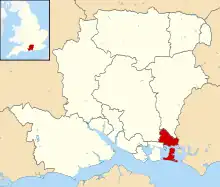 Havant shown within Hampshire | |
| Sovereign state | United Kingdom |
| Constituent country | England |
| Region | South East England |
| Non-metropolitan county | Hampshire |
| Status | Non-metropolitan district |
| Admin HQ | Havant |
| Incorporated | 1 April 1974 |
| Government | |
| • Type | Non-metropolitan district council |
| • Body | Havant Borough Council |
| • Leadership | Leader & Cabinet (Conservative) |
| • MPs | |
| Area | |
| • Total | 21.4 sq mi (55.3 km2) |
| • Rank | 238th (of 296) |
| Population (2021) | |
| • Total | 124,470 |
| • Rank | 191st (of 296) |
| • Density | 5,800/sq mi (2,300/km2) |
| • Ethnicity | 98.5% White |
| Time zone | UTC0 (GMT) |
| • Summer (DST) | UTC+1 (BST) |
| ONS code |
|
| OS grid reference | SU717062 |
| Website | www |
History
The Havant and Waterloo urban district was reconstituted as a non-metropolitan district named just "Havant" by the Local Government Act 1972 on 1 April 1974.[1][2]
Havant Borough Council
Elections to the borough council are held in three out of every four years, with one third of the 38 seats on the council being elected at each election. The Conservative party held a majority on the council from 1978 until they lost a majority in 1990. No party had a majority until the 2002 election when the Conservatives regained overall control. Since then, the Conservatives have had a majority and as of the 2023 election the council is composed of the following councillors:[3]
| Party | Councillors | |
|---|---|---|
| Conservative Party | 30 | |
| Labour Party | 4 | |
| Liberal Democrats | 2 | |
| Green Party | 1 | |
Wards
- Barncroft
- Battins
- Bedhampton
- Bondfields
- Cowplain
- Emsworth
- Hart Plain
- Hayling East
- Hayling West
- Purbrook
- St Faith's
- Stakes
- Warren Park
- Waterloo
References
- "The English Non-metropolitan Districts (Definition) Order 1972". legislation.gov.uk. Retrieved 12 July 2022.
- "The English Non-metropolitan Districts (Names) Order 1973". Legislation.gov.uk. Retrieved 18 August 2022.
- "Your Councillors by Party". Havant Borough Council. Retrieved 21 May 2021.
External links

Towns and villages in the Borough of Havant | ||||||||||||
|---|---|---|---|---|---|---|---|---|---|---|---|---|
|  | |||||||||||