Boysun
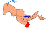
Boysun (Uzbek: Boysun, Russian: Байсун, romanized: Baysun) is a city in Surxondaryo Region, Uzbekistan and capital of Boysun District.[2] The population was 16,732 as of the 1989 census,[3] and 27,600 in 2016.[1]
Boysun | |
|---|---|
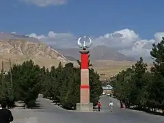
 View of Boysun | |
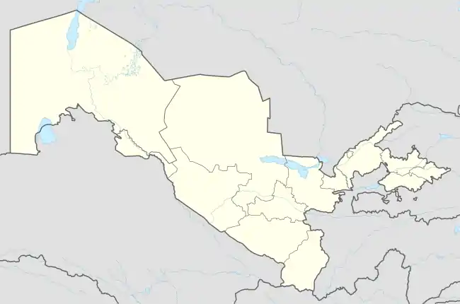
 Boysun Location in Uzbekistan | |
| Coordinates: 38°12′N 67°12′E | |
| Country | |
| Region | Surxondaryo Region |
| District | Boysun District |
| Elevation | 1,217 m (3,993 ft) |
| Population (2016)[1] | |
| • Total | 27,600 |
Thousands of years in the narrow mountain gorge, the merchant caravans have passed through Iron Gates. This region has been passed by the Armies of Alexander the Great, Genghis Khan, and Tamerlane. The Teshik-Tash caves contain remnants of the Neanderthal people. The nearby Kugitang Mountains nearby still contain wall paintings known as "magic bull hunting", dating from the Mesolite period.[4]
Boysun's citizens adorn their homes with colorful suzane (sticky covers), lightweight, sturdy, and cozy tapestries, and elegant decorations and springwear embellish their clothes and shoes. On tables and sculptured trunks near walls are painted ceramic dinnerware.[5]
Geography
Boysun lies in a valley running through a hilly region and overlooked by the Boysuntoq Ridge of the Gissar Range, which rises to 3,100 metres (10,200 ft) here and as even higher to the west. The landscape is dramatic but arid, and varies from grassy areas to exposed rock.
Climate
Boysun has a cool desert climate (Köppen climate classification BWk), with cool winters and hot summers. Rainfall is generally light and erratic. Autumn is the wettest season, while summers are very dry.
| Climate data for Boysun | |||||||||||||
|---|---|---|---|---|---|---|---|---|---|---|---|---|---|
| Month | Jan | Feb | Mar | Apr | May | Jun | Jul | Aug | Sep | Oct | Nov | Dec | Year |
| Daily mean °C (°F) | 1.3 (34.3) |
2.3 (36.1) |
7.2 (45.0) |
13.1 (55.6) |
17.9 (64.2) |
23.2 (73.8) |
25.2 (77.4) |
23.5 (74.3) |
18.4 (65.1) |
12.3 (54.1) |
7.6 (45.7) |
3.9 (39.0) |
13.0 (55.4) |
| Average precipitation mm (inches) | 13 (0.5) |
10 (0.4) |
19 (0.7) |
22 (0.9) |
14 (0.6) |
4 (0.2) |
4 (0.2) |
3 (0.1) |
3 (0.1) |
10 (0.4) |
10 (0.4) |
13 (0.5) |
125 (5) |
| Average relative humidity (%) | 77 | 73 | 67 | 57 | 49 | 47 | 48 | 51 | 54 | 59 | 69 | 77 | 61 |
| Mean monthly sunshine hours | 116.6 | 142.3 | 168.8 | 220.8 | 318.8 | 360.6 | 374.1 | 356.0 | 287.6 | 219.2 | 151.2 | 101.9 | 2,817.9 |
| Source: NOAA (1961-1990)[6] | |||||||||||||
Transportation
The main road through the town is Route P-105. This connects with the M39 to the west near Shorab, leading to Dehqonobod, Gʻuzor, Shahrisabz and Samarkand further north, and to Akkurgon and Termez further south. To the east, P-105 connects to Shoʻrchi and Qumqoʻrgʻon.
World Heritage Status
This site was added to the UNESCO World Heritage Tentative List on 18 January 2008 in the Mixed (Cultural and Natural) category.[7]
References
- Soliyev, A.S. Shaharlar geografiyasi [Geography of cities] (PDF) (in Uzbek). p. 145.
- "Classification system of territorial units of the Republic of Uzbekistan" (in Uzbek and Russian). The State Committee of the Republic of Uzbekistan on statistics. July 2020.
- Population census-1989
- "Boysun, Uzbekistan". Retrieved January 8, 2021.
- "Boysun". Retrieved June 22, 2021.
- "Climate Normals for Bajsun". National Oceanic and Atmospheric Administration. Retrieved 10 February 2013.
- "Boysun". UNESCO World Heritage Centre. Retrieved 10 February 2013.

.jpg.webp)