Bubak, Sindh
Bubak is a town and union council[3] in Sehwan taluka of Jamshoro District, Sindh.[4][5] It is located on the northeastern shore of Lake Manchar, 9 miles west of Sehwan.[4] Besides Sehwan, it is connected by road with Bhan and Talti.[4]
Bubak
Būbak | |
|---|---|
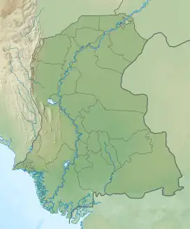 Bubak Location in Sindh 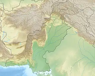 Bubak Bubak (Pakistan) | |
| Coordinates: 26.445423°N 67.721323°E[1] | |
| Country | Pakistan |
| Region | Sindh |
| District | Jamshoro |
| Taluka | Sehwan |
| Population (2017)[2] | |
| • Total | 5,563 |
| Time zone | UTC+5 (PST) |
| • Summer (DST) | UTC+6 (PDT) |
As of 2017, Bubak has a population of 5,563, in 1,152 households,[2] while the total population of the Bubak union council is 28,776.[3] It is the seat of a tappedar circle, which also includes the villages of Jaffarabad and Jaheja.[2]
Name
The name "Bubak" is alternately derived from its supposed Jamot founder or from a plant that grows near the town.[4] Historically, Bubak was also known as Bubakan.[6]
The trematode Paramonostomum bubaki is named after Bubak, as it was originally discovered in the waters of nearby Lake Manchar in 2006.[7]
History
During the reign of the Samma dynasty ruler Jam Nizamuddin II, aka Jam Nindo, the peasants of Bubak constructed a massive dam south of Lake Machar under the supervision of Darya Khan, the Jam's commander-in-chief.[8]
Under the Mughal Empire, Bubak (or Bubakan) was the seat of a pargana; its inhabitants were considered relatively recent converts to Islam.[9] Later, during the era of the Talpur dynasty, the madrasa at Bubak was one of the most prominent in Sindh.[6]
Bubak was made a municipality in July 1854.[4] It was hit hard by an outbreak of cholera in 1869.[4]
Around 1874, Bubak's population was estimated at 4,234 people, including 4,120 Hindus and 114 Muslims.[4] The Muslims mainly belonged to the Kori, Chaki, Jamot, and Machhi tribes, while the Hindus were mainly Brahmins and Lohanos.[4] The population was mainly employed in agriculture and trade.[4] At the time, Bubak was surrounded by a large moat which was intended to protect against inundation from the waters of Lake Manchar; such inundation had already claimed some of the best farmland outside the town, leading to the financial decline of the zamindars.[4] Bubak was then well known for its carpets and bhang, although it was not a significant commercial centre in its own right.[4] It had a government vernacular school, a police outpost with three officers, and a cattle pound at the time.[4]
References
- "Geonames Search". Do a radial search using these coordinates here.
- Population and household detail from block to tehsil level (Jamshoro District) (PDF). 2017. p. 18. Retrieved 25 December 2021.
- "Union Council wise Thematic Analysis". Department of Health, Government of Sindh. Retrieved 25 December 2021.
- Hughes, A.W. (1874). A Gazetteer of the Province of Sindh. London: George Bell and Sons. pp. 142, 725. Retrieved 25 December 2021.
- "List of Dehs in Sindh" (PDF). Sindh Zameen. Retrieved 25 December 2021.
- Siddiqui, Habibullah (1987). Education in Sind: Past and Present. Jamshoro: University of Sindh. p. 147. Retrieved 27 December 2021.
- Birmani, Nadir Ali; Dharejo, Ali Murtaza; Naz, Shagufta; Khan, Muhammad Munif; Shaikh, Abdul Munan (2013). "Paramonostomum bubaki n. sp. (Digenea: Notocotylidae) from the Black Coot, Fulica atra (Gruiformes: Rallidae), in South Central Pakistan" (PDF). International Scholarly Research Notices Zoology. 2013. Retrieved 27 December 2021.
- Naz, Humera (2020). "Sindh under the Mughals: Some Glimpses from Tarikh-i-Masumi and Mazhar-i-Shahjahani". Pakistan Perspectives. 24 (2): 15. Retrieved 27 December 2021.
- Khan, Ansar Zahid (1980). History and Culture of Sind: A Study of Socioeconomic Organization and Institutions During the 16th and 17th Centuries. Royal Book Company. pp. 234, 276. Retrieved 27 December 2021.