Talti, Sindh
Talti is a town and union council[3] in Sehwan taluka of Jamshoro District, Sindh.[4][5] It is located in the historical pargana of Baghban,[6] 8 miles north of Sehwan and 2 miles off the main road from Sehwan to Larkano.[4] It also has road connections with nearby Bhan and Bubak.[4] There is a dhandh near Talti that is used as a source of fishery.[4]
Talti | |
|---|---|
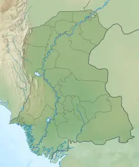 Talti Location in Sindh 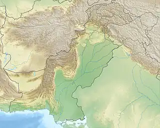 Talti Talti (Pakistan) | |
| Coordinates: 26.527191°N 67.811658°E[1] | |
| Country | Pakistan |
| Region | Sindh |
| District | Jamshoro |
| Taluka | Sehwan |
| Population (2017)[2] | |
| • Total | 6,716 |
| Time zone | UTC+5 (PST) |
| • Summer (DST) | UTC+6 (PDT) |
As of 2017, Talti has a population of 6,716, in 1,387 households,[2] while the total population of the Talti union council is 37,694.[3] It is the seat of a tappedar circle, which also includes the villages of Bilawalpur, Duridero Jatoi, and Jatoi.[2]
The Sufi saint Makhdoom Bilawal was born here in 1451.[6] Later, around 1520, Talti was the site of the battle where the Samma dynasty was decisively defeated by Shah Beg Arghun, who as a result of the battle became the uncontested ruler of Sindh.[4] In this battle, the Sammas were joined by Sehta and Sodha tribesmen in an alliance facilitated by Makhdoom Bilawal and other local religious leaders.[7] After the battle, Shah Beg encamped at Talti for three days.[7] He had Talti and its small fort razed, its crops destroyed, and its inhabitants massacred.[7]
Around 1874, Talti was described as a small town with an estimated population of about 900: about 250 were Muslims, mostly Khaskelis, and about 650 were Hindus, mostly Lohanos.[4] It had a small police station, a government vernacular school, and a dharamsala.[4] There was no significant industry in the town at the time apart from small-scale production of cloth and rugs.[4] Local trade consisted of ghee, grain, and oil, but there was no major long-distance trade.[4]
Less than 1 km east of Talti, by the road to Bubak, is the 18th-century dargah of the Muslim holy man Shahab Uddin Shah Bukhari.[8] The tomb is well-maintained by the locals and was significantly renovated in the 2000s or 10s, and new āina-kāri decoration was also added at the same time.[8]
The 1951 census recorded the village of Talti as having an estimated population of about 690, in about 350 houses.[9] It had a Sanitary Committee at that point.[9]
References
- "Geonames Search". Do a radial search using these coordinates here.
- Population and household detail from block to tehsil level (Jamshoro District) (PDF). 2017. p. 18. Retrieved 25 December 2021.
- "Union Council wise Thematic Analysis". Department of Health, Government of Sindh. Retrieved 25 December 2021.
- Hughes, A.W. (1874). A Gazetteer of the Province of Sindh. London: George Bell and Sons. pp. 29, 698, 709, 726, 730, 732, 807–8. Retrieved 25 December 2021.
- "List of Dehs in Sindh" (PDF). Sindh Zameen. Retrieved 25 December 2021.
- Kalhoro, Zulfiqar Ali (11 September 2020). "Heroic Saint of Baghban". The Friday Times. Retrieved 25 December 2021.
- Naz, Humera (2020). "Sindh under the Mughals: Some Glimpses from Tarikh-i-Masumi and Mazhar-i-Shahjahani". Pakistan Perspectives. 24 (2): 15. Retrieved 27 December 2021.
- Shah, Syed Shakir Ali (2016). "Archaeological Investigations in Manchar Concession Area (Area of Operation)" (PDF). Journal of Multidisciplinary Studies in Archaeology. 4: 790–1. Retrieved 27 December 2021.
- Census of Pakistan, 1951: Village List (PDF). p. 19 in section "Dadu District". Retrieved 31 December 2021.