California Historical Landmarks in San Francisco
List table of the properties and districts — listed on the California Historical Landmarks — within City and County of San Francisco, California.
- Note: Click the "Map of all coordinates" link to the right to view a Google map of all properties and districts with latitude and longitude coordinates in the table below.
Listings
| Image | [1] | Landmark name | Location | Neighborhood/Region | Summary |
|---|---|---|---|---|---|
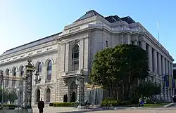 Birthplace of the United Nations, War Memorial Complex |
964 | Birthplace of the United Nations, War Memorial Complex | San Francisco War Memorial and Performing Arts Center 37°46′46″N 122°25′14″W |
Civic Center | |
 California Masonic Lodge No. 1 |
408 | California Masonic Lodge No. 1 | 728 Montgomery St. 37°47′45″N 122°24′12″W |
Jackson Square | |
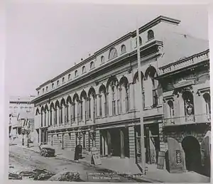 California Theatre |
86 | California Theatre | 430 Bush St, between Kearny and Grant 37°47′27″N 122°24′17″W |
Financial District | |
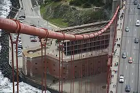 Castillo De San Joaquín |
82 | Castillo De San Joaquín | SE corner of Fort Wall, Fort Point, San Francisco (below Golden Gate Bridge) 37°48′38″N 122°28′36″W |
Presidio | |
.JPG.webp) City of Paris building |
876 | City of Paris building | SE corner of Geary and Stockton Sts. 37°47′15″N 122°24′24″W |
Union Square | |
_VIEW_OF_CLAY_STREET_SHOWING_THE_WIRE_RAILROAD_pg191.jpg.webp) Eastern Terminus of Clay Street Hill Railroad |
500 | Eastern Terminus of Clay Street Hill Railroad | Portsmouth Square 37°47′41″N 122°24′18″W |
Chinatown | |
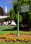
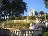
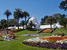 Conservatory of Flowers |
841 | Conservatory of Flowers | 100 John F Kennedy Dr 37°46′20″N 122°27′36″W |
Golden Gate Park | |
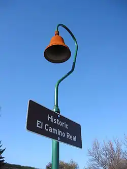 El Camino Real |
784 | El Camino Real | 310-336 Dolores St 37°45′51″N 122°25′35″W |
Mission District | The same plaque is located in San Diego |
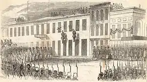
.jpg.webp) Site of the Jenny Lind Theatre and San Francisco City Hall |
192 | Site of the Jenny Lind Theatre and San Francisco City Hall | 750 Kearny St at Merchant 37°47′42″N 122°24′17″W |
Portsmouth Square | |
 Entrance of the San Carlos into San Francisco Bay |
236 | Entrance of the San Carlos into San Francisco Bay | Aquatic Park, NW corner of Beach and Larkin Sts 37°48′24″N 122°25′22″W |
Fisherman's Wharf | |
 Farnsworth's Green Street Lab |
941 | Farnsworth's Green Street Lab | NW corner of Sansome and Green Sts. 37°48′01″N 122°24′10″W |
North Beach | |
Upload Photo |
1002 | First dynamite factory in the United States | Glen Canyon Park 37°44′20″N 122°26′31″W |
Diamond Heights/Glen Park | The location of a subsequent Giant Powder Company factory in Point Pinole is listed as California Historical Landmark number 1002-1. |
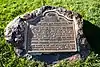
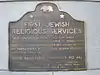 First Jewish religious services in San Francisco |
462 | First Jewish religious services in San Francisco | 735 Montgomery between Washington and Jackson 37°47′46″N 122°24′13″W |
Jackson Square | |
.jpg.webp) First Public School in California |
587 | First Public School in California | Portsmouth Plaza 37°47′41″N 122°24′20″W |
Chinatown | |
.jpg.webp) First San Francisco Mint building |
87 | First San Francisco Mint building | 608-610 Commercial St. 37°47′39″N 122°24′12″W |
Financial District | |
 Fort Gunnybags |
90 | Fort Gunnybags | S side of Sacramento between Davis and Front 37°47′40″N 122°23′54″W |
Financial District | |
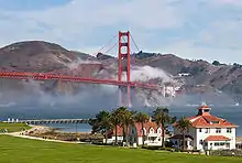
 Golden Gate Bridge |
974 | Golden Gate Bridge | Observation area, N end of bridge 37°49′56″N 122°28′48″W |
Presidio | |
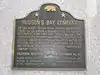 Hudson's Bay Company headquarters |
819 | Hudson's Bay Company headquarters | 505 Montgomery 37°47′39″N 122°24′12″W |
Financial District | |
 Juana Briones, Pioneer settler of Yerba Buena |
1024 | Juana Briones, Pioneer settler of Yerba Buena | Washington Square 37°48′04″N 122°24′34″W |
North Beach | |
 Landing place of Captain J. Montgomery |
81 | Landing place of Captain J. Montgomery | 552 Montgomery St. 37°47′41″N 122°24′19″W |
Financial District | |
 Laurel Hill Cemetery |
760 | Laurel Hill Cemetery | 3333 California St. |
Laurel Heights | |
 Long Wharf |
328 | Long Wharf | Leidesdorff and Commercial Sts. |
Financial District | |
 Lucas, Turner & Co. Bank |
453 | Lucas, Turner & Co. Bank | NE corner of Montgomery and Jackson |
Jackson Square | |
 Mark Hopkins Institute of Art |
754 | Mark Hopkins Institute of Art | California at Mason |
Nob Hill | |
.jpg.webp) Liberty Bell Slot Machine |
937 | Liberty Bell Slot Machine | Traffic island on N side of Market St between Bush and Battery Sts. 37°47′28″N 122°23′58″W |
Financial District | |
Upload Photo |
459 | Mellus and Howard | 555 Montgomery |
Financial District | |
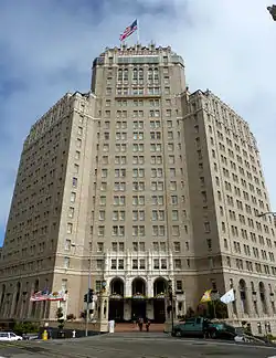
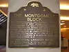 Montgomery Block |
80 | Montgomery Block | 600 Montgomery St. 37°47′42″N 122°24′11″W |
Financial District | |
.jpg.webp) Niantic Hotel |
88 | Niantic Hotel | First floor of Two Transamerica Center 37°47′42″N 122°24′08″W |
Financial District | |
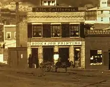 Office of the California Star newspaper |
85 | Office of the California Star newspaper | 743 Washington St |
Chinatown | |
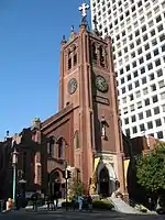 Old Saint Mary's Cathedral |
810 | Old Saint Mary's Cathedral | 660 California St. 37°47′34″N 122°24′21″W |
Nob Hill | |
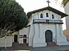 Original Mission Dolores and Dolores Lagoon |
327 | Original Mission Dolores and Dolores Lagoon | Camp and Albion Sts. 37°45′51″N 122°25′22″W |
Mission District | |
 Original site of the Bancroft Library |
791 | Original site of the Bancroft Library | 1538 Valencia St. |
Mission District | |
 Original site of St. Mary's College |
772 | Original site of St. Mary's College | Mission and College Sts. |
Bernal Heights | |
Upload Photo |
1010 | Original site of the Third Baptist Church | Grant Ave and Greenwich 37°48′09″N 122°24′28″W |
Telegraph Hill | |
Upload Photo |
89 | Parrott Granite Block | California and Montgomery |
Financial District | |
Portsmouth Plaza |
119 | Portsmouth Plaza | Portsmouth Square |
Chinatown | |
 Presidio of San Francisco |
79 | Presidio of San Francisco | Funston Ave. and Lincoln Blvd. 37°47′53″N 122°27′57″W |
Presidio | |
.jpg.webp) Rincon Hill |
84 | Rincon Hill | Rincon and Bryant Sts. |
Rincon Hill | |
San Francisco Mint |
875 | San Francisco Mint | Plaque in sidewalk, NE corner of Bush and Market Sts. 37°46′58″N 122°24′21″W |
Lower Nob Hill | |
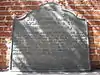
 Sarcophagus of Thomas Starr King |
691 | Sarcophagus of Thomas Starr King | First Unitarian Church (San Francisco) |
Western Addition | |
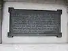
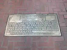 Tablet of San Francisco Bay |
83 | Tablet of San Francisco Bay | Plaque in sidewalk, NE corner of Bush and Market Sts. 37°47′29″N 122°23′57″W |
Financial District | Tablet in downtown San Francisco marking the site of the original shoreline. |
.jpg.webp) Site of the first California State fair |
861 | Site of the first California State fair | 269 Bush 37°47′27″N 122°24′05″W |
Financial District | |
 Telegraph Hill |
91 | Telegraph Hill | 37°48′09″N 122°24′21″W |
Telegraph Hill | |
Treasure Island |
987 | Treasure Island | 37°49′N 122°22′W |
Treasure Island | |
 Union Square |
623 | Union Square | Geary and Powell 37°47′17″N 122°24′27″W |
Union Square | |
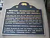 Western business headquarters of Russell, Majors and Waddell (Pony Express) |
696 | Western business headquarters of Russell, Majors and Waddell (Pony Express) | 601 Montgomery St. 37°47′42″N 122°24′12″W |
Financial District | |
.jpg.webp) What Cheer House |
650 | What Cheer House | SW corner of Sacramento and Leidesdorff Sts. 37°47′38″N 122°24′08″W |
Financial District | |
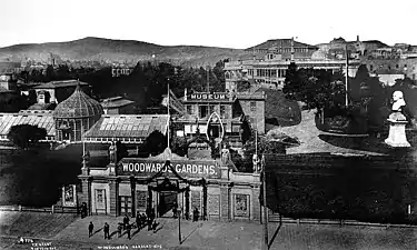 Woodward's Gardens |
454 | Woodward's Gardens | SW corner of Mission and Duboce Sts. |
Mission District |
See also
Wikimedia Commons has media related to California Historical Landmarks in San Francisco.
References
- "California Historical Landmarks By County". Ohp.parks.ca.gov. Retrieved 2019-04-03.
This article is issued from Wikipedia. The text is licensed under Creative Commons - Attribution - Sharealike. Additional terms may apply for the media files.