Canoa, Cuba
Canoa or La Canoa is a small town in Villa Clara Province, Cuba, in the vicinity of the Sagua la Chica River. Nearby towns include Vega Alta, La Levisa, Chicharón, Paso Real, Santa Ana, La Doncella, and La Catalina.[3] “Canoa” translates to “Canoe” in Spanish and shares the name with Arroyo La Canoa, a stream north of Canoa.
Canoa | |
|---|---|
Hamlet [1] | |
| Nickname: La Canoa | |
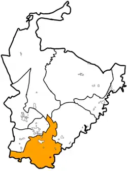
 Canoa (red) in Encrucijada | |
.svg.png.webp) Canoa Location in Cuba  Canoa Canoa (Villa Clara Province) _location_map.png.webp) Canoa Canoa (Encrucijada) | |
| Coordinates: 22°33′29″N 79°49′57″W | |
| Country | Cuba |
| Province | Villa Clara |
| Municipality | Encrucijada |
| Ward | Constancia |
| Population (2013)[2] | |
| • Total | 27 |
History
The Cuban War of Independence brought great concerns in Camajuaní which is in the border of Canoa. On October 30, 1895. Leoncio Vidal, a Cuban revolutionary with his troops attacked Fort La Vigía in Hills of Santa Fe nearby the Camajuaní, Santa Clara border and he put orders to attack the Canoa Bridge on the Sagua la Chica River and the Tuinicu bridge.[4]
In 1933 Cuban revolutionary Juan Francisco Aro Fernandez was born in Canoa, Cuba.
Transportation
Canoa is on a railine starting in Santa Clara, going to Crucero Margot, to Luis Arcos Bergnes, Vega Alta, Canoa, Tuinicu, Constancia, Encrucijada, Mata, El Vaquerito, Aguada la Piedra, Cifuentes, San Diego del Valle, Conyedo, and finally back to Santa Clara. [5][6]
Culture
Jesús Menéndez public library has three video rooms located in Canoa, Progreso, and Castaño for the hamlets cultures. [7]
References
- "Canoa (Encrucijada) Street Guide and Map".
- Lisbet Morales Martínez, Lisbet; Dr. Leonid, E. Hernández Sánchez; Pereira Leonard, Yainalis (2013). "LA INFLUENCIA DE LA INDUSTRIA AZUCARERA EN LAS CARACTERÍSTICAS SOCIOCULTURALES DE LA COMUNIDAD DE ENCRUCIJADA" (PDF). Santa Clara, Cuba: dspace (Institutional Repository of the Central University "Marta Abreu" of Las Villas). p. 46.
- "List of Cities near Canoa in Villa Clara, Cuba". www.gomapper.com. Retrieved 2022-06-28.
- Nacional, Equipo de Producción. "Portal del Ciudadano en Camajuaní - Un poco de historia". www.soycamajuani.gob.cu (in European Spanish). Retrieved 2022-07-21.
- lezumbalaberenjena (2017-11-09), Composed road map from a tour guide (1980's), retrieved 2023-04-12
- "Road guides of Cuba" (PDF). 2019.
- Lisbet Morales Martínez, Lisbet; Dr. Leonid, E. Hernández Sánchez; Pereira Leonard, Yainalis (2013). "LA INFLUENCIA DE LA INDUSTRIA AZUCARERA EN LAS CARACTERÍSTICAS SOCIOCULTURALES DE LA COMUNIDAD DE ENCRUCIJADA" (PDF). Santa Clara, Cuba: dspace (Institutional Repository of the Central University "Marta Abreu" of Las Villas). p. 48.