Cartwright, Oklahoma
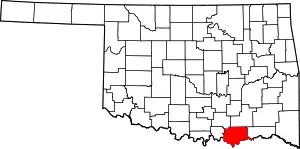
Cartwright is an unincorporated rural community and census-designated place in Bryan County, Oklahoma, United States. As of the 2010 census it had a population of 609.[2] The post office opened April 25, 1940, and it is one of the newest communities in Bryan County. The ZIP code is 74731.
Cartwright, Oklahoma | |
|---|---|
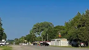
Top to bottom, left to right: Viewing east on Oklahoma State Highway 91 in Cartwright, the city's United States Postal Service post office, and the Texoma Inn | |
| Coordinates: 33°51′20″N 96°33′40″W | |
| Country | |
| State | |
| County | Bryan |
| Area | |
| • Total | 2.371 sq mi (6.14 km2) |
| • Land | 2.37 sq mi (6.1 km2) |
| • Water | 0.01 sq mi (0.03 km2) |
| Elevation | 666 ft (203 m) |
| Population (2010) | |
| • Total | 609 |
| Time zone | UTC-6 (Central (CST)) |
| • Summer (DST) | UTC-5 (CDT) |
| ZIP code | 74731 |
| Area code | 580 |
| GNIS feature ID | 2629910[1] |
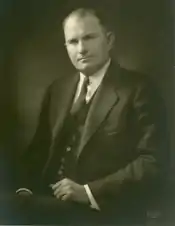
It is named for Congressman Wilburn Cartwright. Cartwright was established because of the construction of Denison Dam when a community of shelters for workmen was erected.

Overview
In Cartwright for the years 2010–2014, the median household income is $27,212 and the median house value is $101,500. The median year that a house in Cartwright was built is 1983. Cartwright's population density is 267.77 inhabitants per square mile (103.39/km2); whites make up 78.49% of the total population. The average temperature of Cartwright is 62.50 °F (16.94 °C).[3]
References
- U.S. Geological Survey Geographic Names Information System: Cartwright, Oklahoma
- "Geographic Identifiers: 2010 Demographic Profile Data (G001): Cartwright CDP, Oklahoma". U.S. Census Bureau, American Factfinder. Archived from the original on February 12, 2020. Retrieved February 24, 2014.
- "USA.com Basic Information about Cartwright, Oklahoma". USA.com. Retrieved January 24, 2018.
Further reading
- Shirk, George H. Oklahoma Place Names. Norman: University of Oklahoma Press, 1987. ISBN 0-8061-2028-2.


