Chaource
Chaource (French pronunciation: [ʃa.uʁs] ⓘ) is a commune in the Aube department in north-central France.
Chaource | |
|---|---|
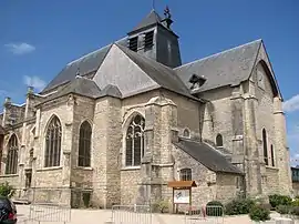 The church in Chaource | |
.svg.png.webp) Coat of arms | |
Location of Chaource | |
 Chaource 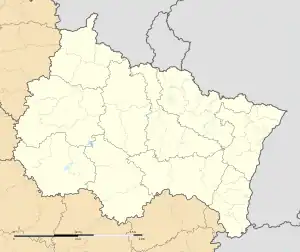 Chaource | |
| Coordinates: 48°03′34″N 4°08′20″E | |
| Country | France |
| Region | Grand Est |
| Department | Aube |
| Arrondissement | Troyes |
| Canton | Les Riceys |
| Government | |
| • Mayor (2020–2026) | Florent Hurpeau[1] |
| Area 1 | 31.06 km2 (11.99 sq mi) |
| Population | 1,017 |
| • Density | 33/km2 (85/sq mi) |
| Time zone | UTC+01:00 (CET) |
| • Summer (DST) | UTC+02:00 (CEST) |
| INSEE/Postal code | 10080 /10210 |
| Elevation | 134–233 m (440–764 ft) (avg. 150 m or 490 ft) |
| Website | www.chaource.fr |
| 1 French Land Register data, which excludes lakes, ponds, glaciers > 1 km2 (0.386 sq mi or 247 acres) and river estuaries. | |
A cheese is named after this town. See Chaource cheese.
In the Chaource parish church there is a sculpture by The Maitre de Chaource.
Population
|
|
See also
References
- "Répertoire national des élus: les maires" (in French). data.gouv.fr, Plateforme ouverte des données publiques françaises. 13 September 2022.
- "Populations légales 2020". The National Institute of Statistics and Economic Studies. 29 December 2022.
External links
Wikimedia Commons has media related to Chaource.
- Chaource tourism website
- Maitre de Chaource. List of major works of this sculptor
This article is issued from Wikipedia. The text is licensed under Creative Commons - Attribution - Sharealike. Additional terms may apply for the media files.