Saint-André-les-Vergers
Saint-André-les-Vergers (French pronunciation: [sɛ̃.t‿ɑ̃dʁe le vɛʁʒe]) is a commune in the Aube department in north-central France.
Saint-André-les-Vergers | |
|---|---|
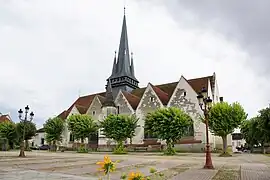 The church in Saint-André-les-Vergers | |
 Coat of arms | |
Location of Saint-André-les-Vergers | |
 Saint-André-les-Vergers 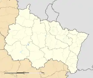 Saint-André-les-Vergers | |
| Coordinates: 48°16′50″N 4°03′17″E | |
| Country | France |
| Region | Grand Est |
| Department | Aube |
| Arrondissement | Troyes |
| Canton | Saint-André-les-Vergers |
| Intercommunality | CA Troyes Champagne Métropole |
| Government | |
| • Mayor (2020–2026) | Catherine Ledouble[1] |
| Area 1 | 5.86 km2 (2.26 sq mi) |
| Population | 12,701 |
| • Density | 2,200/km2 (5,600/sq mi) |
| Time zone | UTC+01:00 (CET) |
| • Summer (DST) | UTC+02:00 (CEST) |
| INSEE/Postal code | 10333 /10120 |
| Elevation | 106–129 m (348–423 ft) (avg. 113 m or 371 ft) |
| 1 French Land Register data, which excludes lakes, ponds, glaciers > 1 km2 (0.386 sq mi or 247 acres) and river estuaries. | |
Population
| Year | Pop. | ±% p.a. |
|---|---|---|
| 1968 | 7,660 | — |
| 1975 | 10,370 | +4.42% |
| 1982 | 10,681 | +0.42% |
| 1990 | 11,329 | +0.74% |
| 1999 | 11,125 | −0.20% |
| 2007 | 11,088 | −0.04% |
| 2012 | 11,528 | +0.78% |
| 2017 | 12,311 | +1.32% |
| Source: INSEE[3] | ||
See also
References
- "Répertoire national des élus: les maires" (in French). data.gouv.fr, Plateforme ouverte des données publiques françaises. 13 September 2022.
- "Populations légales 2020". The National Institute of Statistics and Economic Studies. 29 December 2022.
- Population en historique depuis 1968, INSEE
Wikimedia Commons has media related to Saint-André-les-Vergers.
This article is issued from Wikipedia. The text is licensed under Creative Commons - Attribution - Sharealike. Additional terms may apply for the media files.