Charly, Cher
Charly (Engl) is a commune in the Cher department in the Centre-Val de Loire region of France.
Charly | |
|---|---|
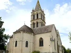 The church of Our Lady, in Charly | |
Location of Charly | |
 Charly  Charly | |
| Coordinates: 46°54′00″N 2°44′59″E | |
| Country | France |
| Region | Centre-Val de Loire |
| Department | Cher |
| Arrondissement | Saint-Amand-Montrond |
| Canton | La Guerche-sur-l'Aubois |
| Intercommunality | Pays de Nérondes |
| Government | |
| • Mayor (2020–2026) | Dominique Régnault[1] |
| Area 1 | 25.66 km2 (9.91 sq mi) |
| Population | 246 |
| • Density | 9.6/km2 (25/sq mi) |
| Time zone | UTC+01:00 (CET) |
| • Summer (DST) | UTC+02:00 (CEST) |
| INSEE/Postal code | 18054 /18350 |
| Elevation | 169–256 m (554–840 ft) (avg. 190 m or 620 ft) |
| 1 French Land Register data, which excludes lakes, ponds, glaciers > 1 km2 (0.386 sq mi or 247 acres) and river estuaries. | |
Geography
A farming area comprising a village and a couple of hamlets situated some 20 miles (32 km) southeast of Bourges at the junction of the N76 with the D91 and the D6 roads. Ancient quarries here provided the stone for the cathedral of Bourges.
The river Airain forms most of the commune's northwestern boundary.
Population
| Year | Pop. | ±% |
|---|---|---|
| 1962 | 329 | — |
| 1968 | 364 | +10.6% |
| 1975 | 273 | −25.0% |
| 1982 | 272 | −0.4% |
| 1990 | 252 | −7.4% |
| 1999 | 257 | +2.0% |
| 2008 | 226 | −12.1% |
Sights
- The church of Notre-Dame, dating from the twelfth century.
- Some ancient houses.
- Remains of a Benedictine abbey.
- Two watermills
See also
References
- "Répertoire national des élus: les maires". data.gouv.fr, Plateforme ouverte des données publiques françaises (in French). 2 December 2020.
- "Populations légales 2020". The National Institute of Statistics and Economic Studies. 29 December 2022.
Wikimedia Commons has media related to Charly (Cher).
This article is issued from Wikipedia. The text is licensed under Creative Commons - Attribution - Sharealike. Additional terms may apply for the media files.