Chipstead, Surrey
Chipstead is a predominantly commuter village in north-east Surrey, England, that has been a small ecclesiastical parish since the Domesday Survey of 1086. Its rolling landscape meant that Chipstead's development was late and restricted compared to parishes of comparable distance from London. Formerly and formally including Hooley and Netherne-on-the-Hill, on census day, 1831 Chipstead had 66 homes. Today, excluding those two parts, the village has 1,212 homes spread across the slopes and crests of a northern section of the North Downs. Parts of the village are in or adjoin the Surrey Hills AONB.
| Chipstead | |
|---|---|
 The upper Chipstead Valley, Chipstead from Banstead Wood. | |
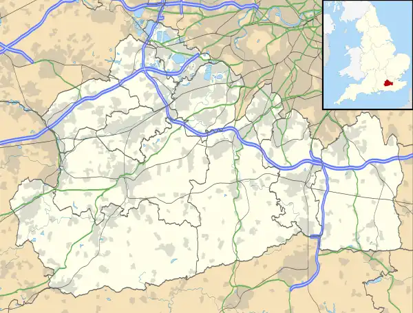
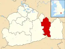
 Chipstead Location within Surrey | |
| Area | 9.6 km2 (3.7 sq mi) |
| Population | 3,136 (2011 census)[1] |
| • Density | 327/km2 (850/sq mi) |
| OS grid reference | TQ278569 |
| District | |
| Shire county | |
| Region | |
| Country | England |
| Sovereign state | United Kingdom |
| Post town | Coulsdon |
| Postcode district | CR5 |
| Dialling code | 01737 |
| Police | Surrey |
| Fire | Surrey |
| Ambulance | South East Coast |
| UK Parliament | |
Geography
The land within and to all sides forms curved valleys of downland. Beyond Chipstead's boundaries are the villages of Woodmansterne and slightly more distant Coulsdon, Banstead, Hooley and Kingswood. Woodmansterne is in two parts, one of which is in Greater London (as is Coulsdon) – the nearest, the Surrey part is the western follow-on to the built-up valley street of Chipstead. Housing and parks span the east slopes of a narrow valley known as Chipstead Valley or Chipstead Bottom which is a dry valley. This has some subterranean flows common in the chalk hills of the North Downs, a long hill range south of Woking, Croydon and the Thames Estuary.
Conservation
The residents of Chipstead have prevented installation of street lighting, particularly in the southern parts of the village. Two residents associations exist, both founded in the 20th century. One caters broadly for all parts from Chipstead Valley to Hooley, while the second concentrates on architectural beauty and views from public places in areas where these may be at risk. Identified as among Chipstead's characteristics are its mature trees, hedgerows, rural wildlife and dark skies at night:
Villagers value the mature trees and hedgerows, the open fields and farmland, the narrow, winding lanes and the absence of street lighting
— Chipstead Residents Association[2]
Chipstead Downs is a Site of Special Scientific Interest (SSSI). To the north-west of the village is Banstead Heath, a rolling plateau of open common land. This area is maintained by the Banstead Commons Conservators.
Today Chipstead does not have a clearly defined village centre; instead there are several small areas of economic activity in a largely residential area.
The village is home to many societies, some of which are linked to the church. Another focal point of the village is a small parade of shops, near to the railway station.
History
The village lay within the Reigate hundred.
Chipstead appears in Domesday Book as Tepestede. It was held by William de Wateville. Its Domesday assets were: 3 hides; 7 ploughs, 1 mill worth £1, woodland worth 5 hogs. It rendered £8.[3]
| Census year | population | homes (where known) |
|---|---|---|
| 1801 | 347 | |
| 1811 | 403 | |
| 1821 | 440 | |
| 1831 | 522 | 61 |
| 1841 | 666 | 81 |
| 1851 | 505 | 95[4] |
| 1861 | 541 | 110 |
| 1881 | 644 | 137 |
| 1891 | 688 | 142 |
| 1901 | 640 | 157 |
| 1911 | 876 | |
| 1921 | 992 | 215 |
| 1931 | 1,513 | 392 |
| 1951 | 1,548 | 433[5][6] |
The Grade I listed church of St Margaret is in Hooley, the official hamlet of the village, with somewhat isolated geography and its own article. It was restored in 1827 when its patron was the Jolliffe family of Chipstead Court keeping its 12th century arch and foundations.[7][8] The school in the Victorian era here was endowed by Mary Stephens in 1746 with land producing £70 per annum. Sir Edward Banks (builder) enterprising building contractor for public works, was in 1835 buried in the churchyard – his business partner and daughter's husband being the patrons of the church and owners of Chipstead Court since 1788.[7][9][10]
From 1894 until 1934 Chipstead was part of Reigate Rural District.
Demography
The current three-member electoral ward Chipstead, Hooley and Woodmansterne had a population of 6,912 as at the United Kingdom 2011 Census.[11]
The census areas which Chipstead occupied were drawn as Reigate and Banstead 004C and 004D.[12] As such, Chipstead has 7.4% of the borough's area and has 2.3% of borough's population. Less than a third of the borough's own proportion of dwelling types, 8% of Chipstead homes were flats or apartments. In total 380 Chipstead residents, 24% of the population in 2011, were retired. Further common comparators for places in the United Kingdom are as shown below.
| Measure | Chipstead | Wider borough – Reigate & Banstead |
|---|---|---|
| Detached | 66% | 28% |
| Semi-detached | 18% | 29% |
| Terraced | 8% | 17% |
| Flats/apartments | 8% | 25% |
| Caravan or other mobile or temporary Structures | none | 0.6% |
| Shared Dwellings | none | 0.1% |
| Total dwellings | 1,212 | 57,184 |
| Area (km²) | 9.6 | 129.13 |
| % of population claiming income support | 1.6% | 12% |
| Population | 3,136 | 137,835 |
| of which retired | 24.1% | 8.9% |
Sport and leisure
Within the vicinity of Chipstead, there are several sports clubs, many taking the Chipstead name.
- Chipstead F.C. a Non-League football club has a minor claim to fame as some of Footballers' Wives was filmed here.
- Chipstead Rugby Football Club. They play in Surrey League 1 and were founded in 1959.[13]
Transport
Chipstead railway station is on the Tattenham Corner Line.
There are no bus services through the village – route 166, run by Arriva London for London Buses, passes its suburban northern edge to serve neighbouring Woodmansterne. Route 405 passes through Hooley, a short walk from the church. Other services are at Banstead and Coulsdon.
Notable persons
- Actress June Brown lived in Chipstead.
- The poet Catherine Maria Fanshawe (1765–1834) was born at Shabden in Chipstead.[14]
- Professional golfer Charles Mayo lived there in 1906.[15]
- Former footballer Danny Murphy and his actress wife Joanna Taylor are residents of Chipstead.
- Singer-songwriter David Wiffen spent his early childhood in Chipstead.
- Mark Serwotka, General Secretary of the Public and Commercial Services Union, lives in Chipstead.
References
- Key Statistics: Population; Quick Statistics: Economic indicators. (2011 census and 2001 census) Retrieved 27 February 2015.
- extract from 'The Village of Chipstead Chipstead Residents Association. Accessed 20 March 2015.
- Surrey Domesday Book Archived 15 July 2007 at the Wayback Machine
- "Census of England and Wales for the Year 1861: population tables"
- "Chipstead Houses" 'Vision of Britain' The University of Portsmouth and Others. Accessed 20 March 2015
- "Chipstead Population" 'Vision of Britain' as above.
- 'Chinley – Chiswick', in A Topographical Dictionary of England, ed. Samuel Lewis (London, 1848), pp. 599–603 http://www.british-history.ac.uk/topographical-dict/england/pp599-603 [accessed 20 March 2015].
- Historic England. "Details from listed building database (1029041)". National Heritage List for England. Retrieved 20 March 2015.
- Historic England. "Details from listed building database (1029042)". National Heritage List for England. Retrieved 20 March 2015. Banks Tomb, Hooley, Chipstead, Surrey.
- 'Parishes: Chipstead', in A History of the County of Surrey: Volume 3, ed. H E Malden (London, 1911), pp. 189–196 Available online at British History (The University of Portsmouth and Others) Accessed 20 March 2015.
- Census data
- Neighbourhood.gov.uk Archived 6 January 2009 at the Wayback Machine Office for National Statistics. Accessed 20 March 2015. Note: exact map not linkable as resolution incorporated into URL and site constantly updated – search Map Viewer: Reigate and Banstead.
- Chipstead RFC
- ODNB Retrieved 4 September 2018.
- "Golf – Professional Golfers' Association". Edinburgh Evening News. 5 July 1906. Retrieved 4 July 2015 – via British Newspaper Archive.
External links
![]() Media related to Chipstead, Surrey at Wikimedia Commons
Media related to Chipstead, Surrey at Wikimedia Commons
- Surrey County Council. "Chipstead". Exploring Surrey's Past. Retrieved 31 May 2017.
