Chisago County, Minnesota
Chisago County (/ʃɪˈsɑːɡoʊ/ shi-SAH-goh)[2] is a county in the east-central part of the U.S. state of Minnesota. The county covers an area of 442 square miles (1,140 square kilometers) and, as of the 2020 Census, had a population of 56,621 people. It is part of the Minneapolis-St. Paul-Bloomington Metropolitan Statistical Area.
Chisago County | |
|---|---|
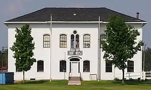 Old Chisago County Courthouse originally in Center City, Minnesota, moved in 1990 to Almelund, Minnesota. | |
 Location within the U.S. state of Minnesota | |
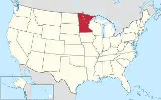 Minnesota's location within the U.S. | |
| Coordinates: 45°30′09″N 92°54′30″W | |
| Country | |
| State | |
| Founded | September 1, 1851[1] |
| Named for | Chisago Lake |
| Seat | Center City |
| Largest city | North Branch |
| Area | |
| • Total | 442 sq mi (1,140 km2) |
| • Land | 415 sq mi (1,070 km2) |
| • Water | 28 sq mi (70 km2) 6.2% |
| Population (2020) | |
| • Total | 56,621 |
| • Estimate (2022) | 57,988 |
| • Density | 136.4/sq mi (52.7/km2) |
| Time zone | UTC−6 (Central) |
| • Summer (DST) | UTC−5 (CDT) |
| Congressional district | 8th |
| Website | www |
The county's largest city is North Branch. Within Chisago County is the Chisago Lakes area, which includes the combined areas of Shafer, Chisago City, Lindström, and Center City. Center City is the county seat.[3]
The county has a diverse economy, including manufacturing, agriculture, and tourism.[4]
History
Early history
Before the arrival of European settlers, the area that is now Chisago County was home to the Dakota and Ojibwe tribes. The Dakota lived in the southern part of the county and the Ojibwe in the northern part.[5]
In the late 18th and early 19th centuries, French fur traders who traveled south from Lake Superior established trading posts along the river, extending as far south as Taylors Falls.
European Settlement
The first European settlers arrived in the Chisago County area in the early 1800s. Most of them were of Swedish descent, and they came in search of land and new opportunities. They established small farms and communities throughout the county, and the first church organization in the county was that of the Swedish Evangelical-Lutheran tradition.
In the mid-1800s, the area that is now Chisago County was part of the Minnesota Territory, and it was not officially established as a county until 1851.[6] It took its name from the Chisago Lake.[7] In its aboriginal form it was "Ki-chi-saga", from two Ojibwe words: "kichi" (large) and "saga" (fair or lovely).[8]
The county seat was originally in Taylors Falls, but was relocated to Chisago City in 1865. It took three more years before the legislature approved this relocation and voters approved it in a referendum. The move was later challenged in the courts on allegations of election fraud, resulting in a two-year delay before the state Supreme Court validated the results.
Economic growth
Chisago County's early economy was based on farming, logging, and mining. The county was rich in natural resources, and its forests and mines attracted many settlers to the area. As the county grew, it became a hub of commerce and trade, with many businesses and industries establishing themselves in the area. Records of early businesses in Chisago County are recorded in Lindströmsjö.[9]
In the late 1800s and early 1900s, the county's economy shifted toward manufacturing and industry. The county was home to many factories and mills, including sawmills, flour mills, and paper mills. These industries helped fuel the county's growth and prosperity, and they remain an important part of the county's economy.[9]
Modern era
Today, Chisago County has a diverse economy. It is home to several manufacturing companies, including the Anderson Corporation, a major producer of windows and doors.[10] Agriculture is also an essential part of the local economy, with crops such as corn, soybeans, and wheat grown in the county.[11] Tourism is also a significant industry in the county, with visitors drawn to the Chisago Lakes area's recreational opportunities.[3]
The county has retained and continues to celebrate much of its Swedish heritage.[12]
Geography
Chisago County lies on Minnesota's eastern border, abutting the western border of Wisconsin (across the Saint Croix River). The Saint Croix flows south-southeast along the county's eastern border. The Sunrise River flows north through the county's central part, collecting the waters of the North Branch Sunrise River and Hay Creek before discharging into the St. Croix at the county's eastern boundary. The county terrain consists of rolling hills, devoted to agriculture.[13] The terrain slopes to the south and east, with its highest point near the northwest corner, at 1,017 ft (310 m) ASL.[14] The county has an area of 442 square miles (1,140 km2), of which 415 square miles (1,070 km2) is land and 28 square miles (73 km2) (6.2%) is water.[15]
Major highways
Adjacent counties
- Pine County - north
- Burnett County, Wisconsin - northeast
- Polk County, Wisconsin - east
- Washington County - south
- Anoka County - southwest
- Isanti County - west
- Kanabec County - northwest
Protected areas
- Fish Lake County Park
- Franconia Bluffs Scientific and Natural Area
- Interstate State Park
- Lawrence Creek Scientific and Natural Area
- Ojiketa Regional Park
- Saint Croix National Scenic Riverway (part)
- Wild River State Park
Climate and weather
| Center City, Minnesota | ||||||||||||||||||||||||||||||||||||||||||||||||||||||||||||
|---|---|---|---|---|---|---|---|---|---|---|---|---|---|---|---|---|---|---|---|---|---|---|---|---|---|---|---|---|---|---|---|---|---|---|---|---|---|---|---|---|---|---|---|---|---|---|---|---|---|---|---|---|---|---|---|---|---|---|---|---|
| Climate chart (explanation) | ||||||||||||||||||||||||||||||||||||||||||||||||||||||||||||
| ||||||||||||||||||||||||||||||||||||||||||||||||||||||||||||
| ||||||||||||||||||||||||||||||||||||||||||||||||||||||||||||
Chisago County has a humid continental climate (Köppen climate classification Dfb) with long, cold winters and warm summers. The average high temperature in the summer is around 80 °F (27 °C), while the average low temperature in the winter is around 5 °F (−15 °C).
A record low of −38 °F (−39 °C) was recorded in January 1977 and a record high of 104 °F (40 °C) was recorded in July 1988.[16]
The county's location in the Upper Midwest region of the United States exposes it to a wide range of weather patterns, including severe thunderstorms, tornadoes, and blizzards. The county experiences moderate precipitation throughout the year, with an average annual rainfall of 30 inches (760 mm) and an average annual snowfall of 47 inches (1,200 mm). Spring is the most active season for severe weather, with thunderstorms and tornadoes common. Winter storms are common during the winter, with heavy snowfall and blizzards.
Chisago County has many lakes and wetlands, which significantly affect its weather and climate. It has over 100 lakes, the largest being North and South Center Lakes, Green Lake, and Chisago Lake. The lakes and wetlands moderate temperatures by absorbing heat during the summer and releasing it during the winter.
Demographics
| Census | Pop. | Note | %± |
|---|---|---|---|
| 1860 | 1,743 | — | |
| 1870 | 4,358 | 150.0% | |
| 1880 | 7,982 | 83.2% | |
| 1890 | 10,359 | 29.8% | |
| 1900 | 13,248 | 27.9% | |
| 1910 | 13,537 | 2.2% | |
| 1920 | 14,445 | 6.7% | |
| 1930 | 13,189 | −8.7% | |
| 1940 | 13,124 | −0.5% | |
| 1950 | 12,669 | −3.5% | |
| 1960 | 13,419 | 5.9% | |
| 1970 | 17,492 | 30.4% | |
| 1980 | 25,717 | 47.0% | |
| 1990 | 30,521 | 18.7% | |
| 2000 | 41,101 | 34.7% | |
| 2010 | 53,887 | 31.1% | |
| 2020 | 56,621 | 5.1% | |
| 2022 (est.) | 57,988 | [17] | 2.4% |
| U.S. Decennial Census[18] 1790-1960[19] 1900-1990[20] 1990-2000[21] 2010-2020[22] | |||
According to the most recent census data, Chisago County's population is 56,621, making it Minnesota's 18th-most populous county. 52.1% of residents are male and 47.9% are female. The average family size in Chisago County was 3.05 persons, and 62.2% of households were married-couple families.
95.4% of residents have at least a high school education, and 22.2% have attained a bachelor's degree or higher. 4.9% are veterans.[23]

Race and ethnicity
Historically, Chisago County has been overwhelmingly populated by non-Hispanic Whites. Since 2000, it has been home to a small but growing Black, Asian, and Hispanic population.
| Race/ethnicity | ||||||||
|---|---|---|---|---|---|---|---|---|
| 1990[24] | 2000[25] | 2010[26] | 2020[27] | |||||
| Number | % | Number | % | Number | % | Number | % | |
| White alone | 30,099 | 98.62% | 39,953 | 97.21% | 51,013 | 94.67% | 50,804 | 89.73% |
| Black alone | 65 | 0.21% | 210 | 0.51% | 636 | 1.18% | 845 | 1.49% |
| Hispanic or Latino (any race) | 137 | 0.45% | 473 | 1.15% | 835 | 1.55% | 1,451 | 2.56% |
| Native American alone | 125 | 0.41% | 187 | 0.45% | 313 | 0.58% | 309 | 0.55% |
| Asian alone | 90 | 0.29% | 287 | 0.7% | 480 | 0.89% | 771 | 1.36% |
| Other race alone | 53 | 0.17% | 126 | 0.31% | 19 | 0.04% | 185 | 0.33% |
| Two or more races | — | — | 327 | 0.8% | 591 | 1.1% | 2,256 | 3.98% |
Ancestry
The most common ancestries in Chisago County are German (33.4%), Swedish (15.8%), Norwegian (13.0%), Irish (9.7%), and English (5.4%).
Nativity
In 1930, 2,733 persons were foreign-born, 2,319 (84.9%) of whom were born in Sweden.
In 1970, 3,804 persons were foreign-born, 2,190 (57.6%) of whom were born in Sweden. 19.6% were native-born with one or both parents born abroad.[28]
In 2021, 97.9% of residents were born in the United States, and 78.5% had been born in Minnesota. Among the foreign-born population, 56.5% were naturalized U.S. citizens. 97.1% of residents spoke only English at home.
Religion

The 2020 U.S. Religion Census conducted by the Association of Statisticians of American Religious Bodies found that 7,549 Chisago County residents were affiliated with the Catholic Church, 6,098 with the Evangelical Lutheran Church in America, and 2,975 with the Assemblies of God.[29]
A notable religious building in Chisago County is the Chisago Lake Lutheran Church. The church was founded in 1890 and has been in Center City since 1906. It is part of the Evangelical Lutheran Church in America.
Another prominent religious building in the county is the First United Methodist Church of Lindström. The church has served the community for over 130 years.
The Church of St. Joseph in Taylors Falls is a Catholic church that was founded in 1854. The current building was constructed in 1896.
Transportation
Among workers 16 years and older, 80.3% commuted to work by car, 9.0% carpooled, 1.6% used public transit, and 2.2% walked, biked, or used some other method. 7.0% worked from home. The median household income was $86,900, slightly above the state average. 6.4% of residents lived below the poverty line, and 2.5% were unemployed. 86.4% of housing in the county was owner-occupied.
Education
- Chisago Lakes High School
- North Branch Area High School
- Rush City High School
Communities
Cities
- Center City (county seat)
- Chisago City
- Harris
- Lindström
- North Branch
- Rush City
- Shafer
- Stacy
- Taylors Falls
- Wyoming
Townships
Culture

Chisago County is strongly influenced by the German, Swedish and Norwegian immigrants who settled there in the mid-19th century. It provided the setting for much of Swedish author Vilhelm Moberg's suite of novels The Emigrants in the 1950s, and Moberg engaged in both archival and oral history research for his books to recreate the area's early Swedish immigration. Sculptor Ian Dudley's bronze statue of Moberg stands in Chisago City's park. Moberg's fictional characters Karl-Oskar and Kristina Nilsson from Ljuder parish in Småland settled around Lake Ki-Chi-Saga (from the Ojibwe Ki-chi-saga-igun, or Gichi-zaaga'igan in contemporary spelling), meaning "big lake with an outlet", which was later shortened to Lake Chisago. The annual Karl Oskar Days in Lindström honor the early settlers' heritage.
Government and politics
Government
The County Board, comprising five members, is responsible for setting policies and making laws in the county. Its members are elected from specific regions and serve four-year terms in a rotating manner.[30]
The County Board sets the county tax rate, adopts the budget, appoints boards and commissions, approves grants and personnel actions, and oversees the administration of county government.
The Chisago County Court Administrator's Office is responsible for maintaining records, managing case flow, overseeing jury management, and collecting fines for all District Court cases in the county. These cases encompass various types, such as juvenile, civil, family, probate, criminal, and conciliation court cases. Chisago County accommodates three chambered judges in a full-time capacity, and is part of the 10th Judicial District, which comprises eight counties and 45 judges. Any judge in this district may preside over cases in Chisago County.
County Commissioners
| Office[30] | Name | Party | |
|---|---|---|---|
| District 1 | Jim Swenson | Nonpartisan | |
| District 2 | Rick Greene | Nonpartisan | |
| District 3 | Marlys Dunne | Nonpartisan | |
| District 4 | Ben Montzka | Nonpartisan | |
| District 5 | Dan Dahlberg | Nonpartisan | |
County officials
| Office[31] | Name | Party | |
|---|---|---|---|
| Attorney | Janet Reiter | Nonpartisan | |
| Auditor-Treasurer | Bridgitte Konrad | Nonpartisan | |
| Recorder | Karen Long | Nonpartisan | |
| Sheriff | Brandon Thyen | Nonpartisan | |
Politics
Chisago County has trended conservative in recent state and federal elections, backing every Republican nominee for president since 2000.
State legislators
| Office | District | Name | Party | Residence | |
|---|---|---|---|---|---|
| Senate | 11 | Jason Rarick | Republican | Pine City | |
| Senate | 28 | Mark Koran | Republican | North Branch | |
| House | 11B | Nathan Nelson | Republican | Hinckley | |
| House | 28A | Brian Johnson | Republican | Cambridge | |
| House | 28B | Anne Neu Brindley | Republican | North Branch | |
Federal officials
| Office | District | Name | Party | |
|---|---|---|---|---|
| Senate | Statewide | Amy Klobuchar | DFL | |
| Senate | Statewide | Tina Smith | DFL | |
| House | 8th | Pete Stauber | Republican | |
Presidential elections
| Year | Republican | Democratic | Third party | |||
|---|---|---|---|---|---|---|
| No. | % | No. | % | No. | % | |
| 2020 | 21,916 | 63.40% | 11,806 | 34.15% | 848 | 2.45% |
| 2016 | 18,441 | 61.01% | 9,278 | 30.69% | 2,509 | 8.30% |
| 2012 | 16,227 | 55.12% | 12,524 | 42.54% | 690 | 2.34% |
| 2008 | 15,789 | 53.88% | 12,783 | 43.62% | 733 | 2.50% |
| 2004 | 15,705 | 55.57% | 12,219 | 43.24% | 336 | 1.19% |
| 2000 | 10,937 | 49.74% | 9,593 | 43.63% | 1,457 | 6.63% |
| 1996 | 5,984 | 33.74% | 8,611 | 48.56% | 3,138 | 17.70% |
| 1992 | 4,813 | 28.11% | 7,077 | 41.34% | 5,229 | 30.55% |
| 1988 | 6,163 | 43.49% | 7,875 | 55.58% | 132 | 0.93% |
| 1984 | 6,279 | 48.12% | 6,683 | 51.21% | 87 | 0.67% |
| 1980 | 5,017 | 40.06% | 6,240 | 49.83% | 1,266 | 10.11% |
| 1976 | 3,874 | 35.65% | 6,625 | 60.96% | 368 | 3.39% |
| 1972 | 4,718 | 51.06% | 4,174 | 45.17% | 349 | 3.78% |
| 1968 | 3,053 | 39.90% | 4,102 | 53.61% | 496 | 6.48% |
| 1964 | 2,525 | 36.65% | 4,347 | 63.10% | 17 | 0.25% |
| 1960 | 3,822 | 56.59% | 2,907 | 43.04% | 25 | 0.37% |
| 1956 | 3,413 | 55.47% | 2,731 | 44.38% | 9 | 0.15% |
| 1952 | 3,892 | 60.25% | 2,536 | 39.26% | 32 | 0.50% |
| 1948 | 2,704 | 44.58% | 3,184 | 52.50% | 177 | 2.92% |
| 1944 | 3,020 | 55.58% | 2,376 | 43.72% | 38 | 0.70% |
| 1940 | 3,569 | 55.97% | 2,746 | 43.06% | 62 | 0.97% |
| 1936 | 2,462 | 40.49% | 3,360 | 55.26% | 258 | 4.24% |
| 1932 | 2,524 | 43.86% | 3,047 | 52.95% | 184 | 3.20% |
| 1928 | 4,215 | 75.51% | 1,297 | 23.24% | 70 | 1.25% |
| 1924 | 2,678 | 52.80% | 135 | 2.66% | 2,259 | 44.54% |
| 1920 | 4,361 | 80.02% | 484 | 8.88% | 605 | 11.10% |
| 1916 | 1,749 | 61.22% | 944 | 33.04% | 164 | 5.74% |
| 1912 | 346 | 13.31% | 435 | 16.73% | 1,819 | 69.96% |
| 1908 | 2,107 | 79.90% | 408 | 15.47% | 122 | 4.63% |
| 1904 | 2,417 | 91.45% | 156 | 5.90% | 70 | 2.65% |
| 1900 | 2,354 | 83.36% | 411 | 14.55% | 59 | 2.09% |
| 1896 | 2,558 | 84.37% | 437 | 14.41% | 37 | 1.22% |
| 1892 | 1,480 | 75.01% | 338 | 17.13% | 155 | 7.86% |
See also
References
- "Chisago County History". Chisago County Office. Retrieved April 26, 2022.
- "Minnesota Pronunciation Guide". Associated Press. Archived from the original on July 22, 2011. Retrieved July 4, 2011.
- "Home". Chisago Lakes Visitor Bureau. April 6, 2023. Retrieved May 1, 2023.
- "Housing & Redevelopment Authority - Economic Development Authority (HRA-EDA) - Official Website". Chisago County, MN. Retrieved May 1, 2023.
- Risjord, Norman K. (2005). A popular history of Minnesota. St. Paul: Minnesota Historical Society Press. ISBN 0-87351-531-5. OCLC 56840368.
- "Chisago County, Minnesota". Minnesota Geographic Names. Retrieved April 26, 2022.
- Upham, Warren (1920). Minnesota Geographic Names: Their Origin and Historic Significance. Minnesota Historical Society. p. 107.
- "Page:A history of the Swedish-Americans of Minnesota.djvu/9". Wikisource, the free online library. March 27, 2023. Retrieved May 5, 2023.
- "Chisago County Historical Society". Chisago County Historical Society. Retrieved April 28, 2023.
- "Our Mission". Chisago County. July 29, 2020. Retrieved May 1, 2023.
- "National Agricultural Statistics Service - Minnesota - County Estimates". USDA. February 24, 2023. Retrieved May 1, 2023.
- Bosman, Julie (April 16, 2015). "Lindström Loses Umlauts on Road Signs, and the Town is Dotted With Displeasure (Published 2015)". The New York Times. ISSN 0362-4331. Retrieved December 25, 2020.
- Chisago County MN Google Maps (accessed March 6, 2019)
- ""Find an Altitude/Chisago County MN" Google Maps (accessed March 6, 2019)". Archived from the original on May 21, 2019. Retrieved March 6, 2019.
- "2010 Census Gazetteer Files". United States Census Bureau. August 22, 2012. Archived from the original on October 6, 2014. Retrieved October 6, 2014.
- "Monthly Averages for Center City MN". The Weather Channel. Retrieved November 6, 2011.
- "Annual Estimates of the Resident Population for Counties: April 1, 2020 to July 1, 2022". Retrieved April 15, 2023.
- "U.S. Decennial Census". United States Census Bureau. Archived from the original on April 26, 2015. Retrieved October 6, 2014.
- "Historical Census Browser". University of Virginia Library. Retrieved October 6, 2014.
- "Population of Counties by Decennial Census: 1900 to 1990". United States Census Bureau. Retrieved October 6, 2014.
- "Census 2000 PHC-T-4. Ranking Tables for Counties: 1990 and 2000" (PDF). United States Census Bureau. Archived (PDF) from the original on March 27, 2010. Retrieved October 6, 2014.
- "State & County QuickFacts". United States Census Bureau. Retrieved April 15, 2023.
- Bureau, U.S. Census. "Explore Census Data". Explore Census Data. Retrieved September 25, 2022.
- "1990 Census of Population: General Population Characteristics Minnesota" (PDF). Census.gov. October 6, 2022. p. 20. Retrieved November 25, 2022.
- Bureau, US Census (January 18, 2022). "Population by Age, Sex, Race, and Hispanic or Latino Origin: 2000" (PDF). Census.gov. Retrieved November 25, 2022.
- "P2 HISPANIC OR LATINO, AND NOT HISPANIC OR LATINO BY RACE - 2010: DEC Redistricting Data (PL 94-171) - Chisago County, Minnesota". United States Census Bureau.
- "P2 HISPANIC OR LATINO, AND NOT HISPANIC OR LATINO BY RACE - 2020: DEC Redistricting Data (PL 94-171) - Chisago County, Minnesota". United States Census Bureau.
- "Table 119. Social Characteristics for Counties: 1970" (PDF). U.S. Census. Retrieved March 29, 2023.
- C, Joel (April 24, 2023). "Congregational Membership". theARDA. Retrieved April 24, 2023.
- "County Board of Commissioners - Official Website". Chisago County, MN. January 3, 2023. Retrieved May 5, 2023.
- "Departments - Official Website". Chisago County, MN. Retrieved May 5, 2023.
- Leip, David. "Atlas of US Presidential Elections". uselectionatlas.org. Retrieved April 17, 2018.
External links
- Official website

- Chisago County Historical Society website
- Minnesota DOT Highway map of Chisago County
Places adjacent to Chisago County, Minnesota | ||||||||||||||||
|---|---|---|---|---|---|---|---|---|---|---|---|---|---|---|---|---|
| ||||||||||||||||
Municipalities and communities of Chisago County, Minnesota, United States | ||
|---|---|---|
| Cities | Map of Minnesota highlighting Chisago County | |
| Townships | ||
| Unincorporated communities | ||