Cianjur Regency
Cianjur Regency is a regency (kabupaten) of West Java, Indonesia. The area of the regency is 3,614.35 km2 and its population at the 2010 Census was 2,171,281;[2] the 2020 Census produced a total of 2,477,560[3] and the official estimate as at mid 2022 was 2,542,793.[1] The district of Cianjur is its seat. Northern parts of the regency form a valley (above the 'neck'), and are far more densely populated than southern regions. As such, a portion of the northern valley (consisting of Cugenang, Pacet, Sukaresmi and Cipanas districts in the far northwest of the regency) was briefly included in a definition of Greater Jakarta called Jabodetabekjur (jur for Cianjur).
Cianjur Regency
Kabupaten Cianjur | |
|---|---|
| Other transcription(s) | |
| • Sundanese | ᮊᮘᮥᮕᮒᮨᮔ᮪ ᮎᮤᮃᮔ᮪ᮏᮥᮁ |
 Flag  Coat of arms | |
| Motto(s): Sugih Mukti Wealthy Joyous | |
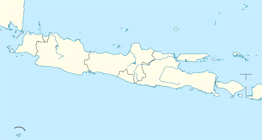
 Location within West Java | |
| Coordinates: 6°49′16″S 107°08′24″E | |
| Country | Indonesia |
| Province | West Java |
| Government | |
| • Regent | Herman Suherman |
| • Vice Regent | Tubagus Mulyana Syahrudin |
| Area | |
| • Total | 3,614.35 km2 (1,395.51 sq mi) |
| Population (mid 2022 estimate) | |
| • Total | 2,542,793 |
| [1] | |
| Time zone | UTC+7 (IWST) |
| Area code | (+62) 263 |
| Website | cianjurkab.go.id |

Administrative divisions
Cianjur Regency is divided into thirty-two districts (kecamatan), listed below with their areas and their populations at the 2010 and 2020 Censuses,[2][3] together with the official estimates as at mid 2022.[1] The table also includes the locations of the district administrative centres, the number of villages (rural desa and urban kelurahan) in each district, and its post code.
(A) Districts south of the "neck"
| Name of District (kecamatan) | Area in km2 | Pop'n 2010 Census | Pop'n 2020 Census | Pop'n mid 2022 Estimate | Admin centre | No. of villages | Post code |
|---|---|---|---|---|---|---|---|
| Agrabinta | 192.65 | 36,758 | 40,544 | 41,323 | Mekasari | 11 | 43276 |
| Leles | 114.32 | 31,931 | 31,595 | 31,730 | Pusakasari | 12 | 43273 |
| Sindangbarang | 159.08 | 51,777 | 58,508 | 59,912 | Saganten | 11 | 43272 |
| Cidaun | 295.51 | 64,181 | 69,548 | 70,642 | Kertajadi | 14 | 43275 |
| Naringgul | 281.32 | 44,665 | 47,470 | 48,036 | Wangunjaya | 11 | 43274 |
| Cibinong | 235.48 | 57,842 | 64,164 | 65,469 | Sukajadi | 14 | 43271 |
| Cikadu | 188.66 | 34,654 | 37,028 | 37,508 | Cikadu | 10 | 43286 |
| Tanggeung | 59.80 | 44,288 | 50,165 | 51,393 | Tanggeung | 12 | 43267 |
| Pasirkuda | 115.15 | 34,513 | 38,149 | 38,898 | Kalibaru | 9 | 43266 & 43267 |
| Kadupandak | 104.41 | 48,768 | 52,941 | 53,792 | Kadupandak | 14 | 43268 |
| Cijati | 49.02 | 32,737 | 34,452 | 34,796 | Cijati | 10 | 43284 |
| Takokak | 142.16 | 50,883 | 52,072 | 52,308 | Pasawahan | 9 | 43265 |
| Sukanagara | 174.05 | 48,727 | 55,730 | 57,201 | Sukanagara | 10 | 43264 |
| Pagelaran | 199.44 | 68,121 | 75,668 | 77,227 | Pagelaran | 14 | 43266 |
| Campaka | 143.75 | 63,847 | 69,727 | 70,930 | Cidadep | 11 | 43263 |
| Campaka Mulya | 74.28 | 23,756 | 24,020 | 24,073 | Campakamulya | 5 | 43269 |
| Totals | 2,529.08 | 737,448 | 801,781 | 815,238 | 177 |
(B) Districts north of the "neck"
| Name of District (kecamatan) | Area in km2 | Pop'n 2010 Census | Pop'n 2020 Census | Pop'n mid 2022 Estimate | Admin centre | No. of villages | Post code |
|---|---|---|---|---|---|---|---|
| Cibeber | 124.73 | 115,907 | 133,786 | 137.561 | Cihaur | 18 | 43262 |
| Warungkondang | 45.16 | 64,880 | 77,749 | 80,525 | Jambudipa | 11 | 43260 |
| Gekbrong | 50.77 | 51,026 | 60,919 | 63,048 | Gekbrong | 8 | 43261 |
| Cilaku | 52.53 | 96,823 | 117,658 | 122,188 | Sukasari | 10 | 43285 |
| Sukaluyu | 48.02 | 70,082 | 89,538 | 93,892 | Sukaluyu | 10 | 43287 |
| Bojongpicung | 88.34 | 70,959 | 83,446 | 86,111 | Bojongpicung | 11 | 43283 |
| Haurwangi | 46.18 | 53,641 | 63,813 | 65,998 | Kertasari | 8 | 43280 |
| Ciranjang | 34.81 | 74,439 | 88,754 | 91,833 | Cibiuk | 9 | 43282 |
| Mande | 98.79 | 69,148 | 81,567 | 84,222 | Mulyasari | 12 | 43292 |
| Karangtengah | 48.53 | 134,318 | 164,367 | 170,927 | Hegarmanah | 16 | 43281 |
| Cianjur (town) | 26.15 | 158,125 | 173,265 | 176,368 | Pamoyanan | 11 | 43215 & 43216 |
| Cugenang * | 76.15 | 99,539 | 117,211 | 120,961 | Mangunkerta | 16 | 43252 |
| Pacet * | 41.66 | 96,664 | 110,970 | 113,981 | Cipendawa | 7 | 43253 - 43281 |
| Cipanas * | 67.28 | 103,911 | 113,592 | 115,574 | Cipanas | 7 | 43253 |
| Sukaresmi * | 92.15 | 80,009 | 91,342 | 93,720 | Cikanyere | 11 | 43254 |
| Cikalongkulon | 144.02 | 94,262 | 107,802 | 110,646 | Sukagalih | 18 | 43291 |
| Totals | 1,085.27 | 1,433,733 | 1,675,779 | 1,727,555 | 183 |
Note that 4 districts (indicated by "*" in the table above) for a while formed part of the defined metropolitan district of Jabodetabekjur.
Of the 360 villages, 354 are rural desa, while 6 are urban kelurahan, which are all part of Cianjur (town) District (kecamatan).
Tourism
Mount Padang
A terracing structure, although local people mention it as a pyramid, lies on Mount Padang, 31 kilometer from Cianjur through Warung Kondang. It is the biggest Megalithic Site in Southeast Asia.[4]
References
- Badan Pusat Statistik, Jakarta, 2023, Kabupaten Cianjur Dalam Angka 2023 (Katalog-BPS 1102001.3203)
- Biro Pusat Statistik, Jakarta, 2011.
- Badan Pusat Statistik, Jakarta, 2021.
- "Megahnya Situs Megalith Gunung Padang Cianjur". Archived from the original on January 3, 2012. Retrieved February 9, 2012.
Places adjacent to Cianjur Regency | |
|---|---|